Day 3 :
- Coastal Living
Session Introduction
Prof. Adib SAAD
Laboratory of Marine Science, Faculty of Agriculture, Tishreen University, Lattakia, Syria
Title: NEGATIVE IMPACT OF INVASIVE INDO- PACIFIC BLUESPOTTED CORNET FISH ON THE BIODIVERSITY AND NATIVES FISH STOCKS IN THE SYRIAN AND LEBANESE MARINE WATERS

Biography:
Abstract:
Background:Syria a, just like Lebanon and the neighboring countries, is one of the most influenced countries by the invasive alien species due to its proximity to the Suez Canal and the dense maritime traffic along its coastline. Invasive species, in fact, may alter the evolutionary pathway of native species by competitive exclusion, niche displacement, predation and other ecological and genetic mechanisms. The bluespotted cornet fish Fistularia Commersonii (Ruppel,1838) may contribute to increase this alternation, because it is one of the most abundant and dominant Indo-Pacific alien fishes along the Levantine basin of the Mediterranean Sea at the onset of the past decade Objective: In order to know the extent and mechanism of the negative impact of this exotic species on the diversity and the natural stock of native species and her environment, it has been the study of the reproductive cycle and diet of bluespotted cornet fish. Methods: The study was performed in the coastal area of Lebanon and Syria along 380 km (approximately). A total of 460 specimens of Bluespotted cornet fish were collected by beach seine and trammel net at depth of 2-20 m from October 2012 to September 2013 Results: The results of this work was shown a rapid development among the ichtyofauna in the Eastern Mediterranean. Fistularia commersonii spawned in the Syrian and Lebanese coast from the second half of May until early August, with greatest intensity in June. Fecundity ranged between 355-697 eggs/g /ovary. This species It is carnivorous, and feed on many small fish species, such as Sardinella spp., Sprarus spratus, Alosa fallax, Boops bops .etc. 12-30 individual preys was found in the stomach of every specimen). Conclusion: The high fecundity rate, the long period of reproduction, and its rapidly expanding population feeding on fish, make a decline of the biomass and causing damage and loss to fisheries yield and perturbed the marine biodiversity.
Ebrahem M. Eid
College of Science, King Khalid University, Abha, Saudi Arabia
Title: Distribution of soil organic carbon in the mangrove forests along the southern Saudi Arabian Red Sea coast
Biography:
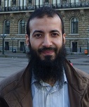
Dr. Ebrahem M. Eid obtained his Ph. D. Degree in Plant Ecology from Faculty of Science, Tanta University, Tanta, Egypt (2009). His fields of research experience include plant population ecology, aquatic plant biology, ecological modeling, water pollution, nutrient budget, carbon sequestration and conservation of the Nile Delta vegetation including the Egyptian Mediterranean wetlands (e.g. Lake Burullus). He has been working as a research assistant in three research projects that have been carried out in the Egyptian western desert and wetland ecosystems since 2000 up till now. He has attended many training courses and scholarships in Egypt, Germany, the Netherlands, Hungary, Finland, Estonia, Japan and Czech Republic; as well as several national and international symposia and conferences in Egypt and abroad. His scientific school includes 4 M.Sc.’s and Ph.D.’s in the fields of population and wetland ecology.
Abstract:
Climate change is an issue that has huge concerns worldwide. Carbon dioxide (CO2) emission is one of the important factors in global climate change. Carbon sequestration potential (CSP) of various terrestrial ecosystems especially wetlands play a role in manipulating the excessive increase of CO2 in the atmosphere. In the current investigation, we report on the efficiency of mangrove forests located in the southern Saudi Arabian Red Sea coast in carbon sequestration and establishment of a baseline data on soil organic carbon (SOC) pools for future studies on SOC dynamics. Sampling was carried out in three locations along the southern Saudi Arabian Red Sea coast. The sampled locations were classified into landward and seaward stands. In each of the sampling location, ten sampling sites were selected to assure representative samples to each of the landward and seaward stands. Three soil cores were taken in each sampling site and were pooled together into one composite core per sampling site. A total of 480 soil samples were collected. The mean distribution of soil bulk density (SBD) in the landward and seaward stands increased significantly with depth reaching the maximum at a depth of 20-25 cm. SOC concentration in the landward stands declined significantly with depth from 35.8 g C kg−1 at depth 0-5 cm to 20.9 g C kg−1 at depth 20-25 cm. SOC concentration in the seaward stands declined significantly with depth from 35.7 g C kg−1 at depth 0-5 cm to 24.8 g C kg−1 at depth 20-25 cm. The carbon sequestration rate (CSR) ranged between 11.7 g C m−2 year−1 in the landward stands and 12.0 g C m−2 year−1 in the seaward stands. Based on the area of mangrove stands (292 km2) and CSR, the total CSP of mangroves in Saudi Arabia was 3.47 ± 0.05 Gg C year−1
Murat Sezgin
Sinop University Faculty of Fisheries, TURKEY
Title: Meiofauna as an environmental bio-indicator in marine ecosystems
Biography:
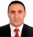
Murat Sezgin: Professor of Marine Biology and Ecology in Sinop University. He received the Ph.D. in marine ecology field from Ege University, Ä°zmir in 2003. Research interests: Black Sea, Mediterranean Sea, Crustacea taxonomy and ecology, benthic ecology, benthic pollution, exotic species. He has collaborated in umpteen national and international research projects, published 80 papers in peer review journals and he is author more than 40 communications in national and international conferences.
Abstract:
Metazooan meiofauna are defined by their body size (44-1000 µm) and are the most diversified element of the marine biota: as many as 24 of the 35 animal phyla have meiobenthic representatives which live in meiofauna, whether for all their life or just temporarily. It is the most abundant benthic group in the marine realm, the function of meiofauna in marine benthic systems seems to be much more complex than previously supposed, and requires further research. The use of meiofauna as a biological indicatoris a more recent development than the utilization of macrofauna in the assessment and monitoring of aquatic ecosystems. The advantages of the former are numerous and strongly emphasized by many scientists, while some of the arguments traditionally advanced against their use underline difficulties in identification, the high rate of sampling frequency and the microscopic size of these organisms. However, new technologies and tools, such as standardized methodologies, electronic identification keys, molecular approaches and the creation of new indices, currently allow for and promote the use of meiofauna in ecological studies. Whilst less is currently known about meiofaunal responses to pollutants, they have certain inherent advantages over the macrofauna in the determination of the biological effects of pollutants at the community level. Meiofaunal communities are inherently more stable, both qualitatively and quantitatlvely, on a seasonal and year-to-year basis, than those of the macrofauna, and it is obviously easier to monitor temporal changes in community structure from a stable rather than a fluctuating baseline. The meiofauna are abundant and diverse even in habitats, such as estuaries, which are subjected to considerable natural physical and chemical stress and where only a small numbers of macrofauna species occurs.
Francisca Alberta Lourenço Pires Delgado
Ministério das Pescas, Angola
Title: The Angola Coastal Fisheries versus Climate Change

Biography:
Francisca Alberta Lourenço Pires Delgado has completed her Master Degree at University Agostinho Neto, Luanda, Angola, Graduated on Aquaculture and Technology at Polytechnic Institute for Industrial Development (PISIE), Italy. She is former General Director of National Institute for Fisheries Research, Former Member of Management Board of Benguela Current Large Marine Ecosystem (BCLME) Former National Director of Guinea Current Large Marine Ecosystem (GCLME) and National Coordinating Body for liaison with the Intergovernmental Oceanographic Commission (IOC). She has published more than 10 papers in BCLME Scientific seminars, GCLME Scientific seminars, IOCAfrica Technical Meetings and National Scientific Conferences and African Union Summit.
Abstract:
Angolan coast is characterized by the movement of the cold Benguela Current that flows towards north and the Angola Current that flows in opposite direction. Both currents get together between Namibia and Benguela regions forming the Angola-Benguela Frontal region. Currents variability and dynamics strongly influence regional spatial and temporal distribution patters, abundance and productivity of Angola marine resources. Angola coast line has 1650 km, with more than 50,000 artisanal fishermen living directly from fishing. Coastal fisheries in Angola play a crucial role in the diet of the Angolan population. Angola is the largest consumer of fish in the southern region of Africa. However, climate changes occurring in the world and in Angola in particular have a great influence on the incomes of artisanal fishermen. This work will present the importance of fishing activity of the Angolan coast and climate variations on it occur through results from oceanographic stations installed in southern Angola. The results show that Angola has a unique characteristic, since most of the fishermen involved in this activity live very close to the coast. Climate change has dominated the absence, torrential rains, high winds, floods, appearance of seals in unusual areas which influence the daily activities of fishermen forcing often fishing in areas not permitted endangering their lives and sustainability of their families. Keyword. Coastal fisheries as the main food source
HUDA QARI
Faculty of Science and Arts, King Abdul Aziz University, Saudi Arabia
Title: Effect of Drinking Natural Sea Saline Water on Growth Performance, Some Blood Parameters and Carcass Traits on New Zealand White Rabbits
Biography:
Abstract:
This experiment was carried out to study the effect of drinking natural sea saline water on growth performance and some blood parameters of growing New Zealand White (NZW) rabbits reared under Saudi Arabia conditions. The obtained results indicated that the final body weight, live body gain daily feed intake, feed conversion, water intake, plasma total protein, albumin, globulin, total lipids, cholesterol and urea-N were decreased (p<0.05&0.01) significantly with drinking growing rabbits natural sea water. Also, the carcass weight, dressing % and prime cuts % were decreased, while the rectal temperature and respiration rate were insignificantly affected by the using natural sea saline water up to 20% / litter well water.
Neetika Kumari Sahai
Fiji National Univeristy, Suva, Fiji Isalnds
Title: Salt Water Intrusion into Coastal Freshwater Wetlands of Madhuvani, Ra, Fiji Islands

Biography:
Neetika Kumari Sahai has completed her Bachelor of Environmental Science degree at the age of 25 from the University of the South Pacifc from Fiji and is currently pursing her post graduate diploma in Environmental Geoscience from the University of the South Pacific in Post Graduate Dilpoma in Environemental Geoscience. She is a Teching Assistant in department of Environemntal Science at the Fiji National University.
Abstract:
The Fijian Government has identified 676 villagers to be relocated in the near future due to a rise in sea level in the region. This paper discusses a very such village from the 676, which will face the brink of increase in sea level rise and has already become a highly stressed area due to salt water intrusion. Contamination of freshwater bodies caused by saltwater intrusion is a global issue, affecting water quality, vegetation, and soil conditions along coastal lines of countries. The first relationship between seawater and freshwater was first established in the 1800’s by Bodon Ghyben and Herzberg who developed the relationship for static equilibrium conditions and latter observed the density variations between seawater and freshwater were also important (Perlmutter et al., 1959). Two ground water wells, located around less than 300meters from the high tide level in Madhuvani village have confirmed a significant change in salinity ratio in relation to salt water used as control through laboratory tests. Laboratory testing’s for two month on the site samples confirm that there is a certain increase in salt concentration. The site of study, Madhuvani, a sugar cane farming area is already under the threat of losing its coastal land area. But for now, the biggest issue faced by the sugar cane farmers is the poor quality of sugar production. With poor soil richness, production rate has reduced. Conductivity of well 1 920(μS/cm) and Salinity of 0.58ppt in contrast to well 2 conductivity of 460(μS/cm) and salinity of 0.46ppt demonstrate a rather clear picture of salt water intrusion. Moreover, interviewed villagers have stopped using the wells complaining about the salty taste in the well waters. As expected, villagers have confirmed that the well located further inland have a reduced saltiness in well water. The major causes of salt water intrusion could be the tidal activity intruding further inland creating a thicker interface that would occur without tidal effects and the configuration of the interface is radically changed when the tidal fluctuations are included (Ataie-Ashtiani et al., 1999). It also occurs naturally in many areas but can become problematic when groundwater is withdrawn (pumped) from the acquifer; this includes the hydraulic head in the aquifer, subsequently slowing or stopping the seaward (Khublaryan et al., 2008). The wells supplied water to 3 generations for 25 years. Furthermore, Over-abstraction is considered the main cause of saltwater intrusion where most of the water has been used. Moreover, climate change and sea level rise speed up saltwater intrusion (Abd-Elhamid and Javadi, 2011). Extreme whether events is also a highly contributing factor to saltwater intrusion. There are more reasons discussed in the paper. In the past, many communities who came across a saltwater intrusion problem simply set up new production wells further inland (Barlow, 2003). This only complicated the issue. Since then, various methods have been employed to help alleviate the concerns of saltwater intrusion. This paper looks into how this situation of salt water intrusion be managed.
- Coastal Recreation
Session Introduction
Lynda Crowley
School of Law and Justice, University of Southern Queensland, Australia
Title: Comprehension and Perception of International and Domestic Tourtists and Far North Queensland residents in the presence of Irukandji Jellyfish Warning Signs

Biography:
Lynda Crowley-Cyr has completed her PhD at the Sydney University Law School. Her area of interest is Health Law and Safety. She is an Associate Professor at the School of Law and Justice at the University of Southern Queensland. She relocated there in 2011 after 22 years at James Cook University where her interest in marine stingers begun. She was admitted as a barrister in 1991 and has been a presiding member of a Tribunal in Australia. She has published book chapters and numerous papers in reputed refereed journals, and has served as a referree for various high end journals.
Abstract:
The Irukandji jellyfish sting can cause a range of symptoms from cramping and nausea to death. Aside from the health implications, marine based industries such as fishing and tourism can be negatively impacted. The aim of the current study was to assess comprehension of a sign used to warn of the Irukandji danger. 109 local residents and tourists to Palm Cove beach, on Australia’s Great Barrier Reef coastline, and Irukandji hot-spot, were interviewed during the main Irukandji season to assess their understanding of the warning sign and their perceptions of swimming safety. Over 70% of participants saw the sign, but many still thought it was safe to swim inside purpose-built marine stinger nets. Those that knew it was unsafe to swim in the nets were unsure why. The message on the sign was found to be unclear as to what the actual danger was and the potential risk posed by an Irukandji sting. Some words and colours were inconsistent with beachgoers expectations of a danger sign. With regards to Irukandji risk, signs should include a brief overview of the Irukandji, consequences of being stung, how to avoid being stung and what to do if a sting should occur. In addition, fifty seven various signs were counted in the immediate area perhaps resulting in signage overload. Other strategies could be employed in the local area to keep people safe, including comprehension reviews in situ to improve warning signs, escalating warnings during peak Irukandji times and distributing additional educational materials to visitors
Dr.Rengarajan Sridhar
HSM,National Center for Sustainable Coastal Management, Anna University
Title: Measuring and Evaluating Tourism Carrying Capacity in beaches have Lock and Neil Islands of Andaman,India
Biography:
Abstract:
The present work is an attempt to understand the tourism carrying capacity of beaches Havelock and Neil Islands of Andaman (India) in terms of number of visitors that can be allowed over a period of time to help for better management of tourism operations. The approach was based upon the physical, biological conditions and the infrastructure available on the tourism destinations. The total Effective Carrying Capacity for beaches of Havelock and Neil Islands is showing the tourism activity is in lower level with its carrying capacity. The A&N Islands can be promoted for high value low volume eco-friendly and environmentally sustainable tourism. This type of carrying capacity assessment can be used as an input into the regular planning process and in multidisciplinary approach in achieving sustainable development of Coastal Zones. A comprehensive analysis of tourism development in A&N Islands carried out through its Strength, Weakness, Opportunity and Threats (SWOT) approach yielded useful information about the future viability of the tourism development.
Biography:
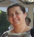
Dr. Marina Krylenko has completed Ph.D from Institute of Oceanology RAS in 2007. She is senior researcher of the Southern Branch of Shirshov Institute of Oceanology RAS. Scientific interests are lithodynamical processes in the coastal zone, coastal erosion and protection, ecology of the coastal zone, coastal monitoring, integrated coastal zone management. She took part in a number of international and Russian coast scientific projects and field experiments. She has published more than 70 scientific papers and participated in many scientific conferences and meetings
Abstract:
The Russian sea coasts are perspective areas for economical using. The recreational sector development is important for economy and the main resource of it is the coastal geosystems. Economic activity within the concept of sustainable development should help to socio-economic development, but not to increase the negative impact on environment. The modern technologies of the rational management have to include the protection of the natural-territorial complexes. However, the current state and the regularities of seacoast dynamics are represented deficiently in the scientific and applied projects devoted to economic problems and the coastal protection. The state and dynamics of coastal accumulative geosystems are defined by many intra-system factors and are very sensitive to external impact. In this paper the criterion system for estimation of natural uniqueness and recreational attraction of the coastal geosystems is presented. Criterions are divided on positive (landscapes safety, rare species of plants and animals, possibility of natural restoration, etc.) and negative (inter-industry contradictions, hazards, economic use, etc.). The criterions are estimated in points. Numerical representation of criterions simplifies statistical and estimating works and more convenient for users. Important element of the criterion system is existence of an estimation of the modern coastal dynamics. The pilot estimations of a number of accumulative coastal geosystems of the Sakhalin island southern part and Russia Black Sea coast are made on the basis of developed system. The obtained results will be useful for economic planning and landscape objects protection in the coastal regions.
Truong Hoang Minh
College of Aquaculture and Fisheries,Vietnam
Title: Assessment on efficiency of Intensive White leg shrimp farm forms in the Mekong Delta
Biography:
Abstract:
The study was conducted from September 2014 to February 2015 through survey of 90 small scale white leg shrimp farmers (HH), 12 cooperatives (Co) 12 Farms (F) and 12 companies (Com) by using questionnaire. The results indicated that the total cultured area (ha/HH) and cultured ponds (ponds/HH) of NH were respectively 4.6 and 4.9 lower than Co (32.4; 30.3), F (15.1; 13.1) and Com (92.9; 83.7). Stocking densities, survival rate, cultured periods and harvested size of shrimp were highest in Com, followed by F, Co, HH, respectively shrimp yield 13.9 respectively; 10.6; 10.9 and 8.37 tons /ha/crop. The lowest production costs of F and highest in Comwere67.5 to 73.9 VND/kg, respectively. The profits (Mill/ha/crop) of all cultured forms were rather high, HH (596), Co (692), F (696) and Com (1,038) respectively. Benefit per cost was ranged at 1.0; 0.85; 1.03 and 1.04 times respectively. Profitability ratio in this research was very high, except for HH (unprofitable 6% of HH). Biosecurity level and staff capacity building activities of Com form was more considered than the other forms.
Jeng-Di Lee
Assistant Professor, Integrated Ocean and Coastal Management, Institute of Marine Affairs, National Sun Yat-sen University
Title: The Direct and Indirect Environmental Impacts from Tourism in a Small Island, Hsiao Liuqiu, Taiwan
Biography:
Abstract:
Ahmed A. Abdalazeez
Red Sea University, Institute of marine research, Portsudan, Sudan
Title: Seasonal variations of runup, wave height and wind speed in the northern Indian Ocean
Biography:
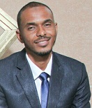
Ahmed Abdalazeez has completed his Master degree from University of Bergen / Geopgysical Institute – department of Physical Oceanography. He is the resarcher at Red Sea University-Institute of Marine Research.
Abstract:
The aim of this study is to estimate the seasonal variation of runup, wave height and wind speed on selected beaches around the northern Indian Ocean. The runup has been estimated using ERA-Interim, which is the latest global atmospheric re-analysis produced by the European Centre for Medium-Range Weather Forecasts (ECMWF). ECMWF uses the global Wave Model (WAM) model to calculate two dimensional wave spectra. A great circle calculator has calculated the distances between the model grid points and the beaches. The significant wave height as well as the peak wave period at the grid points assumed the same at the beach. The most frequent estimated runup is between 0.5 m and 1.0 m, which produced by swell coming from the southern Indian Ocean for all locations except Sri Lanka and Indian shores, where the most frequent runup value is less than 0.5 m. However, the extreme wave runup occurs with the largest wave heights during summer monsoon in July. Generally, the high wave height depends on wind speed. The mean elevation of the runup for all locations is 0.56 m.
Vega Erdiana Dwi Fransiska
Bogor Agricultural University, Indonesia
Title: Regional Tourism Optimization and Improvement of Food Crops in the Coastal Area Through the Agrocoastal System in East Java Indonesia
Biography:
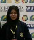
Vega Erdiana Dwi Fransiska is undergraduate student with Bogor Agricultural University of Landscape Architecture Departement, Faculty of Agriculture, Bogor 16680, West Java, Indonesia. I was study at elementaryschool 2 Kupang (2001-2007), Junior High School 1 Jetis (2007-2010) and Senior HighSchool 1 Puri (2010-2013). I am from MojokertoEast Java. My adreess on Warugunung village, Mojokerto district 61352 East Java. and My adreess on bogor. My achievement since 2008 are 3rd winner speech of Pancasila at province, painting art competition 3rd winner . Paper of Environment Education 3rd winner. On 2012 be 1st winner on english debat competition, 1st winner on tell news. And also Grantees PKM - M by DIKTI on 2013. Abyan Rai Fauzan Machmudin is undergraduate student with Bogor Agricultural University of Landscape Architecture Departement, Faculty of Agriculture, Bogor 16680, West Java, Indonesia
Abstract:
Particulary, One problem often encountered people are population growth leads to a problem of shortage of land. Due to the ownership of the land is too narrow for farm could pose obstacles to agricultural development such as low productivity. The real impact as a result of higher population can make ratio of land with the smaller humans, causing a gap between the expected production with the needs that must be satisfied. Tourist resort area is an environmental services that offer aesthetic and recreational needs for humans. The dynamics needs of the population can result in a lack of increase in regional tourism, so as to affect the level of income generated. Solutions to address the problems of agriculture and tourism sectors by implementing agrocoastal system. Agrocoastal is a modern agricultural system by utilizing coastal land, so it can create marine farm tours. The system uses a static floating land with concept of hydroponics and aquaculture. Utilization of sea water distillation apparatus so that the creation of a sea wave power plants. Circulation of oxygen derived from aquaculture that can improve plant growth with the addition of small fish. The advantage of this concept is still preserving aquatic ecosystems without damaging the coastal life in it. The division of spatial influenced by local wisdom on the coast, so there are four important part of this system.
Siti Zahrani bte Haji Md Salleh
University Brunei Darussalam Brunei Darussalam
Title: The effect of littering on distribution of ghost crabs (Ocypode sp.) in Muara Beach, Brunei Darussalam

Biography:
Siti Zahrani bte Hj Md Salleh had her M.Ed.Science Education from University Brunei Darussalam in 2011. She is a biology teacher in Rimba II Secondary School and had worked as teacher for 10 years. She is head of leadership for 21st Century Teaching and Learning where she had managed the 1:1 Computer in Model Schools project initiated by Ministry of Education, Brunei Darussalam. She is also head of Nature Lover Society where she exposed students to appreciate nature and some conservation projects.
Abstract:
Brunei Darussalam is blessed with beautiful beaches and a lot of potential as tourist attractions. Therefore, beaches were developed for recreational purposes which may affect the ecological habitat. The study was trying to see the effect of human disturbances on ghost crabs (Ocypode sp.) distribution in terms of beach litters (organic and inorganic litters). The study was divided in 2 phases with the following aims: Phase I, Identification and distribution of the ghost crabs (Ocypode sp.) species found on the least disturbed site of Muara beach ; Phase II, Comparison of mean burrow density of ghost crabs (Ocypode sp.) between 3 zones (Yellow Zone: cleaned by removing the inorganic litter; Red Zone: not cleaned at all having both organic and inorganic litter and Green Zone: cleaned) of Muara beach within 4 weeks. In Phase I, sampling were conducted during day and night at least disturbed site of the beach. 2 species of ghost crabs were identified that were Ocypode ceratophtalma and Ocypode cordimanus thus confirming that the burrows were made by the ghost crabs. Based on the samples collected it was discovered that there were clear zonation of species where O.ceratophtalma were mostly found near water and O.cordimanus were found near the dune. In Phase II, burrow counts were monitored weekly for 4 weeks to compare the mean burrow density of ghost crabs in each zone (Yellow Zone, Red Zone and Green Zone). The result showed that there were decrease in ghost crab burrow density in Yellow zone and there were shifting of distribution from Plot C to Plot D (towards the water) after 4 weeks. Red zone also showed decrease in ghost crab burrow density and shifting occurred but faster in 3 weeks. Green zone showed increase in ghost crab burrow density and no shifting of zone took place as the ghost crabs were adapted to clean beach. These result indicate that clean beach was preferred over heavily littered beach. Ghost crabs tend to shift away from the litters found on the beach. This information is valuable for us to reflect on how we had treated our beach.
- Growth and Opputunities
Session Introduction
Ashraf Suloma Soliman
Fish Nutrition Laboratory, Cairo University,Egypt
Title: Develop of Saline-Solar-Aquaponic system: a strategy to reduce the footprints of water and energy inputs in intensify food production in Coastal and desert communities
Biography:
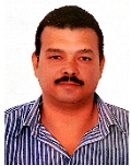
Dr. Ashraf Suloma is the head of Fish Nutrition Lab at the Department of animal production, Fac. of Agriculture, Cairo University. He has published more than 34 papers in reputed journals. His main fields of interest are: 1- Develop least cost diet for freshwater fish from local ingredients 2- Improve the land and water productivity for fish farms through aquaculture-agriculture integration, periphyton and biofloc systems
Abstract:
Demand for food is increasing with an increase in human population. Saline agriculture can greatly contribute to increase agricultural output and support future demand in food and energy. This has led researchers to turn to coastal and desert lands to provide food via saline agriculture. The major problem in saline agriculture start after irrigation, and when the water evaporates leaves behind a salt residue that will build up over time eventually destroying the soil. Moreover, adding too much salt water to a desert soil will form a salt pan, creating a totally arid and sterile environment. The goal of this project is to develop closed-loop saline aquaponic (soilless culture) processes for zero-waste sustainable production of fish and crops in areas where traditional crops cannot be grown in order to turn the deserts and costal land into crops and biofuel producing agricultural lands. This work was supported by TriNex project; Knowledge-Triangle Platform for the Water-Energy-Food Nexus.
Izumi Tsurita
University of Tokyo, Graduate School of Arts and Sciences, JAPAN
Title: Comprehensive study of a Marine Protected Area Managed by the Fishermen in Hinase, Japan
Biography:
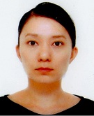
Izumi TSURITA is a doctoral student at the Department of Cultural Anthropology, Human Security Program, Graduate School of Arts and Sciences, University of Tokyo. She used to work for the Ocean Policy Research Foundation and the Institute for Global Environmental Strategies in Japan. She also worked at the Parque Nacional Natural Los Corales de Rosario y de San Bernardo, Colombia, as a Japan Overseas Cooperation Volunteer. Her research interests include Marine Biodiversity Conservation and Climate Change based on the ideas of Cultural Anthropology and Environmental Ethics
Abstract:
In May 2011, the Eighth Meeting of the Headquarters for Ocean Policy officialy announced the basic concepts and relevant regulations of Japanese Marine Protected Areas (MPAs) according to the definition of the Marine Biodiversity Consrvation Strategy which is “Marine areas designated and managed by law or other effective means, in consideration of use modalities, aimed at the conservation of marine biodiversity supporting the sound structure and function of marine ecosystems and ensuring the sustainable use of marine ecosystem services”. Accordingly, MPAs in Japan at present confirm to different existing systems such as Natural Parks Act 1957 and Fisheries Act 1949. Many of those MPAs have fishery resource management objectives with either a government-based or community-based management approach. In order to comprehensively understand the effect of such MPAs, we conducted three-years joint-research from 2013 to 2015 by examining several MPA sites around Japan. In this presentation, after a brief introduction about the Japanese MPA systems, research outcomes at one of the case study sites, Hinase, Bizen City, Okayama Prefecture, Japan, will be shared from various viewpoints including ecological, economic, and social effects as well as their linkages to the human wellbeing.
Sulaiman O Olanrewaju
Universty Malaysia Terengganu, Malaysia
Title: Integrated Aquaculture Floating System for Near-shore and Offshore Oceanic Farming
Biography:
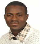
Dr. Sulaiman O. Olanrewaju is a Professor of ocean engineering and maritime technology at University Malaysia Terengganu and visiting Professor at other University. He has PhD in Mechanical Engineering with specialization in Marine Technology. He is chartered engineer with diverse academic and professional background. He has taught and mentor different courses and research projects on issue in maritime field. His specialization is in maritime energy and environment, sustainable maritime system design, risk and reliability for maritime and ocean systems. He has taught and mentor courses and research projects on contemporary issues in maritime field. He published about 80 abstract and presentation in national and international conferences. He has authored and co-authored a total of about more than 120 publications which include proceeding papers, journal papers, and chapters in book, monograph, seminar papers and other types of academic publications. He has patent on marine green technology. He has authored five books in maritime science and technology field.
Abstract:
Seaweed farming has become one of the natural resources which are economically important. In 2012, the global seaweed trade and industry was worth USD 6.4 billion with production of 23.4 million MT seaweeds (FAO 2014). Malaysia produced only 331,490 MT wet wt. worth USD 64.4 million in 2012 (FAO 2014). Our work share the view of the FAO (2005) that our green biomass production has to grow with 70% in order to give the 10 billion inhabitants of our planet at the midst of the 21st century their primary needs by concentrating on development of technology platform for large scale offshore aquaculture cultivation. The existing cultivation system for seaweed are not environmentally, socially and economically sustainable development. The study present work on socio-economic and sustainable development project, reliable, scientific based and verifiable cultivation technologies for offshore and onshore oceanic farming and local capability of existing method towards novel products will be developed. The project focuses on synergy of marine biology and ocean engineering for development of proper marine technology aquaculture floating system for large scale seaweed cultivation onshore and offshore. The project aim to provide supplementary income to fishermen in rural areas by selling seaweed as a cash crop and enhanced effective use of ocean resources. The ocean farming technology is useful for climate change mitigation, coastal erosion mitigation, bioremediation, functional food, medicine, and range of natural biotech products.
Ouk Vibol
Department of Fisheries Conservation, Royal Kingdom of Cambodia
Title: Participatory Design of Marine Fisheries Management Areas in Cambodia

Biography:
With this position I manage the whole activities related to fisheries management and conservation in both freshwater and marine areas, including preparation of work plan, preparation of legal framework, controlling and guiding staff performances at office and field to conserve the endangered fisheries resources and habitat, making proposal and seeking funding from other donors to support conservation activities and collaboration with relevant partners to manage and conserve the fisheries resource
Abstract:
Marine living resources in Cambodia play a very important role to the national economy and assist in the balance of regional and global environment ecosystems. However, they are facing destruction and it is now time to increase attention in protecting the essential habitats to sustain the marine fisheries of Cambodia and ensure future livelihood of the people of Cambodia. The development of Marine Fisheries Management Area – MFMA – a type of multiple-use Marine Protected Area (MPA) could ensure sustainable fishing, protection of biodiversity and increasing eco-tourism. The establishment is required 5 steps, including stakeholder consultation. The Koh Rong Archipelago is rich in biodiversity and tourism attraction. However, this area is under the threat. The Cambodia’s First MFMA model is established and required a comprehensive exercise in stakeholder engagement. The first step of the process is the creation of a provincial government management team, which coordinated the consultation process and developed the provincial legislation needed to establish management structures. A technical working group was formed, reporting to the provincial government team, and incorporating government authorities, NGO’s, island concessionaires, Community Fisheries (CFi) and tourism agencies (dive companies). This integrated approach is designed to ensure effective collaboration and coordination, and enabled stakeholder input to zoning plans. 06 zoning types have been resulted from zoning consultations including Conservation Area (13 sites), Protected Area (01 site), Community Fisheries Area (3 sites), Fisheries Refugia Area (4 sites), Recreational Area (13 sites) and Multiple Use Area (13 sites). Monitoring and evaluation is undertaken through socio-economic surveys, habitat monitoring as well as the MPA Management Effectiveness Tracking Tool. The model could yield results in terms of improved marine and coastal conditions and enhanced socio-economic benefits for local villagers.
- Entrepreneurs Investment Meet
Session Introduction
Dr. Enayet Karim
President, Global Economist Forum Bangladesh
Title: Entrepreneurs Investment Meet

Biography:
Dr. Enayet Karim—a Bangladeshi national has completed his double Masters in Economics and Journalism from Dhaka University. He obtained Ph, D from the University of Oxford, UK in Banking. He is the author of CAMELS Rating, a theory book on Capital, Asset, Management, Earnings, Liquidity and Sensitivity to the Market Risk, which is now a text book in different universities and banking institutes. Dr. Karim has been elected President of Global Economist Forum, a United Nations Special Consultative Status Organisation, having stake in 104 countries. He is the editor of Daily Industry, only economic and Industrial newspaper of the world.
Abstract:
Investment in coastal area poses high risk but having huge business potentiality in the global changing atmosphere. It could generate huge employment opportunity as well. Hunting of Coastal resources could be added at least 1% growth in the global GDP. Coastal towns throughout the world are flooded with tourists who are keen to soak up the sun and unwind in relaxing surroundings. With the warmer climates of summer approaching, it’s only natural for investors to begin looking at coastal property markets for potential investment opportunities. For the past 10 years, house prices in coastal markets have typically seen strong levels of growth. In the majority of coastal locations, house prices have recorded annual growth of 10% over the last one decade. Environment and Natural Resources experts identified five projects intended to accelerate the development of the coastal and marine sector as priority areas for investment during the Coral Triangle Initiative (CTI) High-Level Financial Round Table meeting at the Philippine International Convention Center in Manila, in conjunction with the annual meeting of the Asian Development Bank. These include the establishment of an endowment fund as a sustainable financing mechanism for projects; design of a payment scheme for ecological services to promote private sector involvement; rehabilitation of mangroves as climate change adaptation strategy; establishment of an integrated information management system; and development of national integrated coastal and management program to uplift lives in coastal communities in Asia. Maine Coastal Program, promote sound waterfront planning and harbor management, balanced development of shore and harbor areas, advance planning for waterfront infrastructure improvements and access to the shore.

