Day 1 :
Keynote Forum
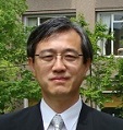
Hitoshi Tanaka
Tohoku University, Japan
Keynote: Tsunami Propagation into Rivers; Problems and Solutions
Time : 9:30 to 10:00
Biography:
Prof. Hitoshi Tanaka finished his PhD study at Tohoku University, Japan in 1984. After job experience in other universities such as Utsunomiya University (Japan) and Asian Institute of Technology (Bangkok, Thailand), he was promoted to a full-professor of Tohoku University in 1996. He was a visiting researcher at ISVA (Institute of Hydrodynamics and Hydraulic Engineering), Technical University of Denmark in 1996. His main research interest lies in fluid mechanics such as turbulent wave boundary layers, related sediment movement and also resulting morpho-dynamics in coastal and estuarine environments. His study sites are not confined in Japan, but covering various countries worldwide such as Vietnam, Thailand, Korea, Indonesia, Oman and Bolivia etc.
Abstract:
The 2011 Great East Japan Earthquake Tsunami overflowed existing embankments along Japanese coasts, and inundated the coastal area facing the Pacific Ocean. The maximum tsunami run-up height attained as high as 40m. Because of so extreme energy, tsunami propagated far upstream of rivers as well. The maximum tsunami run-up distance in a river was 50km observed along the Kitakami River located in Miyagi Prefecture, resulting in serious damages to riverine structures. In addition the tsunami propagation into the river and subsequent return flow caused considerable change in river topography such as erosion of sand bar and sand spit at the river entrance. Although there have been so numerous number of studies dealing with tsunami behavior in the sea area, limited number of investigations have been made for tsunami in rivers. The main objective of this lecture is to introduce hydrodynamics of tsunami ascending rivers, resulting riverine disasters, and also countermeasures.
- Coastal Management
Session Introduction
Prof CHOU Loke Ming
Tropical Marine Science Institute, National University of Singapore
Title: Rehabilitating Singapore’s impacted coral reefs

Biography:
Dr. CHOU Loke Ming is Adjunct Research Professor at the Tropical Marine Science Institute, National University of Singapore. He obtained his PhD in Zoology from the University of Singapore in 1976. His research on coral reef ecology and integrated coastal management covers Southeast Asia. His current research focus is reef restoration and he is particularly interested in how corals can be re-established in the highly turbid conditions of rapidly developing coastal areas. He is an Honorary Fellow of the Singapore Institute of Biology and a Fellow of the Singapore National Academy of Science.
Abstract:
Singapore’s rapid coastal urbanization since the 1960s resulted in a 65% loss of its coral reefs to land reclamation. Increased sedimentation reduced underwater visibility from 10m in the early 1960s to less than 2m now. Reef rehabilitation to increase coral cover of degraded reefs and promote colonization of non-reef areas however, is deemed viable based on predictable mass spawning events, recruitment and vigorous growth. Techniques employed should be compatible with the high sediment load and destabilized reef substrate. Fixed horizontal table nurseries were most suitable for sites with sediment-coated substrate as they elevated the fragments above the bottom while the supporting mesh net on which coral fragments were placed reduced sediment accumulation around them. Of the 1,251 fragments from 22 hard coral genera raised in the nurseries over a year, 92% survived. The observation is part of an on-going project aimed at assessing 1) if rehabilitation can effectively assist with degraded reef recovery, 2) whether “new” reefs can be created in non-reef areas, and 3) the survivability of corals in close vicinity to coastal development. Results from the project when completed will help to establish protocols to support management decisions on reef rehabilitation.
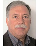
Prof José S Antunes do Carmo
University of Coimbra,Portugal
Title: Integrated coastal management and adaptation needs
Biography:
José Simão Antunes do Carmo has completed his M.Sc. in Hydraulics and Water Resources in 1990 from University of Lisbon, Portugal, his Ph.D. in Engineering Sciences in 1995 from University of Coimbra, Portugal, and postdoctoral studies in Civil Engineering in 2003 from University of Coimbra. He has been Director of several Degree and Master Courses in Civil Engineering and Environmental Engineering in the period 1995-2010. He is Director of the Portuguese Journal of Water Resources, Coeditor of the International Journal of Integrated Coastal Zone Management and Editorial Board Member of the Ocean & Coastal Management journal, Elsevier. He has published over three dozen papers in ISI journals and more than a hundred publications in International Conferences.
Abstract:
The sustainable management of coastal areas depends on the success of an integrated adaptation to climate and other changes that take into account and promote the system's ability to adapt. A proper definition of spatial and temporal scales is crucial in vulnerability assessment, in any attempt to establish good management actions and adaptation options. Through the action of various factors such as wave height and direction, tides, currents, wind speed, water depth, sediment supply, frequency and intensity of extreme meteorological events, including storms, the coastline is constantly changing. Coastal ecosystems are also particularly sensitive to the increase in sea surface temperature, ocean acidification, salt water intrusion, rising water tables and altered runoff patterns. Thererfore, it is important that coastal vulnerability assessments follow an integrated assessment approach considering environmental changes induced by climate and non-climatic actions as well as socio-economic developments and their interactions. Adaptation measures in the assessment must be considered, both in terms of already implemented measures and scenarios of future adaptation. According to IPCC, vulnerability to climate change is defined as “a function of the character, magnitude, and rate of climate change to which a system is exposed, its sensitivity, and its adaptive capacity”. The key ideas of this definition were incorporated into coastal vulnerability. The first two components (exposure and sensivity) together represent the potential impact and adaptive capacity is the extent to which these impacts can be avoided; therefore, vulnerability (V) is potential impact (I) minus adaptive capacity (AC), i.e., V = f ï‰ï€ ï€ï€ ïC The main options to be considered in any adaptation program are: protection to reduce the risk associated with climate change impacts and others, especially those resulting from the rise in mean sea level; accommodation to increase people's ability to deal with those impacts and associated risks, and retreat to reduce the risk of serious events caused by climate change and others, limiting their potential effects. The medium and long term goals underlying adaptation measures should be properly assessed and pondered.
Dr Satoshi Nagai
National Research Institute of Fisheries Science,Japan
Title: Plankton metagenomics in Okhotsk Sea in Japan

Biography:
Satoshi Nagai has completed his PhD at the age of 29 years from Kyoto University, and started to work as a permanent resercher at Fisheries Research Agency of Japan. He is the group leader of metagenome research group at the research center for aquatic genomics. He has published more than 110 papers in reputed journals and has been serving as an editorial board member of Plankton & Benthos Research and BMC genomics
Abstract:
We have conducted a monitoring of eukaryote biodiversity by using massively parallel sequencing (MPS)-based technology one a week for nearly three years in Mombetsu city, Hokkaido, Japan. In this study, we analyzed the biodiversity of some samples (n = 32) as a preliminary study and succeeded in detecting several hundreds of operational taxonomic units (OTUs) from 500 mL seawaters. In the NMDS analysis, samples taken at the same month but in different dates were more closely plotted and also the samples of closest months were located in the closest positions, showing the consecutive transition of species composition and the clear seasonal pattern of eukaryote species in Okhotsk Sea. The relative abundance of identified OTUs at the supergroup levels at the four groups was compared. The relative abundance of Alveolata or Stramenopiles was highest, and the third highest groups were Opisthokonta, or Viridiplantae, which varied depending on the samples, and they accounted for 77.1-86.4% of the total. The relative abundance of Stramenopiles was 37.6% at Jan-Mar group and the highest among the groups, reflecting the conspicuous diatom spring blooms. The lowest water temperature during diatom spring blooms in Okhotsk Sea is nearly -2 oC, but 8-9 oC in the Seto Inland Sea. Diatom species isolated from western Japan cannot grow below 5 oC under laboratory conditions. The MPS-based technology also enabled to detect conspicuous diatom spring blooms and sudden blooms, which occurred irregularly, caused by dinoflagellate, ciliate or metazoa species, strongly suggesting the effectiveness of the monitoring by the MPS-based technology.
DR.SAINUDEEN SAHIB.S
Department of Zoology, S.N.College, India.
Title: Post-Tsunami Impact on Coastal Belt and Coastal Issues of the Kerala State,India
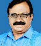
Biography:
Dr.Sainudeen sahib.S working as Associate professor in Zoology at S.N.College, Kollam, Kerala ,India . I have 20 years of teaching and research experiences. I have published more than 50 research papers and 10 books internationally. He is the chief editor of international journals. He is the president of Kerala Environmental Researchers Association. He is the expert member of Govt. of India to study possible impact of mobile towers on living beings. Considering his contribution NASA and IAU had named A minor planet after my name ( Pattazhy planet) in 2008
Abstract:
Kerala is a coastal state with an extensive coast line of 590 km long with Arabian sea in the west and stretching from Thiruvananthapuram distrct in the south to Kasargod district in the north. The state has a population of 3.33 crores as per the census of 2011 and most people live in the coastal area of Thiruvananthapuram, Kollam ,Alapuzha ,Ernakulam,Thrissur, Malappuram ,Kozhikode, Kannur and Kasargod districts of Kerala. Considering the havoc caused by Tsunami which hit Indian coast line on 26th December 2004 , in many places around the Tsunami disaster ravaged coastlines, the water and sewage system were wrecked by the quake-driven waves, and groundwater supplies were contaminated by sea water. Fisheries are one of the most important sectors of Kerala’s economy providing livelihood to the fishermen population living in the 222 marine villages. Tsunami of 2004 affected fisheries sector adversely especially on motorized and non-mechanized segments and prices of different species of fishes slashed down . The rehabilitation related issues will have to be given concerted effort in the light of various localized problems. Many industries are situated in the coastal stretches and about 300 medium and large scale and about 2000 small scale industries are discharging effluent directly into marine or freshwater bodies. Infrastructure development including port and harbours, sand mining for industrial and construction purposes, recreational activities etc have contributed to coastal erosion. Major impact of tsunami and coastal issues are highlighted in this paper on the basis of the situation before and after the tsunami in the affected areas
Yong Ming Luo
Director LOICZ(Land-Ocean Interactions in the Coastal Zone),East Asia Node China
Title: Adaptive Integrated Coastal Zone Management in China: From Pressures to Solutions
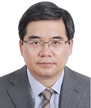
Biography:
Prof. Yongming Luo is the director of the East Asia Node, Land-Ocean Interactions in the Coastal Zone (LOICZ), and the executive deputy director of Yantai Institute of Coastal Zone Research, Chinese Academy of Sciences (YIC-CAS). He is also the director of the Key Laboratory of Coastal Environmental Processes and Ecological Remediation, CAS. He obtained his PhD degree in soil chemistry at the Queen’s University of Belfast in the UK, and was preferentially enrolled by the “100-Talents Program” of CAS in 1997. Since 1998, he has been a professor of the Institute of Soil Science, Chinese Academy of Sciences in Nanjing. During the period from 2008 to 2011, he was also the director of the Key Laboratory of Soil Environment and Pollution Remediation, CAS. He was appointed as a vice director and professor at YIC-CAS in 2011, and the director of YIC-CAS in 2013.Yongming Luo completed his PhD in 1997 at The Queen’s University of Belfast, UK. He is a professor and the executive deputy director of Yantai Institute of Coastal Zone Research, Chinese Academy of Sciences. His research mainly focuses on coastal environmental quality and risk management, and remediation of polluted soil. He has published 190 (co-)authored SCI papers and 15 books, and obtained 16 patents in China. He is a consultant expert group member of “973” Program and a chief scientist of “863” Major Project of MOST. He serves as an editorial board member of International Journal of Phytoremediation
Abstract:
The coastal zone (CZ) is a social-ecological system (SES) that is both dynamic and complex. Coastal SES are some of the most valuable in the Earth System (ES). The high ecologic, social and economic value of the coastal zone is influenced by global and climate changes, as well as pressures from anthropogenic activities. The rapid development of the economy and society in China has led to a concentration of the human population along the coast. This puts these coastal SES under increasing and multiple pressures, but also increases the risk to the population from dramatic accidents (e.g. oil spills, Tianjin explosion) and natural hazards (e.g. storm surges). Such accidents have resulted in the deterioration of the coastal environment, damage to natural resources, and loss of ecosystem functions and services. A comprehensive understanding of the coastal natural status, changes and resilience is fundamental for sustainable development. Such knowledge is the basis for the adaptive management of coastal SES and is crucial to their sustainability. Several analytical frameworks exist to support the adaptive management of the coastal SES. They can contribute valuable insights and be used together to develop a locally adapted integrative framework. Research on coastal environmental damage assessment (CEDA) as well as coastal social-ecological systems in China aims to setup a technical framework for CEDA and to contribute to co-designed, locally-adapted integrative management frameworks. This paper presents our preliminary results to provide scientific support for the policy- making with respect to the sustainable coastal zone management in China
Yang-Chi Chang
Dept. of Marine Environment & Engineering National Sun Yat-sen University Taiwan
Title: ICZM for Sustainable Development of Coastal Land Subsidence Area Using System Dynamic Approach

Biography:
Dr. Yang-Chi Chang received his Ph.D. degree in Civil Engineering from Purdue University, West Lafayette, Indiana, USA. Before joining National Sun Yat-sen University (NSYSU), Dr. Chang was a researcher fellow of the Energy & Resources Laboratories in Industrial Technology Research Institute. He is now a professor of the department of Marine Environment and Engineering in NSYSU, Kaohsiung, Taiwan. His research interests include marine environmental system analysis, information technology applications, and integrated coastal zone management. He has published more than 25 papers in reputed journals and has been serving as an editorial board member of Ocean and Coastal Management.
Abstract:
Land subsidence in Taiwan coastal zone has caused severe impact on natural environment and people welfare. In particular, some coastal areas in the western Taiwan, which were previously above high-tide level, have become the low-lying area and suffered the threat of sea water inundation during Typhoon seasons. Based on the concept of Integrated Coastal Zone Management (ICZM), the current study adopted the System Dynamic (SD) approach to outline the dynamic, interrelated, and feed-back loop system structure. A SD model was built using the DSR (Driving force, State, Response) sustainable development indicator system. In addition to the assessment of sustainable development, DSR can delineate the causal loop relations in the whole system. The causal loop diagram of the land subsidence SD model integrates all related DSR factors which have been partitioned into three subsystems. Several managerial strategies have been analyzed using the proposed SD model to evaluate their performances of sustainable development in the coastal land subsidence area.
Elianny Dominguez Tejo
University of New South Wales, Australia
Title: Advancing Marine Spatial Planning across the Sydney Harbour, NSW, Australia.
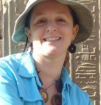
Biography:
Ms Dominguez Tejo is an AUSAID awardee currently completing her PhD at the University of New South Wales, Australia. She obtained her Master of Science degree with Distinction from Heriot-Watt University (United Kingdom) as a recepient of the Cheevening Scholarship Award. She also holds the degree of Master of Business Administration from PUCAMAIMA University (Dominican Republic). She worked 8 years as Marine Program Manager for The Nature Conservancy, an international non-governmental organization. She has published several publications on marine consevation issues and two books related to the conservation of Humpback Whales and a proposed Marine Zoning Plan for Samana Bay, Dominican Republic.
Abstract:
Planning a sustainable future for sea-bounded megacities will require rigorous evaluation of coastal management frameworks and how they integrate human activities. The Marine Spatial Planning framework has been supporting integrated management of marine resources; however, prior research shows implementation challenges in accounting for adjoining land-use and catchment plans, and the need to deliver multidisciplinary planning approaches. The Sydney Harbour in New South Wales, Australia, currently lacks an integrated approach environmental resource planning. This affects management of estuarine and coastal resources, as enhanced understanding is needed on how environmental impacts affect social systems. Hence, research into a prototype decision support system is underway to assist coastal councils analysing management alternatives. The prototype builds on an existing support system to include a Bayesian Belief Network to model relationships between planned management scenarios and key social, economic and environmental community values. Initial work included a comprehensive review of six existing coastal management plans and 275 community surveys to gather information on community demographics, environmental and socio-economic values, and perceptions of coastal threats. In-depth interviews with government managers are planned to jointly develop management goals and operational objectives, design management scenarios and to validate an initial model. Community-based validation will take place through local workshops. Research outcomes are expected to support the comparison of alternative coastal management scenarios by assessing their influence on community values. Such multi-criteria approach can anticipate outcomes of marine spatial planning process and provide valuable insights into potential impacts from stakeholder trade-offs and environmental policies.
Prof. Suzan E.A. Kholeif
National Institute of Oceanography and Fisheries (NIOF),Egypt Egypt
Title: Integrated Coastal Zone Management : Putting Knowledge into Practice
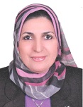
Biography:
Prof. Suzan Kholeif is an experienced Egyptian Marine Geologist, having over 20 years of work experience in Environmental Assessment, Coastal Zone management, in the area of geology, Climate changes, geo-environment, water quality assessment (EIA). She holds a PhD in Marine Geology (1999) and holds a strong track record of publications which include Climate changes, sea-level changes, assessment of coastal waters quality, shore protection, as well as Environment Impact Assessment (EIA). She also has participated in many national and international projects, as investigator, team leader and/or coordinator, for instance; EU-funded project - “SESAME” (2007-2011); Evaluation of chemical contamination in the Eastern Mediterranean by the method of transplanted mussels “MYTIOR” (2009-2010); “PEGASO” (2010-2013). AQUAMED (2010 - 2014); FORCE" (2011-2014); MEDINA (2010-2014); Advisory Board of IASON (2013-2015) and national expert of “MIRA”, FP7 project (2011-2013).
Abstract:
In general, Integrated Coastal zone Management (ICZM), is an interdisciplinary and comprehensive strategy or framework based on the best available science and governance to be implemented at the community level and national level targeting sustainable ecosystem. In the past, many initiatives have been categorized in the name “ICZM projects” both in Mediterranean Countries and elsewhere, but it is now widely recognised that, ICZM is a process which takes many years to develop. Several ICZM projects and initiatives were launched since 1990s, to put into practice national and regional coastal zone management strategies, however up to now they have not been implemented in a reliable way. ICZM use to regulate the spatial deployment of economic activities and to set up spatial planning systems for coastal areas. However, there is still a lack of experience in some countries, and little data and knowledge available to policy makers and practitioners for successfully development and/or implement of ICZM. The most important problem now is how to make better use of knowledge and data in integrated Climate changes into ICZM process. The importance of improving knowledge transfer between countries is considered a vital component for cooperation. Knowledge transfer involves the processes for collecting and sharing knowledge, skills, best practices and consultancy. Identify relevant information regarding ICZM and impact of climate changes on coastal areas are required to identify the most likely priority uses, current potential pressures, synergies and governance framework for ICZM.
Delianis Pringgenies
Fisheries and Marine Science,Diponegoro University, Indonesia
Title: Exploration of bacteria Symbionts Mangrove Waste for the production of decompositer
Biography:
Abstract:
Waste of mangrove is a collection of mangrove waste consisting of leaves, twigs, branches fall to the ground and eventually turned into decomposition. The research objective was to determine the types of bacterial symbionts of waste mangrove potential as an anti-bacterial, anti-bacterial bacteria subsequently used as bio-activator for the production of compost that contains nutrients. Research includes: isolation of bacterial symbionts, screening bacterial symbionts that potential as an anti-bacterial, DNA extraction using the High Pure PCR Template Preparation Kit (Roche), DNA amplification by PCR of 16S rDNA, DNA sequencing. Results 16S r-DNA sequences were analyzed and edited using Genetix program and sequence analysis of 16S rDNA. Results 16S r-DNA sequences were analyzed and edited using Genetix program and sequence analysis of 16S rDNA. Bacteria that potential as an antibacterial used as a bio-activator production and the production of bio-activator tested nutrient content of compost seaweed Sargasum. The results were compared with the activator products found on the market. The identification results are found there are 4 types of bacterial symbionts that potential as an anti-bacterial: the bacterium Pseudomonas sp., Flavobacterium sp., Acinetobacter sp., Bacillus subtilis. Production of bio-activator bacterial symbionts waste mangrove have better quality than the quality of bio-activator that exist in the market and liquid organic fertilizer without a bio-activator. Production of bio-activator bacterial symbionts waste mangrove have better quality than the quality of bio-activator that exist in the market and liquid organic fertilizer without a bio-activator. The conclusion is that the production of bio-activator of bacterial symbionts mangrove waste of potential as probiotics production environment.
Dr Sylvia Jagerroos
Environmental Resource Management (ERM),Kuala Lumpur, Malaysia
Title: Environmental sensitivity mapping as a management tool for Coastal protectionin the contingency planning for oil spill response

Biography:
Sylvia is a senior consultant with ERM and she has over fifteen years’ experience assessing a wide range of marine environment and has in depth knowledge of sensitive tropical habitat assessments. Sylvia is specialised in Climate Change and resilience adaptation, and she has collaborated with the World Bank to establish Coastal Management plans on islands in the Maldives and she has assessed other projects in a wide range of countries like Kenya, Sri Lanka, Australia, Philippines, Brunei Darussalam and Malaysia. She is currently working on several offshore projects in the region of South East Asia where she is developing environmental studies mainly for the oil and gas sector.
Abstract:
The Deepwater Horizon oil spill is considered the largest accidental marine oil spill in the history. Extensive damage to marine and wildlife habitats, fishing and tourism industries was reported, and is still ongoing today. One of the primary objectives of oil spill planning and response, after protecting human life, is to reduce the environmental consequences of a spill. This objective is best achieved if the locations of sensitive resources are identified in advance, so that protection priorities can be established and the most appropriate clean-up strategy selected. The most commonly adopted approach to define these sensitive areas or receptors are based on the Environmental Sensitivity Index (ESI) Mapping strategy, where the data collected are divided into different categories of sensitivity with their relevant features and stored in a GIS database. The question is whether the operators are updating their coastal areas sensitivity map accordingly and efficiently and whether the operators are sharing their data with government agencies, in order to enhance coastal conservation and coastal protection and maximise the response in case of an emergency event.
Dr Fan Hangqing
Guangxi Mangrove Research Center, China
Title: UNDERGROUND TUBE MANGROVE ECOFARMING SYSTEM
Biography:
Fan Hangqing has completed his PhD at the age of 27 years in 1991 from Xiamen University of China. He is the director of Guangxi Mangrove Research Center. He has published more than 100 papers and 10 monographs in mangrove and seagrass. He is the chairman of Academic Association for China Mangrove Ecology
Abstract:
Following 7 years of field trials conducted in the mangrove areas of Guangxi Province, China, between 2007 and 2012, a mariculture system has been developed that greatly enhances natural productivity. This system is based on the installation of underground tubes, and has resulted in annual mean production values of between 35,283, and 44,097 USD(1USD=6.5 China Yuan) per hectare per annum without requiring cutting or conversion of mangrove vegetation. Based on the peer trials, an improved system is being established in 2015. This article provides details of the system, its construction, operation, economics and production. Consisting of a network of underground tubes, erect pipes and management chambers, this system is based on enhancing the spatial heterogeneity of the benthic environment by burying plastic pipes in the mangrove soils thus providing refuges for economically important fishes with minimal disturbance to the mangrove root system. Landward shrimp ponds can be used as reservoirs to oxygenate the water in the system during low tide. Molluscs are raised on mudflat surfaces within the habitat. The ecofarming site is accessed by boardwalks that also facilitate ecotourism and public education. This ecofarming system is environmentally friendly because no enclosures are constructed and there is no industrial feed input. Since the bulk of the system is buried within the mangrove soils it is resistant to storm and tidal surges, is easy to control and has low management cost, whilst the products are of high quality and have high recapture rates. To date, ten indigenous species have been trialled and five of them have been successfully raised and harvested. The underground tube ecofarming system is unique and original and not derived from any similar system currently in operation elsewhere in mangrove ecosystems. In 2015, the underground ecofarming system was improved by fish living box to minimize eruption probability of fish natural enemy, the leech Aestabdella sp, and round chamber replaced the prior rectangle chamber to increase drainage efficiency of sediment that usually causes lack of dissolved oxygen. In order to mitigate high water temperature during low tide period in summer, one meter depth ditches were dug on the bottom of shrimp pond, and plant drafts,Sesuvium portulacastrum, were put on water surface. In addition, mangrove and saltmarsh plants are cultivated along the pond edge as a shelter for fish. These measures facilitate shrimp pond not only being a reservoir but also a perfect habitat for multi-species aquaculture. Regarding the shrimp pond and underground tube as a whole system, more products and higher benefits are anticipated.
Dr AARON Lipton
Centre for Marine Science and Technology, Manonmaniam Sundaranar University, India
Title: Conservation steps through confined breeding, sea ranching and evaluations of growth in natural habitats of chosen sea horses and sacred conches along the South Eastern Indian coast
Biography:
Dr. A.P. Lipton is working as a Professor Emeritus in the Centre for Marine Science and Technology, Manonmaniam Sundararnar University, India. He is a former Principal Scientist & Head of the Marine Biotechnology Division of CMFRI with nearly 39 years of research, teaching, guidance, extension and research management experience. Fields of intrests include: marine natural products, /bioactive metabolites, mariculture of marine medicinal species for drug leads, conservation mariculture, disease diagnosis and disease management in marine aquaculture. He has published more than 125 peer reviewed publications in national and International journas and serving as Reearch Director and Manging Trustee of NGO.
Abstract:
Sea horse, Hippocampus trimaculatus obtained as by-catch from the shallow coastal habitats in the Gulf of Mannar and Palk Bay coast of India and maintained in laboratory were observed for courtship and egg transfer. Spherical eggs measured 2.12±0.019 mm in length and 1.97±0.045 mm in width weighing 2.94±0.3 mg. After egg transfer, male’s pouch became water-tight and pregnancy lasted for 12 to 14 days. The mean brood size of H. trimaculatus was 389±56.11. Newborn seahorses were 7.0±0.05 mm in length and 0.97±0.08 mg in weight. Feeding regimens were standardized. Juvenile sea horses captive-bred and were collar tagged, released in the natural habitat and wide publicity was given to return the tagged seahorses. Data revealed an average growth of 4.15mm/month in the natural habitat. Sacred conch, Turbinella (=Xancus) pyrum collected from sea bed up to 20 meters depth in the Gulf of Mannar, India and maintained in rectangular tanks containing sand substratum with adequate sea water flow through were used for breeding trials. Brooders were fed ad libitum with live clams Donax cuneatus and Donax faba. The release of egg capsules and the number of baby conches were recorded. Baby conches started growing from an initial 9.09mm length to 62.23mm in length with an increase in shell diameter of 31.47 mm from 4.07 mm in 360 days. After tagging, the baby conches were sea-ranched in Gulf of Mannar with wide publicity for returning the recaptured tagged conches. The recovery was14.6% and the average breadth-wise growth was 8.0 mm/year in nature.
Assoc. Prof. Sr. Dr. Mohd Zulkifli Mohd Yunus
Universiti Teknologi Malaysia, Malaysia
Title: Coastal Management In Malaysia: Appreciation To Geographic Information System Problem Solutions
Biography:
Dr. Mohd Zulkifli Mohd Yunus received his PhD degree in Geographic Information System from University of Newcastle upon Tyne, United Kingdom and started to work as an academician since 1986. He has been Director of Centre for Part-Time Studies, UTM in the period 2009-2015. His research mainly focuses on application of GIS in civil engineering especially in transportation and coastal zone management. He serves as a reviewer for many conferences and as an editorial board member of International Journal of Real Estate Studies.
Abstract:
Research on coastal management has been quite intensive over the last decades in Malaysia. Determining the coastal vulnerability index is one of the most complex analysis due to the different effects of various parameters. The objective of this article is to promote the use of Geographic Information System (GIS) as a tool for coastal management problem solving. Hence, in this study, GIS is proposed to determine the coastal management with special focus on the Malaysia coastal and tsunami vulnerability assessment, and coastal erosion problems. This methodology has been implemented on a case study region in north, center and south of Peninsular Malaysia, and therefore the parameters criteria have been obtained for the case study conditions. The assessment was conducted in three phases which extended diagonally from a macro-scale to several local scale, and finally a micro-scale assessment. The outcomes of the assessment in the form of GIS-based maps are able to discriminate between the numerous levels of vulnerability, the several levels of impact severity towards existing structures, property and land use within the study area. Most essentially, the maps could help planners to establish a zoning pattern for potential coastline development. The final result of the study indicates that the GIS is the brilliantly best solution for coastal management in Malaysia with the proposed methodology can concurrently satisfy all relative parameters in vulnerability and erosion based on their impact. Thus, a system that can manage these problems has been developed.
BENHAR SAID
HASSAN II University, Casablanca, MAROC
Title: The validation of an analytical method is defined in the ISO / IEC 17025
Biography:
BENHAR SAID has completed his a DOCTOR from HASSAN II University. He is the director of PROFESSOR VACATION in this university. He has published more than 15 papers in reputed journals and has been serving as an editorial board member of repute.
Abstract:
The validation of an analytical method is defined in the ISO / IEC 17025 [1] standard as the confirmation by examination and provision of objective evidence that the particular requirements for a specific intended use are fulfilled. Intra-laboratory validation of an analytical method is defined as the act of submitting a method of analysis to a statistical study intra- laboratory based on a standardized and / or recognized protocol, and demonstrating that its scope, method of analysis satisfies predetermined performance criteria. Method validation is a primary requirement of the technical part of the ISO17025 standard [1]. In this work, we used the protocol DR-12-VMC Revision: 2009[2] on the validation of an analytical chemistry, for validation and to demonstrate that the method of dosage of Lead (Pb) in marine organisms , used internally, according to AOAC Official Method 999.10 by atomic absorption spectrophotometry with graphite furnace (quantitative method)[3] is suitable for the intended use. Also, through this study , we conducted to characterize the performance of the analytical method used , evaluating , through experimental work and statistical tests several parameters among the most often recommended are: the detection limit the limit "of quantification , the ratio of compliance, linearity, accuracy , sensitivity, specificity, accuracy , and finally recovery
Qian Zhou
Yantai Institute of Coastal Zone Research, Chinese Academy of Sciences, China
Title: Surface Morphology and Adhered Substances of Microplastics from the Coastal Beaches in China

Biography:
Ms Qian Zhou is a postgraduate student studying for MSc in Yantai Institute of Coastal Zone Research, Chinese Academy of Sciences, majoring coastal environmental science and engineering. She has published 2 papers in Chinese Science Bulletin and applied for 1 patent and has been studying microplastics pollution in the coastal zones in China
Abstract:
Microplastics refer to small pieces (<5mm) of plastics and are considered as an emerging pollutant of concern worldwide in coastal and ocean environment. This is because ingestion of microplastics and transfer in the trophic levels may pose adverse effects on marine organisms which accumulate plastic pollutants, monomers and additives. In this paper, we introduced in particular surface morphology and substances on the sediment microplastics in different shape types such as foam, particle, pellet, fiber and fragment. The microplastic debris in the sediment was separated by a continuous flow and air floating/density separation apparatus. Spectroscopic approaches including FT-IR and SEM were used for the microplastics identification coupling with pretreatments using several chemicals. The technique of attenuated total reflectance FT-IR (ATR-FT-IR) was used to identify chemical components of the microplastics from the samples. Scanning electron microscope equipped with an energy dispersive spectrometer (SEM-EDS) was applied for observation of surface morphology of the microplastics and for identification of the inorganic substance absorbed onto the surface. The observation showed that the microplastics surfaces were irregular, rough, hollow and porous, indicating severely weathered and eroded. Some microplastics surfaces had iron oxides and the others had crude oil and likely organisms, implying that the field microplastics could be rather complicated and provide highly adsorptive carriers adhering toxic pollutants and harmful living biotas in coastal environment. The paper also puts forward an insight on future research needs on microplastics in ocean and coastal zones in China.
El John Engaño
Department of Biology, College of Science, Adamson University, Philippines
Title: Effect of Water-Accommodated Fraction on the Early Life Stage of Favites colemani

Biography:
El John S. Engaño and Genevive B. Bocalig are currently finishing their undergraduate studies in Biology at Adamson University.
Abstract:
Oil is one of the major pollutants in the marine ecosystem which has short and long-term effects upon its contact with marine organisms especially corals. Coral organisms are sensitive to environmental changes which can affect their breeding and growth, thus, making them bioindicators. For instance, the effect of this pollutant is manifested by the dramatic deterioration of coral reefs in the coastal municipality of Bolinao in Northwestern Philippines. This study aimed to provide benchmark information on the juvenile stage of Favites colemani,one of the coral species in Bolinao. In this study, a controlled amount of two-day old Favites colemani larvae were subjected to different concentrations of water accommodated-fraction (WAF) of diesel fuel oil condensate for 48-hours while surviving larvae were exposed to Crustose Coralline Algae (CCA) for 24 hours to test their competency. Results showed that there is a significant difference between the survival of the two-day old Favites colemani larvae within 24 and 48 hours of exposure in diesel fuel oil condensate WAF; while there is no significant difference on the settlement rate of larvae exposed to CCA. These results showed that time serves as an important determinant of the survivability of corals since the possible response of the early life stage of corals is dependent on how long these are exposed to oil contamination. Therefore, looking into the response of said corals gives an insight on what to expect when oil spill occurs and what possible courses of actions are needed to prevent further degradation of coral organisms.
Dr Aijun Wang
Laboratory for Coast & Ocean Geology, Third Institute of Oceanography, State Oceanic Administration, China
Title: Effects of rapid urbanization on coastal geomorphology evolution in a semi-enclosed embayment

Biography:
Aijun Wang has completed his PhD at the age of 32 years from Nanjing University. His major is Marine Geology, and he specilize in sediment dynamic and coastal geomorphology. He has published more than 10 papers in reputed journals and has been serving as an reviewer for many reputed journals.
Abstract:
The growing human pressure on natural systems results in strong impacts, some of which may be irreversible, especially in coastal area. Urbanization in coastal zone can transform the structures, functions and processes of coastal environment. Coastal embayment, as an important type of coastal system, is undergoing a heavy influence by strong human activities and urbanization. Tongan Bay is a typical semi-enclosed embayment adjacent to Xiamen Island, southeast China. Due to construction of the Gaoji Seawall, the Tongan Bay have occurred a heavy accretion from 1950s’, and the hydrodynamic processes were changed obviously, and the fine fraction of the sediment increased. Since 2006, due to the requirement of the rapid urbanization, the Tongan Bay was experienced a series of complicated rearrangement, and hydrodynamic processes were changed again, and associated suspended sediment and bedload transport patterns were also altered, and then the new sediment distribution pattern and geomorphology structure were established correspondingly. The evolution of geomorphology in Tongan Bay is experiencing the adjustment from naturally developed pattern to artificial geomorphology types. After the complicated rearrangement, it will be fashioned into a set of new geomorphology pattern which is the net effects of physical hydrodynamic processes and human activities.
Yvette Baninla
Research Center for Eco-Environmental Sciences, CAS, China
Title: Pollution Tolls in Cameroon Estuarine System: The Quest for an Integrated Approach
Biography:
Yvette Baninla has completed his Masters from Xiamen University and is now doing her PhD in Researh Center for Eco-Environmental Sciences, CAS
Abstract:
The Cameroon estuarine ecosystem is of immense socioeconomic and biogeographic importance. This ecosystem harbors more than 2 million inhabitants and the countries’ industries are disproportionately located in this zone. The Wouri estuary in Douala alone is the main gateway in and out of Cameroon. The latter handles more that 95 percent of Cameroon’s maritime trade. Moreover, the estuarine zone is the seat of the rich and diverse mangrove ecosystem. The mangrove serves as a spawning milieu for marine organisms; the reason many people from all over central Africa converge here to earn a living through fishing. Despite being of environmental and economic significance, non-point and point source pollution is gradually gaining momentum. Surging population coupled with pollution from industrial and domestic wastes, pollution from shipping and oil terminals, sea level rise, overfishing, deforestation and sprawl, will further excess deleterious effects on the estuarine milieu. This paper makes an attempt in identifying the various sources of marine pollution in the Wouri estuary as well as the causes. The negative effects of polluted substances were identified by collecting and studying the relevant literature. Pollution at the coast is increasing at an alarming rate and addressing this problem has been a difficult task. The review looks at the definition of coastal pollution, discusses the causes, impacts and preventive measures. Finally it makes an appraisal of Cameroon’s estuarine ecosystem, pinpoints the lacunas in current management approach. Though efforts have been made to address compelling pollution challenges, they have been government-dominant and largely enshrined in the sectorial approach. The integrated estuarine approach (IEA) built on integrated coastal management (ICM) is recommended as a management strategy to curtail estuarine pollution. The IEA though a prototype, is also expected to shape management within the academic arena.
Ahmed Amirsha. PV
Department of Geography, School of Earth and Atmospheric Sciences, Madurai Kamaraj University, India
Title: Evaluation of Ground water Quality and its suitability for the Inhabitants of Kavarati Island,Lakshadweep
Biography:
Ahmed Amirsha PV doing his Ph.D on the topic ICZM, Lakshadweep Islands under the supervision of Dr. V. Emayavaramban, Head & Chairperson in the department of Geography, Madurai Kamaraj University, Madurai, Tamilnadu, India. He has presented many papers in National and International Conferences. His three papers are published in reputed journals and he attended many training programme
Abstract:
Lakshadweep is a group of some three dozen islands scattered in the Arabian Sea off the western coast of India. The principal island Kavaratti is the headquarters of the union territory of Lakshadweep. The groundwater is getting contaminated which is the main source of drinking water. A proper understanding of the groundwater condition in terms of availability, distribution and quality is important in order to meet the increasing demand and also for the future planning and development of the water resources. Management of fresh water, which is floating as a lens over the brackish and saline water, is a big challenge. There are public health problems and waterborne disease in the Islanders. This paper understanding the groundwater condition is important in order to meet this increasing demand and also to formulate future development and management strategies. Detailed hydrological and hydro chemical studies had been carried out to identify potential fresh groundwater resources and quantify vulnerable parts of Kavaratti Island. This island is located at a distance of 404 km (218 nautical miles) from Kochi and it lies between 100 32’ and 100 35’ N latitude and 720 35’ and 720 40’ E longitude, having an area of 3.63 sq km. The data used in this study consisted secondary data were collected from water quality lab Kavaratti Island. The maps are prepared using Arc GIS 9.3 version which is used to digitize the map. Suitable statistical techniques were used to analyse the data relating to environment, social and ecological parameters.
Prof Carlos Melecio Carmona Cedillo
Institute of Marine Sciences and Limnology, UNAM, MEXICO
Title: Macrobenthic biodiversity into intertidal zone at Colorado River Estuary, Mexico
Biography:
Born in Mexico, and became interested in oceanology (oceanography), after know Ramon Bravo Prieto and Jacques-Yves Cousteau documental work, quickly develop a fascination for ocean and marine life. He studied oceanology at Marine Sciences Faculty, University Autonomous of Baja California. After a stay at Tokyo University of Fisheries, his interest shifted to physical-biological interaction in to the ocean. This was the core of research for earn MSc at Limnology and Marine Sciences Institute, UNAM. Also collaborating into Vaquita-Totoaba Government Program, Colorado River Delta Program, Several Oceanographic Surveys into Gulf of Mexico and Gulf of California, Technical advisor to Shrimp Fishery Cooperatives. And He was a lecturer at University Autonomous of Morelos State and University Autonomous of Hidalgo State.
Abstract:
The objetive was to enlight the rare species contribution to biodiversity of macrobenthic community at Colorado River Estuary. The abundace data was collected by cores into intertidal zone at six points distributed on the east side of the estuary.The observed richnes and abundance data was used for estimated Chao Richness index a bias corrected, diversity by non-parametric Shannon Index, and Morisita Disimilarity Index. The biological variability was explain by CCA analysis and correlated with environmental factors (grain size, organic matter and shelter beach). The results support that the rares species beacome important for the biodiversity. The Morisita Index confirm the disimilarity of the sites. And let to indentify three biocenosis at the estuary zone.
Dr Agus Hartoko
Fisheries and Marine Science, Diponegoro University, Indonesia
Title: Application of Geo-membrane as Innovative Technology in Developing of Traditional to Modern Brackish Water Pond Salt Production at Demak Coastal Area – Indonesia
Biography:
Agus Hartoko has completed his PhD at the age of 42 years from Bandung Institute of Technology. He is Lecturer at the Faculty of Fisheries and Marine Science since 1984, now Professor and the Director of Master Program – Management of Coastal Resources since 2012 at Diponegoro University. Semarang. Indonesia. He has published more than 5 papers in reputed journals and has been serving as an editorial board member of repute in Indonesia
Abstract:
Indonesia with about 81,000 km length of its coastal area is still importing country 1 million tons per year for its industrial needs out the national need of 3 million tons and 2 million tons national production of salt. This was since most of salt production in Indonesia until nowadays still relay on the traditional methods by fisherman families since hundreds years ago. Traditional salt product was identical with poor quality with low NaCl content, turbid-brown and easy melting salt crystal. Such as Demak coastal area as well another coast along the north coast of Java was characterized with turbid coastal seawater, caused by many turbid estuaries and high suspended solid of alluvial riverside systems. Geo-membrane applied in the study was a specially designed with three layer poly ethylene, (Patent ID-P0033348), pore-size 250 micron, size 440 cm x 50,000 cm and 880 x 50,000 cm. Specially designed geo-membrane is a multilayer poly-ethylene which the upper layer function to prevent high the brackish water pond soil porosity, with smooth and scratch-resistance capability for salt harvest. The middle layer will optimally absorbs sun-light heat to increase high sea water evaporation and salinity thus increasing salt production and efficiency. The lower layer will protect for salt production soil table to undergone of soil surface deformation. Result had confirmed a double increase of salt production that is 147 ton/ hectare for three months, increase salt quality from the second or the third class salt quality to become first class salt quality. Increase salt price from IDR. 300 to become IDR 650 (USD 5 cent) per kg, compliance of Iodine concentration range of 50 – 80 ppm with Indonesian Standard.
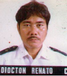
Dr Renato DIOCTON
Samar State University-Mercedes Campus College of Fisheries and Marine Science, Philippines
Title: Ichthyoplankton Distribution in Samar Sea, Philippines && Trawl Catch and By-catch Survey in Samar Sea, Philippines
Biography:
Prof. Renato C. Diocton, has completed his Masters of Science in Aquaculture at the Pangasinan State University- Open University System in October 2013, also completed his Masters of Science in Fisheries major in Fisheries Biology at the University of the Philippines in the Visayas in 1997. He is the Head of Research and Development at the College of Fisheries and Marine Sciences of the Samar State University, Catbalogan City also Chairman of the Marine Biology Department. He presented also a paper in the 4th International Scientific Symposium sponsored by IOC UNESCO WESTPAC at Rukkyus University, Okinawa Japan.
Abstract:
Two major fish landing points where identified namely: Catbalogan Port and Calbayog Fish port and Brgy. Burabud Sta. Margarita as secondary trawl landing port for municipal trawl. Eight researcher/enumerators where oriented on data sampling using National Stock Assessment Program (NSAP) forms. Standardized NSAP forms was used to collect data on trawl both commercial and municipal trawl. For the purpose of segregating municipal trawl for shrimp and fish, we further classify municipal trawl as municipal trawl medium (engine powered by automotive diesel like 4DR5, 6D14,6BB1 etc.) while municipal small are those small trawl for shrimp power by 16BHP gasoline engine or sometimes single piston diesel engines. Travel support was provided under this project. Aside from the landing survey, researcher also conducted on-board observation on trawl operation for commercial and small shrimp trawl. Total catch and towing time was recorded including the cruise track to determine the fishing ground.
Dr John Paul Unyimadu
Nigerian Institute for Oceanography and Marine Research, Nigeria
Title: Concentration of Polychlorinated Biphenyls in sediments of River Niger,Nigeria
Biography:
Doctor John Paul Unyimadu is the Head of Department of Physical and Chemical Oceanography, Nigerian Institute for Oceanography and Marine Research. He received his Ph.D in Analytical Chemistry from University of Ibadan in 1915, at the age of 56. He has over 25 years experience in Coastal Zone Management. He is a consultant to the Federal Ministry of Environment and World Bank on Environmental issues. A chartered Chemist and has published over 25 articles in international Journals.
Abstract:
Polychlorinated Biphenyls (PCBs) are semi-volatile chlorinated hydrocarbons, which are toxic and bio-accumulate in the environment. This research was the first study to report the levels and distribution patterns of PCBs along River Niger, Nigeria. Between 2008-2009, fifteen representative sites along River Niger; three each from Gurara River (tributary) in Niger State, Lokoja (confluence) in Kogi State, Onitsha in Anambra State, Brass and Nicolas Rivers (tributaries) in Bayelsa State, were purposefully selected for sampling over a 24-month period. One hundred and twenty sediment samples (30 per quarter) were collected using Van Veen grab sampler. The sediments were extracted and cleaned up using standard methods. The levels of PCB congeners in the samples were determined using gas chromatograph HP 5890 Series 11 equipped with electron capture detector. The possible ecological risks of the PCB levels in the sediments were assessed using US EPA sediment quality guidelines. The total PCBs (µg/kg) dry weight ranged between 536 to 2964 (µg/kg) dry weight. The US EPA sediment quality guideline, probable effect concentration (PEC) of (676 µg/kg) for PCBs were exceeded in 93.3 % of the samples, sometimes four folds. The highest concentration was detected at the delta region of the River Niger (Nicolas and Brass Rivers) which act as repositories of these contaminants. The level of PCBs in sediments of River Niger presents potential danger for benthic and human health. Therefore, continuous monitoring of this River is very important.
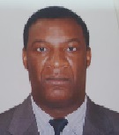
Dr. Carlo Elisca S. CEROME
Consultant - Urban Management Specialist Maritime Service and Navigation, Haiti
Title: The impact of Sargassum on integrated coastal zone management in the Great South of Haiti
Biography:
Carlo Elisca S. Cerome Urban Management and Administration from Arizona State University and completed a Th.D in Christian Counseling at Christian Bible College and Seminary. He is currently the director of Planing for the Maritime Service and Navigation of Haiti (SEMANAH) and professor at university in Haiti. While in position, he conducts several researches in coastal zone development with emphasis on matters related the environmental protection
Abstract:
This article reflects on the impact of Sargassum on integrated coastal zone management in Haiti. It highlights the various local researches on invasive species in general, especially “the Sargassum seaweed”. In terms of purpose, it would emphasize the misdeeds of Sargassum seaweed on the tourist industry, fisheries, and the health of the population. This article offers a new understanding of coastal risks. While the natural dynamics gives coasts intrinsic mobility and, in most cases, a downward trend towards the lands, the evolution of human facilities obeys an inverse logical progression towards the sea and coastline resolution. The combination of strong "natural" hazards and stakes concentrated in a small area creates a great vulnerability on the coastal strip. Haiti, with its 1771 km of coastline and being an island crossed by seismic fault is a high risk territory. I intend to present a model to better approach the integrated coastal zone management at high risk. This model is based on statements made to restore and protect coastal tourist place called "Camp-Louis" dilapidated after the earthquake of January 12, 2010. This intervention is a pilot project that could be applied in the management of the risks of coastal erosion in countries with a coastline that are overgrown with seaweed Sargassum.
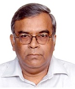
Abu Saleh Khan
Deputy Executive Director, Institute of Water Modelling, Dhaka, Bangladesh
Title: Tidal River Management Concept used in SW Region of Bangladesh
Biography:
Abu Saleh Khan, is Principal Specialist, and Deputy Executive Director (Operations) at Institute of Water Modelling (IWM). A graduate in Civil Engineering from Bangladesh University of Engineering and Technology (BUET) in 1980 and later did his Masters in Water Resources Engineering from the same university, Mr Khan joined IWM erstwhile SWMC in 1990. Since joining the Centre, he has been extensively trained in Mathematical Modelling at home and abroad. He has more than 35 years of professional experience in the field of hydraulic, water resources and environmental engineering. Besides hydrological and hydraulic modelling, he has developed expertise in the field of water quality modelling, and various environment related subjects including EIA. He has attended many seminars and has a few publications to his credit.
Abstract:
Bangladesh is a land of rivers. It is the drainage route of the mighty Brahmaputra, Ganges and Meghna Rivers. Thus all water from these river catchments and also water from other 54 cross-boundary rivers are being carried away by hundreds of rivers, tributaries, and distributaries that crisscross this small land like a giant web. Our everyday life-culture, our agriculture, fisheries, economy, communication, and our industries – all these activities are river-centered. In the 60s of the previous century, a number of polders were constructed in order to reduce the impact of salinity and increase agricultural productivity. But in course of time with the gradual reduction of upstream flow added with the sedimentation of the drainage routes these polders have only assisted in increasing the impact of water logging and salinity. Upstream withdrawals by India on the other hand have resulted in numerous distributaries of the Ganges River of not getting water during the dry seasons and so the freshwater resources have also dried up. Even repeated dredging has failed to maintain the navigability of rivers such as Garai. In the backdrop of such calamitous situation, the people removed the embankment surrounding the wetland beel Voina. As a result the water entered the beel and in the regular course of high and low tide, the wetland has filled up and thus put an end to water logging. Bangladesh Water Development Board has taken initiative to use this experience of the local people. Subsequently Institute of Water Modeling (IWM) has become a partner to the initiative taken by Bangladesh Water Development Board and has verified this concept through the use of mathematical model study.
Dr Rahanna Juman
Institute of Marine Affairs, Trinidad and Tobago West Indies
Title: Development of an Integrated Coastal Zone Management Policy Framework for Trinidad and Tobago

Biography:
Rahanna Juman has been conducted research in the marine and coastal environment of Trinidad and Tobago since 1996. She obtained her PhD in 2004 from the University of the West Indies and her Bachelor of Law in 2015 from the University of London. Rahanna currently chairs the National Steering Committee with responsibility for developing an Integrated Coastal Zone Management Policy Framework, Strategies and Action Plan for Trinidad and Tobago Kahlil Hassanali is a researcher in marine policy at the Institute of Marine Affairs in Trinidad and Tobago. His research interests are wide ranging and include integrated coastal zone management (ICZM); marine protected area (MPA) management; and institutionalization of community based natural resource management. He holds an MSc. in Environment and Development from the University of Reading and a BSc. in Environmental Sciences from the University of East Anglia, both of which are United Kingdom based institutions
Abstract:
Trinidad and Tobago is the southern-most country in the Caribbean archipelagic chain with a land to sea ratio of 1:15, which indicates the importance of the marine and coastal sphere to the country. The country’s economy has always been supported by coastal and marine resources, primarily oil and gas, tourism and fisheries and it is is estimated that almost 80% of all socio-economic activities and 70% of the population are located along the coast. New economic policies, aimed at diversifying the economy, have seen investments in the tourism, agriculture, aquaculture and maritime sectors, all of which depend on a healthy coastal environment. Much of the nation’s coastal resources have already been destroyed, damaged or over-exploited to accommodate a growing population and their economic needs. Climate change, sea level rise and heightened erosion in some areas also exacerbate the problems associated with many interests competing for limited coastal space. In 2012, the Cabinet of Trinidad and Tobago appointed a Steering Committee to Develop an Integrated Coastal Zone Management Policy Framework, Strategies and Action Plan. Integrated Coastal Zone Management (ICZM) has been identified as the best approach globally to achieve balance between development and conservation by managing human activities within the coastal zone, and addressing conflicts amongst different resource users and uses. It is a strategy to adapt to climate change impacts and to reduce vulnerability to coastal hazards. The paper highlights the process undertaken by the Committee to develop the ICZM Policy Framework and the challenges faced with its implementation.
Dr Glory Amarachi Izimah
Independent Environmental Consultant, Netherlands
Title: Integrating livelihood issues in sustainable mangrove conservation: Case study of Ibeno, Niger Delta Nigeria

Biography:
All over the world, mangrove ecosystems are threatened by both natural and human interferences that limit their potentials to deliver benefits for human wellbeing. In Niger Delta region of Nigeria, the unsustainable utilisation of and dependence on mangrove resources for livelihoods by local communities have led to the depletion of the mangrove forest. This is in addition to oil exploration, urbanisation and population growth. Like in many other coastal regions of the world, poor local coastal communities in Niger Delta exploit mangroves for food, fish, fuel wood, timber, building materials and for income generation. In the face of global warming, climate change and extreme flood events, efforts are been made to conserve the world's mangrove forest as it has been discovered to serve as sink for green house gases and as defence against coastal floods. In the bid to conserve the mangrove forests of Niger Delta, restrictions have been placed on utilisation of mangrove resources and in some cases, mangrove forests have been designated as forest reserves by government. Little or no attention has been paid to why coastal communities in the region depend on mangroves for livelihoods and no incentives have been put in place to address the livelihood challenges of the local communities. An understanding of how and why local communities harvest mangrove resources is vital for drawing sustainable mangrove conservation plans. Addressing livelihood needs of local communities and integrating local stakeholders interests in mangrove conservation is equally significant for successful implementation and sustainability of any mangrove conservation plan. This study was carried out in Ibeno, a coastal community in Niger Delta, Nigeria with the aim of understanding why local communities in Ibeno depend on mangroves for livelihood. The study examined the livelihoods of local communities in Ibeno that are supported by mangroves, reasons why the local communities depend on mangroves for livelihood and perception of local stakeholders about mangrove management in Ibeno. Both primary and secondary methods were used for data collection.. The study concludes that the lack of alternative source of fuel, lack of back social amenities and poor income opportunities are the major reasons for local community dependence on mangroves for livelihoods. The study recommends integrating these issues mangrove conservation plans
Abstract:
Glory Amarachi Izimah completed her Masters Programme at UNESCO-IHE Institute for Water Education, Delft, Netherlands in April, 2015 and obtained a Master of Science degree in Environmental Science with specialisation in Environmental Planning and Management . She has also undertaking a startup programme for water, sanitation and natural resource entrepreneurs at the International Centre for Water Management Services, Willisau, Switzerland. Glory has strong interest in environment, renewable energy and WASH policies, research and entrepreneurship for sustainable development.
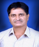
Dr Prabhakar R Pawar
Department of Zoology, Veer Wajekar Arts, Science & Commerce College, India
Title: Monitoring of impact of anthropogenic inputs of Jawaharlal Nehru Port (JNP) on diversity of macrobenthos from coastal environment of Uran, Navi Mumbai, west coast of India
Biography:
Abstract:
Biodiversity, which is the diversity of earth’s ecosystems, species and their genes, is highly valued its natural biological wealth, sustains human life. But it is being systematically degraded. Several hundred species have become extinct and many are on the way to a certain death. ‘When nation loses its biodiversity, it stands to lose not only its wealth, but also its future.’ Mumbai, a major metropolis and one of the world’s most populous cities called as the Urbs Prima of India. Mumbai city with 16 million inhabitants is the most populous city in India with 29,650 people inhabiting per square kilometer. Mumbai generates 0.85 millions m3/d of liquid effluent and 14,600 t/d of solid waste, which without any treatment, are discharged in the coastal region in and around Mumbai. The coastal environment of Navi Mumbai has been under considerable stress since the onset of Thane-Belapur Industrial Belt (TBIB, around 3200 industries), Taloje Maharashtra Industrial Development Corporation Industrial Area (more than 822 industries), Chemical factories of Vashi (Navi Mumbai, around 1000 industries) and Jawaharlal Nehru Port (An busiest international port occupying 28th rank among worlds 100 ports and handled 44 Lac containers in current year). Oil, sewage and industrial pollution were believed to be the main environmental problems in the coastal zone of Navi Mumbai. Urbanization, industrialization, reclamation, encroachment, overexploitation and unsustainable demand have resulted in the considerable degradation of mangroves, diversity loss of macrobenthos and several incidences of dead fish surfacing on the shores of Navi Mumbai. Uran with the population of 23,251 is located along the eastern shore of Mumbai harbour opposite to Coloba. A creek called ‘Uran creek/Sheva creek’ (Lat. 180 50’ 20” N and Long. 720 57’ 5” E) encircles Uran city and is continuous with the Panvel creek and Thane creek joining Arabian Sea. The coastal environment of Uran has been under considerable stress since the onset of industries like Oil and Natural Gas Commission LPG Distillation Plant, Grindwell Norton Ltd., MSEB Gas Turbine Power Station, Bharat Petroleum Corporation Ltd., Jawaharlal Nehru Port (JNP), Nhava-Seva International Container Terminal (NSICT), Container Freight Stations (CFS) etc. Jawaharlal Nehru Port (JNP) was established in 1989 near the Uran creek. JNPT is one of the busiest ports among 11 Major Indian Ports and handles about 60% of the total National Marine Transport of cargos. In current year, JNPT handled 44 Lac containers and occupies 28th rank among worlds 100 ports. The port has two dedicated terminals- Bulk and Container. Bulk Terminal with 3 berths and Container Terminal with 2 berths handles the import/export of liquid bulk, ore, vehicles, fertilizers, fertilizer raw materials, food grains etc. JNPT supports a variety of maritime activities; as a result, the area of Uran creek became the ground for hectic activities of Container Freight Stations (CFS). These activities affect the intertidal benthic ecology of fauna and flora. Hence this area has been identified for the ecological assessment. As benthos acts as environmental monitoring agents, for present investigation, 3 study sites separated approximately by 10 km were selected along the coastal line of Uran i. e. Sheva Creek: (Lat.180 50' 20" N and Long. 720 57' 5" E), Peerwadi coast: (Lat.180 50' 10" N and Long. 720 57' 1" E) & Dharamtar Creek: (Lat.180 50' 5" N and Long. 720 57' 10" E) for study of community structure of macrobenthos. Assessment of species diversity and community structure (population density, biomass & diversity indices) of selected macrobenthos is done from Jun 2013 to May 2015. A total of 170 species of macrobenthos representing 44 orders, 83 families and 119 genera were recorded from the Uran coast. Of the recorded species, 11.176% belonged to sea weeds, 9.412% to sponges, 1.176% each to soft corals & anomuran crabs, 2.353% each to flat worms & cephalopods, 2.941% to polychaetes, 18.235% to brachyuran crabs, 35.294% to gastropods, 15.294% to pelecypods & 0.588% to tunicates. This study reveals that maritime activities of Jawaharlal Nehru Port, hectic activities of Container Freight Stations, disposal of domestic wastes and untreated or partially treated industrial effluents in coastal region of Uran, Navi Mumbai have depleted coastal resources, public health risk and loss of coastal and marine biodiversity. Slaughtering of mangroves from Navi Mumbai region due to over exploration, unsustainable demand and reclamation have resulted in destruction of marine life.
Dr Hugh Kirkman
Private Consultant, Australia
Title: Marine Spatial Planning and Ecosystem Based Management
Biography:
Hugh Kirkman completed his PhD in 1982 from University of Western Australia. He worked for the CSIRO (a government research organisation in Australia) for 28 years and then joined UNEP for five years as the Coordinatorof the South East Asian Seas Regional Seas Programm He has published more than 100 papers in reputed journals and book chapters and reports. He is considered a global seagrass expert and has spent the last ten years working on Marine Protectrted Areas and Marine Spatial Planning. He has presented keynote talks at various UNEP meetings and international conferences and has a wide knowledge of marine environmental issues in South East Asian Seas. He has assessed dredging operations in Australia
Abstract:
As the world’s oceans become more available, more easily crossed and their resources more easily exploited there is a need for management of them all. This review covers some of the present attempts at marine spatial planning (MSP) with the particular emphasis on sustainable resource use and conservation of biological diversity. Definitions of ecosystem based management (EBM) are coupled with MSP to suggest means and types of governance. Trade-offs on resources lost for remediation, recovery and the values of goods and services are discussed. The advantages and barriers to good MSP require coordination, understanding and goodwill of all stakeholders. Management requires monitoring, evaluation and recording of the resources being managed. In some parts of the world transboundary cooperation is well advanced and we can learn from them. In other parts MSP is at a very low level and it can be seen that conflicts between stakeholders, even countries can occur. Examples are given of global efforts to conserve marine biological diversity using conventions, international agreements and “soft law”. MSP in southeast Asia is focussed on as an example of how it is attempted in developing countries. Marine protected areas are an important part of MSP and have come into consideration as more and more of the oceans waters and substrates are exploited.
Dr Muhammad Riaz
Pakistan Meteorological Department Flood Forecasting Division, Pakistan
Title: Needs for Cooperative Regional Approaches to address Climate change and Global warming impacts on Indian Ocean

Biography:
Mr. Muhammad Riaz completed his M.Sc. Physics from Peshawar University and joined Pakistan Meteorological Department as Meteorologist. Presently he is working as Chief Meteorologist Flood Forecasting Division Lahore. He has also worked as Senior Meteorologist at Allama Iqbal International Airport Lahore, Director Regional Meteorological Centre Lahore, Chief Meteorologist of National Seismic Monitoring Centre & Tsunami Warning Centre, Karachi. Heading the FFD the only specialized unit of PMD in connection with forecasting the magnitude, the time and the volume of water during the floods through out the major rivers in Pakistan.
Abstract:
The Climate Changes would also have impacts on oceans as it has on land. Such impacts are most importantly the Sea level Rise, due to which submersion of Islands such as Maldip and part of Bangladesh. Rise of Sea Surface Temperature destabilizes the normal state of the Sea for the marine operation. Increase in the wind speed and in the Frequency of cyclone formation, accelerating the erosion process and massive silting deposition that create the environmental pollution are other types of climate change impacts. Whether these impacts pose any serious threats for the marine security? In this paper the author focused on the collective efforts of the regional countries of Indian ocean for monitoring and reliable predictions of the climate and their impacts on Indian Ocean.
Dr Xiaolan Wang
Climate Research Division, Environment and Climate Change, Canada
Title: Climate change signal and uncertainty in CMIP5-based projections of global ocean surface wave heights
Biography:
Abstract:
This study uses the analysis of variance approaches to quantify the climate change signal and uncertainty in multimodel ensembles of statistical simulations of significant wave height (Hs), which are based on the CMIP5 historical, RCP4.5 and RCP8.5 forcing scenario simulations of sea level pressure. Here the signal of climate change refers to the temporal variations caused by the prescribed forcing. ‘‘Significant’’ means ‘‘significantly different from zero at 5% level.’’ In a four-model ensemble of Hs simulations, the common signal—the signal that is simulated in all the four models—is found to strengthen over time. For the historical followed by RCP8.5 scenario, the common signal in annual mean Hs is found to be significant in 16.6% and 82.2% of the area by year 2005 and 2099, respectively. The global average of the variance proportion of the common signal increases from 0.75% in year 2005 to 12.0% by year 2099. The signal is strongest in the eastern tropical Pacific, featuring significant increases in both the annual mean and maximum of Hs in this region. The climate model uncertainty (i.e., intermodel variability) is significant nearly globally; its magnitude is comparable to or greater than that of the common signal in most areas, except in the eastern tropical Pacific where the signal is much larger. In a 20-model ensemble of Hs simulations for the period 2006–2099, the model uncertainty is found to be significant globally; it is about 10 times as large as the variability between the RCP4.5 and RCP8.5 scenarios
Biography:
Dr. Ahlhorn received his PhD in 2009 at the University Kiel (Germany) in Physical Geography dealing with innovative coastal management processes for coastal defense projects. Currently, he is Managing Director of the company “Kueste und Raum” serving as consultancy in water and coastal issues.
Abstract:
Three German estuaries are located in the southern North Sea. Each of them host an important seaport within a distance of 60 to 120 km from the river mouth. Increasing oversea trade and demanding logistics are asking for appropriate vessel sizes and, thus, fairway dimensions. This process of mutual adaptation enables economic development, but causes multifaceted challenges and problems in the respective estuaries. Deeper and straightened fairways led to a changed current velocity and, thus, to inaproppriate erosion and sedimentation process. Furthremore, salt water intrusion emerges as problem for both fesrh water abstraction and ground water bodies adjacent to the rivers. Alteration of flow velocity and direction affected the accessibility of smaller harbours in the river mouth and the natural environment (e.g. migration of fishes, wetlands) of the river is deteriorating. Integrated policies such as the European Water Framework Directive aims at improving the ecological and chemical status of water bodies. Recently approved legislation tackling the water quantity (e.g. flood risk management) issues or the marine environment poses further challenges on the management of estuaries as transition zone between land and sea. This presentation provides an overview of the development in estuarine management in the Weser estuary. Referring to the pending planning approval for the recent fairway adaptation in the Weser further stresses are expected on the natural as well as the human environment. The presentation will compile the existing investigation results of several (sectoral) research projects and propose a framework for an integrated participatory management approach
Nazma Chamely
GIS unit in Local Govt Engineering Department, Dhaka University, Bangladesh
Title: Applying carrying capacity in the coastal islands management for food security and livelihood earning
Biography:
I am perusing my PhD at the age of 42 years from Dhaka University and I am GIS expert in GIS unit in Local Govt Engineering Department. I have published four papers in reputed journals.
Abstract:
Coastal plains and lowland river valleys have been places for human civilization throughout the history of human beings ((Wolanski et al. 2006) although there is an uneasy relationship existed between the coasts with man. The coast provides rich ecological conditions (Van der Zwiep 1991) and different attractive and culturally important landscapes are situated in these highly complex areas. Due to high biological productivity (Blaber et al. 2000) and valuable ecosystem service and functions (Costanza et al. 1997) the coastal zones of the world are under pressure from human activities. Currently at about 60% of the world’s population is living near the coast (Lindeboom 2002).Bangladesh has coast area of about 20,000 km2 with about 24 million or 22% of the population living there (Hossain 2001) and they are directly or indirectly dependent on the resources of the coast. Exploitation of the coastal resources of Bangladesh .Management for the socio-economy and ecology of the country. Introduction of deer Ecosystem services problems. Selection of the correct stocking rate for vegetation, livestock, wildlife and economic return. Experience in stocking rate decisions .Procedures now available . Considerable financial investment, strong capacity building, acceptance and cooperation by the local communities. Guidelines based on field level data, stakeholders' opinion and modern techniques such as Satellite images, Geographic Information Systems (GIS) for the effective and sustainable management of any resource (Ahmed et al. 2010, 2011; Ali et al. 2013, Giri et al. 1997).Lack of policy guidelines for the management of the natural resources of the coastal ecosystems.Focus on the coastal habitat to understand the ecology.Find out proper management policies of coastal islands by proposing the appropriate stoking rate and hence carrying capacity.Twenty 1m × 1m quadrats were established at different places throughout the char and fresh weight were measured to measure production of Uri-grass since December 22, 2010 to March 2013 (three times a year). First we need to know the average forage production by an area or landscape and the minimum residual biomass to be left for the key forage species, the initial stocking rate can be determined as follows (Holechek 1988, Holechek and Piper 1992)Forage demand of the spotted deer with body weight of 45 kg (for female) and 65 kg (for male ) is about 328.5 kg/y and 474.5 kg/y respectively. If only female in the herd - 4566 individuals. If only male is used – 3161 individuals. If we use 50:50 of female and male then the number will half in either case.But in case of commercial carrying capacity, i.e. meat is the goal, and then male spotted dear with higher body weight might be preferable to the authority. But in this case reproduction of next generation will be a problem. In western ranches, usually 2 bulls are maintained per 20 oxen. If we take this into consideration then of 4566 deer we will need 456 male.This indicated that the studied island can carry 4110 female deer and 456 male deer. Toxel and White (1989) proposed a more simpler and conservative procedure - allocated 25% of current year forage production to livestock, another 25% to natural disappearance (insects, wildlife, weathering) and 50% is left for the protection of the area. Besides Keora plant could be considered as another key species and deer like Keora leaves very much. Monkey can be introduced also – new ecosystem build up.Maximize the utilization of the natural resources - no harm to the island.Vulnerability of coastal zone of Bangladesh - mitigating the natural calamities and saving lives and millions of dollar. Scaling up the knowledge to help manage other similar coastal islands. Meat produced can be sold in local market in higher price as meat of deer has a higher demand. Besides deer can be used as sacrificing animals during the Eid-Ul-Azha festival. CBNRM - Natural resources will be better managed.
Dr Seng-Keh Teng
Freelance Consultant (Aquaculture & Environment) Singapore
Title: Practical Guidelines of Applying Integrated Coastal Zone Management (ICZM) System to attain Sustainable Development of Coastal Aquaculture Practices in Southeast Asian Region
Biography:
Dr. Seng-Keh Teng received his PhD in grouper aquaculture from the University of Science Malaysia in 1980. Over the past 35 years, he had worked as: (a) Fisheries Officer for the Fisheries Department of Brunei; (b) Research Scientist for the Kuwait Institute for Scientific Research of Kuwait; (c) Technical Director for the Coastal Management Center (CMC), Manila, Philippines; (d) Consultant for the International Maritime Organization (IMO) of the United Nations (UN), as well as other UN organizations such as the UNEP and FAO; and (e) Technical Director responsible for the set-up and operation of commercial fish farms with the private companies in Singapore and Indonesia. Apart from being conversant in aquaculture project development, he also has extensive working experience in the promotion of integrated coastal management (ICM) practices, environmental impact assessment, and marine pollution assessment as well as training and capacity building associated with the environmental management. Currently, he is working as a freelance consultant (aquaculture & environment) focusing on developing commercial aquaculture projects in Malaysia and other Southeast Asian countries.
Abstract:
Coastal aquaculture practices have the potential to produce food and to generate income contributing to social and economic well-being in Southeast Asian countries. Planned and properly managed aquaculture development is a productive use of the coastal zone if the development is undertaken within the broader framework of integrated coastal zone management (ICZM) plan tailored to meet national goals for sustainable development and in harmony with international obligations. Aquaculture operations in coastal waters are subjected to organic pollution. Toxic algal blooms are common in many parts of the world including the Southeast Asian countries. The consumption of raw or partially-cooked fish and shellfish grown in polluted waters is likely to cause diseases due to pathogens or toxins, posing risks to human health. The likely consequences of coastal aquaculture development on the social and ecological environment must be predicted and evaluated, and measures formulated in order to contain them within acceptable, pre-determined limits. Coastal aquaculture practices must be regulated and monitored within the context of ICZM to ensure that impacts remain within pre-determined limits and be brought into effect to reverse any trends leading towards unacceptable environmental consequences. Practical guidelines of applying ICZM system to attain sustainable development of coastal aquaculture practices, particularly in Southeast Asian countries, are briefly described
Mbachi Ruth Msomphora
The Arctic University, Norway
Title: Stakeholder participation in fisheries management:Through interactive governance perspective

Biography:
Mbachi Ruth Msomphora has completed her PhD study from UiT the Arctic University of Norway. She is a Master of Science in Fisheries Management and Master of Science in Public Health with specialisation in Epidemiology from UiT the Arctic University of Norway. She also has a Bachelor of Science in Agriculture with a bias in Aquaculture from University of Malawi. Through such a profound diverse knowledge-background, Msomphora have acquired and mastered multidisciplinary and interdisciplinary research skills. She has expertise in both qualitative and quantitative research as exemplified in the publication of her articles in renowned scientific research journals, in international conferences and her book chapter In: Wassmann, P., Olli, K. (eds.). 2004: 'Drainage basin nutrient inputs and eutrophication: an integrated approach'
Abstract:
Stakeholder participation is a concept that has become acceptable in all areas of decision-making during the last few decades, partly due to dissatisfaction with the performance of fisheries management systems across the world. Among other issues, discarding, especially of marketable fish, is a serious and continuing problem despite the heavy emphasis on conservation policies. The absence of responsibility for industry and stakeholder groups is evidenced as the main reason for the problem. In this regard, authors in this field expect that a fisheries governance that entails sharing management responsibilities between the authorities and the resource users i.e. ‘co-management1’ and more recently ‘results-based management’ (RBM2) will result into developing a positive feedback loop. The purpose of this talk is therefore to show how a theoretical framework can be established on how and to what extent the stakeholders can efficaciously be involved in the management of fisheries, especially within the coastal areas (small-scale fisheries). This central topic is explored using the existing literature and practical knowledge from the Scottish Inshore Fisheries Groups (IFGs) case study; with particular interest on how coastal fisheries governance with the perspective of an interactive participation (interactive governance) could successfully be conducted.
Mohamed Firozali Amierali
Chief of Climatology at the Meteorological Service, Suriname
Title: National Data Centre Suriname

Biography:
Mohamed Firozali Amierali finished his Meteorology and Hydrology study at the NATIN institute in Suriname in 1985. Since 1986 working at the Meteorological Service Suriname, currently as chief of Climatology Division. Radar Meteorolgy in 1989. Senior higher secondary school teacher training in 1992. Waveform data Analyst training 2012 in Mexico and 2013 in Vienna Austria. National Data Centre Workshop training in 2014 Vienna Austria. Public Policy and Diplomatic course 2014 in Vienna. Tsunami conference in Oman march 2015. Science and Technology conference in june 2015 Vienna Austria and Radionuclide Analyst training june 2015. National Data Centre Capacity Building Workshop in Costa Rica September 2015.
Abstract:
The coastal zone of Suriname is 386km wide and is one of the most vulnerable coast in the Caribbean, due to Climate change and Sea level rising. Suriname is in the top ten countries according to the World Wide Fund for Nature (WWF) - Guianas. Climate change has a major impact on our economic and social developments which result in influence of our national security and stability. Suriname coastline is very flat as a pancake and almost at sea level. The capital city Paramaribo with 80 percent of the population living nearby the coast is in danger. So we need not only to make preparation but to be prepared in the very near future. Package of measures has to be taken in account to prevent a dissaster. Since September 2012 we have a National Data Centre(NDC) and receiving seismology waveform data daily from the International Data Centre(IDC) in Vienna Austria. This data we use for monitoring and analyzing any events such as earthquakes that occures in our region. The coastal zone of Suriname is 386km wide and is one of the most vulnerable coast in the Caribbean, due to Climate change and Sea level rising. Our coastline is very flat as a pancake and the capital city Paramaribo with 90 percent of the population is very nearby the coast and almost at sea level. So we need to make preparation and be prepared for this in the very near future.
- Disaster Mitigation
Session Introduction
Prof KOGURE Kazuhiro
The University of Tokyo,Japan
Title: On going 10 year project after the Great East Japan Earthquake on March 11, 2011

Biography:
Kazuhiro Kogure has completed his PhD from Ocean Research Institute, the University of Tokyo. He has been working on ecology of marine microorganisms. He is the currently director of Center for Earth Surface System Dynamics, Atmosphere and Ocean Research Institute. Since January 2012, he has been the PI of TEAMS (Tohoku Ecosystem-Associated Marine Sciences) in which more than 200 scientists and students have been conducting research. He also served as the director of 10 cruises for investigating the area disturbed by the earthquake and tsunami that hit on March 11, 2011. He has more than 120 refereed papers.
Abstract:
Japan is a country with frequent earthquakes, approximately, every 5 minutes somewhere in the country. Although it’s not regularly, big tsunami hits coastal area of Japan, approximately, every 20-30 years. Most of them are due to the earthquake occured in Japan, while some are from other countries, like Chilie. On March 11, 2011, the Great East Japan Earthquake hit northern part of Japan, followed by huge tsunami in Tohoku area. Although there have been many reports on the damages to human societies and terrestrial environments, limited information is available for marine ecosystems. For instance, what kind of damages the earthquake and tsunami caused in coastal environments? Any vulnerable environments? Are they recovering? How did it affect bioresources in the area? Because off Tohoku area is one of the three major fishing areas in the world, understandings of effects of the earthquake and tsunami, and ecological processes to make the area productive is important. In order to answer these questions, Tohoku Ecosystem-Associated Marine Sciences (TEAMS) was launched in January 2012 supported by MEXT. Since then, intensive research have been conducted by more than 200 scientists including physics, chemistry, biology, geology, modeling and so on. A part of scientific findings and also its siginificance to the restoration of fisheries will be shown and discussed. We believe, there has been no case of such an intensive and multi disciplinary investigations right after big natural disturbances. Therefore, this can be an importan model for organizing scientific teams for possible future disasters.
Dr Justus Kithiia
School for Field Studies,University of Minnesota,Australia
Title: Climate change response strategies in coastal fisher communities: The case of East African region
Biography:
Abstract:
The intensity of future climate change impacts is likely to increase current vulnerabilities and further compound the destitution of the small scale fishing communities in and around coastal cities in East Africa. The current urbanisation of poverty in the region has caused huge intra-urban social inequalities, and presents an enormous challenge for the region to become an economic growth engine in the global network of coastal zones, capable of delivering adequate services and quality of life for their rapidly growing population. The development and implementation of effective responses will not only depend on the improved understanding of how climate change will affect small-scale fisheries, but also on the available response strategies. This paper explores the fisher communities’ response strategies to climate change and variability. The actual case study involved four fisher community groups, with membership ranging from 40 to 60 people per group. The study design used a mixture of in-depth, exploratory and robust data collection techniques, resulting in data that were both qualitative and interpretative. The paper establishes a tendency by local resource users to self-organise through negotiated social practices, which are better suited to respond to changes in local conditions. Furthermore, it finds a strong tradition of collaboration, trust and reciprocal relationships within the groups, which could be leveraged to generate material interventions directed at coping with adverse effects. The implication of the study is that, addressing the impacts of uncertain climate change and variability cost effectively, will of necessity require the utilisation of local scale self-organisation and innovativeness
Kengo Nishimura
Kyushu University,Japan
Title: New Reinforcement Technique for Breakwater Foundation to Make Breakwater Resilient against Tsunami
Biography:
Kengo Nishimura has completed his Bachelor’s degree from Kyushu University and matriculated at Department of Civil and Structural Engineering, Graduate School of Engineering, Kyushu University.
Abstract:
Tsunami waves generated by the 2011 off the Pacific Coast of Tohoku Earthquake struck the Pacific coast of Tohoku region, Japan, which led to catastrophic damage for the population and waterfront structures, such as breakwaters and tide embankments. Reports said that many breakwaters were destroyed because of scouring of foundation and strong horizontal forces on caisson imposed by the 2011 tsunami. Moreover, countermeasures for compound disaster due to predicted Nankai mega-earthquake and subsequent tsunami are issues that should be resolved urgently. Therefore, the authors developed reinforcing technique for breakwater foundation using steel sheet piles and gabions that can minimize damage subjected to the tsunami higher than the design tsunami level. In this research, hydraulic model tests were performed to evaluate tsunami resistant characteristic of proposed reinforcing technique. Comparisons were made between conventional breakwater foundation and proposed reinforced foundation. Results of this research revealed that the settlement and the inclination of the caissons during tsunami could be significantly reduced by the proposed reinforced breakwater foundation. Furthermore, it was found that steel sheet piles could remarkably reduce seepage flow through the rubble mound, and gabions could protect it from scouring
Dr ShiHong Lee
Institute for Marine and Antarctic Studies,Australia
Title: The photophysiological performance of benthic microalgae towards different environmental variables in the southern temperate wetlands

Biography:
ShiHong Lee is currently undertaking his final year PhD candidature at Institute for Marine and Antarctic Studies at University of Tasmania. He has been working as a research assistant with Professor Andrew McMinn, a leading scientist of seaice ecosystem studies in Institute for Marine and Antarctic Studies. He published a paper after finishing his Bachelor of Marine Science (Honours) at University of Tasmania, entitled “Physiological response of temperate microphytobenthos to freezing temperatures”.
Abstract:
Microphytpbenthos (MPB) or benthic microalgal is unicellular microorganisms live in the surface and subsurface layers of the sediment in the coastal ecosystems. Despite of its microscopic size, it contributes to huge proportion of the worlds’ primary productivity. MPB is the major food source for filter feeders and benthic invertebrates, which in turns the primary food source for the larger animals. The biofilm mats formed by MPBs also alter the biostabilisation and sediment structure of the ecosystem. However, coastal area is a highly dynamic zone, and it is subjected to distinct changes, both physically and biogeochemically. Hence, MPB has to be well-adapted in order to survive in this hydrodynamic environment, particularly Tasmania, where the weather fluctuates dramatically seasonally. This study focuses on the photo-physiological performance of MPB towards different environmental stressors fortnightly throughout a year in two Tasmanian wetlands. The optimum photochemical efficiency (FV/FM) and maximum relative electron transport rate (rETRmax) show that MPB has better photosynthetic performance at both sampling sites during the winter than that of summer, when the temperature and irradiance are lower. This could mainly due to the combined effects of extremely high temperature and irradiance that have exceeded the maximum threshold MPB could withstand, which in turns stressing the MPB. The initial slope, Alpha (α) and light saturation parameter (EK) of of rETR vs Photosynthetically Active Radiation (PAR) curve are showing that MPB starts photosynthesising and reaches the maximum value quickly. This further supports the photosynthetic results that observed during the summer.
Seyed Kazem Alavipanah
Faculty of Geography, University of Tehran, Tehran, Iran
Title: A Comparison Between Surface and Subsurface Temperature of Water Body Based on Remotely Sensed Thermal Infrared Data in the Coastal Zone
Biography:
Seyed Kazem Alavipanah has completed his PhD at the age of 39 years from University of Gent, Belgium. He has received about 10 awards and honors and issued 10 books mainly on RS and GIS, on art and humanities, and also published more than 300 articles and conducted more than 20 projects. He is member of International Desertnet. He has membership in EARSeL, the committee of planning for natural resources of Iran, in high council for natural disasters of Iran. He is also a member of Intergovernmental Panel on Soils (ITPS), and coordinator of World Soil Report of Noth East and North Africa, FAO-UN
Abstract:
Study on surface and subsurface temperature is an important factor in managing coastal processes such as biological activity, heat momentum and exchange, interaction with the surrounding air and climate change. Environmental conditions and different geographical location lead to the temperature difference between the day and night and in different seasons. It may temporarily affect air-sea interactions by altering the heat and gas fluxes, atmospheric circulation and the height of the atmospheric boundary layer. Thermal remote sensing and new sensors such as SEVIRI, HyspIRI, AMSR-E, and MIRAS can be used to simulate sea subsurface temperature. Meanwhile, accurate results of ocean subsurface temperature can be obtained by precise determination of surface parameters like wind speed, radiation/heat balance at the surface, SST and SSH/dynamic height, mixed layer depth, thermocline bottom depth, sea surface salinity, conductivity and etc. Due to the important role of subsurface and deeper ocean temperatures on global warming nowadays, proper and successful estimations of complex nature of SST and ocean subsurface temperature by considering most effective parameters are challenging. Regarding to the horizontal and vertical surface and subsurface temperature anomalies it can be concluded that most diurnal warming can occur at shallower depths. Further the temperatures will decline away from the coast. Studying the diurnal temperature of sea showed that high peak almost was occurring between 10:00 and 15:00 SST in March, April and May, but it was seen between 11:00 and 16:00 in June, July and August. In all month, minimum values were observed between 02:00 and 04:00 almost. A peak decrease was observed during the transition from late winter to summer.

Biography:
Dr.K.Thiruvenkatasamy has completed his PhD at the age of 32 years from Kagoshima University, Japan and postdoctoral studies from University College Cork Ireland. He is the Professor & Head of Department of Harbour & Ocean Engineering, AMET University, World’s, the only Private Maritime University. He has published about 15 papers in reputed journals and has been served as an Editorial Advisory Panel(EAP) member of ICE Journal of Energy. He is a manuscript reviewer of Elsevier and ICE Journals. He has been awarded several Conference Travel Grants and been a Visiting Scientist in Sichuan University China.
Abstract:
Tsunami is a very rare transient seismic event with long return period. The return periods of destructive tsunamis could be of the order of century or more. For country like India, the word tsunami was almost unknown to the public in general and very few earth scientists were aware of the word tsunami. When the 26 December 2004 Sumatran earthquake caused destructive tsunami, Indians became aware of this natural happening. Tsunami is product of large magnitude earthquake (usually M > 7.5). India had been experiencing very large magnitude earthquakes up to Magnitude of 8.7 (the 12 June 1987 Assam Earthquake). But most of these earthquake are confined to Himalayan regions. In absence of any historical records and references about tsunami on eastern side of Indian coast, most of the observed tsunami data were interpreted based on the available literature from the littoral countries of Pacific. Receding of sea few minutes before the advent of tsunami was unknown to India coastal population. On 26 December 2004, at some locations, the sea had receded by a noticeable distance of about 1000 to 1500 meters. Everybody watched this receding and not knowing the precursory tsunami signal in this process, no administrative action could be initiated. This tsunami had taken a very heavy death toll of about 2, 50,000 lives in several Asian countries. After the tsunami the authors tried to understand why there was excessive and extensive damage at locations near Nagapattanam and Chennai. Similar destructive picture was observed on the other side on Thailand Coast. . At these places the height of tsunami waves was up to 7.0 meters. While at distances of about 100 km on either sides of coast in India and Thailand the tsunami heights were about one meter of less and there was no damage. It is important to know the scientific reason for this uneven distribution of destruction by tsunami waves. The Cocos Island located at similar distance from the rupture had only 42 cms of tsunami. During the Sumatran earthquake, the ground rupture was of about 1200 km and it took about 7 minutes and 28 seconds to complete the rupturing process. It was seen that the locations which were at right angles to the rupture suffered the highest tsunami waves. However, the energy and amplitudes of the waves is different in different directions. Nagapattanam of Indian East coast and Thailand coast were hit by high tsunami, while Cocos Island and locations in Sri Lanka and Nagapattanam are at same distance from the ruptured fault. The seismic waves at the hypocenter travel in 4π directions while the tsunami waves travel in 2π directions. It is observed that the waves travelling at right angles to the direction of rupture have maximum energy and amplitude. Waves travelling in the direction of rupture have minimum energy and amplitude. Taking the value of highest tsunami height of 7.0 m at Nagapattanam and rupture direction, tsunami wave heights at different locations on East Indian Coast have been calculated. These values are useful for developmental and expansion activities at various ports, harbors on coast. Further there are two major delta region viz Godavari Delta and Krishna Delta the tsunami height values would also be useful for these delta region. It is proposed to discuss the likely impact of tsunami waves at various ports. The most important finding the study has given is that the Kolkata (Calcutta) and Bangla Desh would not face any destructive tsunamis.
Dr Mohamed EL HOU
National Meteorology Directorate,Morocco
Title: Extreme wind waves events: characteristics and impacts along coastal areas in Southeast region of North Atlantic Ocean
Biography:
Mohamed EL HOU has obtained his Engineering Degree at the age of 26 years in the Meteorology field from Hassania High School in Casablanca. He has a long experience as operational marine forecaster in the Moroccan Meteorological Service. He is a charged of forecasting team over the Mediterranean Sea and North Atlantic Ocean. He participated in marine meteorological seminars (Senegal, Morocco, and France). He participated in the African summer school co-organized by JCOMM (WMO) and IOC (UNESCO) in 2014
Abstract:
The extreme wind waves are one of the most hazardous phenomena affecting the coastal areas. They are generated by strong winds associated to intense sea-storms. The North Atlantic Ocean is considered as one of the most active region in term of storminess. In the context of climate change, the frequency of the extreme meteorological events is expected to increase in the future. Thus, the information related to hazardous events is of a great importance in managing these fragile zones. Integrating this information in design studies and in planning activities will help in minimizing their impacts along the coastline. As the high energetic waves reach the coastal areas, they undergo many changes due to the local bathymetry and the human constructions. As a result, they can be significantly amplified and hence cause many damages among the infrastructures and impact the coastal environment. The present study deal with some aspects connected with this important hydrodynamic phenomenon. First, an attempt is made to characterize these kinds of waves in order to determine the physical parameters and mechanisms explaining their hazardous aspect. In the second part, some large wave forerunners useful in forecasting process are given. Some important indices linked to wave generating areas (sea storms) are suggested to be considered in forecasting the intensity of wind waves. In the last part, we examine different impacts of these high energetic waves along the coastal areas. The study focuses on the Southeastern region of the North Atlantic Ocean through real events occurred in last fifteen years.
Dr. Chilukoti Murali Krishna
Varna Medical Univeristy Varna, Bulgaria
Title: Strengthening/preventive/increases safety from COASTAL DISASTERS

Biography:
Dr Murali Krishna Chilukoti has completed his MBBS, From Varna Medical Univeristy Varna, Bulgaria, Diploma in Orthopedic Surgery From NTR University of Health Sciences, Vijayawada, India, Master of Surgery ( Orthopedics) from Texilia American University,MBA From Manipal University,India, MSAW from Vinayaka Mission Univesity. He is Senior Resident in Narayana Medical and General Hospital, and consultant and Administrator at Lotus Hospital , and since October 2015 he is Administrative Member in Medical Council of Andhra Pradesh Government, He is the chief architect of a number of innovative social technologies humanitarian thinker and a medical practitioner. Dr.Ch.Murali Krishna has meticulously nursed and nurtured Green India and launched a series of programmes such as Social afforestation coastal tree plantation. Rural Health camps and soon.
Abstract:
Forests and Trees can act as bioshields that protect people and other assets against tsunamis and other coastal hazards but whether they are effective and the degree of their effectiveness depend on many variables. These variables include characteristics of the hazards itself, the features of the site such as bathymetry, geomorphology and the characteristic of the bioshield such as type of forest/tree, width, height, density …. The palmyra palm is a very tall, single-stemmed evergreen palm tree that can eventually reach a height of 30 meters. The unbranched stem can be up to 1 metre wide at the base, narrowing to 40 - 50cm at around 4 meters and thereafter cylindrical; it is topped by a crown of up to 60 large, stiffly projecting fan-shaped-leaves. The best lessons learnt out of the horrible Tsunami, Millions of Citizens are suffered, It is evident that while the built up structures are pulled down or flooded away in the Tsunami of 2004, the trees and Green Wall developed across the coast stood as a protective fence against the force and the velocity of the Tsunami. Therefore, it is a lesson that across the vulnerable coasts, development of tree plantation is one such workable option. Green India, hence, made it a point that development of GREEN WALL covering the coast line with Palmyra tree plantation is the need of hour.
Dr Joseph Odhiambo Amollo
Kenya Meteorological Department Kenya
Title: Aspects of Sea Level Variability in the Southwest Indian Ocean and the East Coast of Africa.
Biography:
Abstract:
Analysis of tide gauge sea level observations of varying durations in the southwest Indian Ocean and the East coast of Africa (Lamu, Mombasa, Zanzibar, Durban, Port La Rue and Port Louis) show variability which are related to global, regional scales, local weather and climatic changes, oceanographic and hydrological forcing that manifest in both short and long time scales. This investigations on the tide gauge sea level observations are conducted through the separation of the total sea level measurements into the contributing components (tides and residuals) using a Matlab in built software (t-tide). Short time scale sea level variability in the southwest Indian Ocean is due to the effects of tides which exhibit tidal range variations with latitude and shelf width, storm surges resulting from tropical cyclones passage especially in the mid-latitude region, atmospheric pressure fluctuations over the surface of the sea and local wind fields. Sea surface temperature variations during summer and winter result to non-uniform expansion of the ocean surface and contribute to the observed sea level variability at seasonal time scale especially in the region 25°S and southwards where the temperature differences are large. The equatorial region is characterized by a near constant sea surface temperature that sustains a near uniform thermal expansion of the upper layer of the ocean water throughout the year. Monsoon periods show significant and variable wind speeds that impact on sea level variability in the southwest Indian Ocean and the East coast of Africa and are greatest during the summer monsoon (from June to August). On longer time scales (Interannual and decadal), sea level variations in this region is mostly influenced by the El Nino Southern Oscillation (ENSO) and Indian Ocean Dipole (IOD). During the 1997/98 El Nino event, the sea levels are significantly higher than normal at the coast and the islands. During the 2000/2001 La Nina, the sea levels are significantly lower than normal at the coasts in the southwest Indian Ocean. Indian Ocean Dipole impacts are significant in the southwest Indian Ocean during the period 2006 through to 2008 and are more enhanced in 2007. The annual highest sea levels in this region are influenced by the year to year changes in weather pattern and the perigean cycle of the tides on a 4.4 year period but their secular trends are not statistically significant.
Dr Joseph Odhiambo Amollo
Kenya Meteorological Department Kenya
Title: Aspects of Sea Level Variability in the Southwest Indian Ocean and the East Coast of Africa.
Biography:
Abstract:
Analysis of tide gauge sea level observations of varying durations in the southwest Indian Ocean and the East coast of Africa (Lamu, Mombasa, Zanzibar, Durban, Port La Rue and Port Louis) show variability which are related to global, regional scales, local weather and climatic changes, oceanographic and hydrological forcing that manifest in both short and long time scales. This investigations on the tide gauge sea level observations are conducted through the separation of the total sea level measurements into the contributing components (tides and residuals) using a Matlab in built software (t-tide). Short time scale sea level variability in the southwest Indian Ocean is due to the effects of tides which exhibit tidal range variations with latitude and shelf width, storm surges resulting from tropical cyclones passage especially in the mid-latitude region, atmospheric pressure fluctuations over the surface of the sea and local wind fields. Sea surface temperature variations during summer and winter result to non-uniform expansion of the ocean surface and contribute to the observed sea level variability at seasonal time scale especially in the region 25°S and southwards where the temperature differences are large. The equatorial region is characterized by a near constant sea surface temperature that sustains a near uniform thermal expansion of the upper layer of the ocean water throughout the year. Monsoon periods show significant and variable wind speeds that impact on sea level variability in the southwest Indian Ocean and the East coast of Africa and are greatest during the summer monsoon (from June to August). On longer time scales (Interannual and decadal), sea level variations in this region is mostly influenced by the El Nino Southern Oscillation (ENSO) and Indian Ocean Dipole (IOD). During the 1997/98 El Nino event, the sea levels are significantly higher than normal at the coast and the islands. During the 2000/2001 La Nina, the sea levels are significantly lower than normal at the coasts in the southwest Indian Ocean. Indian Ocean Dipole impacts are significant in the southwest Indian Ocean during the period 2006 through to 2008 and are more enhanced in 2007. The annual highest sea levels in this region are influenced by the year to year changes in weather pattern and the perigean cycle of the tides on a 4.4 year period but their secular trends are not statistically significant.
Ahmed Kamal
National Disaster Management Authority, Pakistan
Title: Sea Water Intrusion & Environmental Issues of Indus River System A Disaster Management Perspective
Biography:
Mr Ahmed Kamal is a professional disaster manager having degrees in Civil Engineering and Hydrology with over 25 years of experience in the filed of disaster management, flood management and planning, water resource management including dams safety. As a Project Director he completed the work of development of 10 Year National Disaster Management Plan of Pakistan in 2012, the National DRR Policy in 2012, two 10 Year each National Flood Protection Plans besides implementing high priority Japan funded Lai Nullah Flood Forecasting & Warning System Project in Islamabad-Rawalpindi, Pakistan in 2007. As a Project Director he spear headed three major studies of national importance relating to Arabian Sea Water Intrusion into south of Pakistan and issue of environmental flows in Indus River System. On account of extensive promotion of cooperation between Pakistan and Japan, in 2015, he was awarded JICA’s International Award of Recognition
Abstract:
Issue of increasing sea water intrusion into coastal city of Karachi and sorrounding areas upto the Kotri barrage upstream on River Indus has remained been a looming environmental disaster besides danger to the freshwater flora and fauna. With a view to bring out solutions to likely consequences of this increasing sea water intrusion into river Indus upstream, to ascertain minimum fresh water needs to determine the minimum desirable quantity of Indus water that needs to pass through Kotri Barrage (the last structure before Indus water enters Arabian Sea) and its distribution through out the year to preserve the ecology and environment of the delta areas with regards to forest and mangroves, fisheries, flora and fauna scientific work has been undertaken suggesting practical solutions to avert the likely disaster to existing coastal zone environment. The scientific work has suggested replacement of Zero release below Kotri Barrage on River Indus with a minimum of 1,000 cusecs even in the dry years besides suggesting location of interface in the tidal range to substantially eliminate sea water intrusion with certain estimates of annual flow volumes. At a future time with the development of additional storage in the Indus River system, a structural measure to ensure availability of fresh water has also been proposed. A minimum annual discharge of fresh water below Kotri Barrage has been recommended for release to improve the present mangrove situation. Estimates of fresh water to maintain vegetation cover/irrigation plantation, to maintain Agro forestry and to practice afforestation techniques have been recommended to be employed. The study intend to suggest effective disaster mitigation measures through effective water release practices
- Strategic Planning
Session Introduction
Dr Gabriela Christmann
Leibniz Institute for Regional Development and Structural Planning,Germany
Title: Local Cultural Perceptions of Climate Change and Sea Level Rise in Coastal Cities in Germany
Biography:
Abstract:
Based on findings of the research project “How societies deal with climate change”, the contribution aims at pointing out by the example of two cities on the Baltic Sea coast how, there, local perceptions of climate-related vulnerabilities and resiliencies are tied to a specific local cultural knowledge and how the local perceptions significantly differ from each other. It is important to underline that the differing perceptions cannot be explained by different natural conditions or physical risk situations. On the contrary, the cities share similar physical-material conditions and they have to face similar scenarios assessed by natural scientists with regard to climate-related developments (including the sea level rise). It will be shown that in Lübeck challenges of storm surges, flooding, and the vulnerability of the old city are recurrent topics in the local discourse. At the same time, however, Lübeck is portrayed as a city that has always defied the biggest challenges in its long Hanseatic history and that is traditionally well-equipped to cope with the climate change-induced threats to come. In Rostock, such a mode of interpretation does not play any role in the perception of climate change. Rather, in the East German city climate change is seen as an opportunity. Long periods of warmth might help to make the region more attractive to tourists which will have a positive effect on the job market and will make the city resilient compared to its precarious economic situation. It need not be emphasised that these differences both in the perceptions and the resilience strategies have consequences for governance processes and for a joint strategic planning in the region. Against this background, it will be argued that the conception of the terms “vulnerability” and “resilience”, which has been strongly influenced by the (human) ecology and natural hazards research, is to be enriched by the idea of the social and cultural construction of reality. The author will present an elaborated conceptualization of the terms and points out how it can be fruitfully harnessed for the analysis of cultural dimensions in coping with potential climate change impacts. Furthermore she will discusses implications for governance processes in coastal zones.
Prof William McClintock
University of California, Santa Barbara,USA
Title: Web-based software as a service for coastal and marine spatial planning.
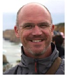
Biography:
Will McClintock has a Ph.D. in Ecology, Evolution and Marine biology from the University of California Santa Barbara. His lab of software engineers and marine spatial planners has supported coastal and marine planning initiatives in the U.S., U.K., Canada, New Zealand, Cook Islands, Barbuda, Montserrat, Curaçao, and the Galapagos Islands.
Abstract:
In the last decade, scientists, resource managers and technologists have made great strides in the development and implementation of online tools that promote participation, science-based decisions and transparency. It is now well recognized that simple, easy-to-use, web-based applications can help stakeholders without a science or technical background, develop spatial plans that are grounded in peer-reviewed research. This talk underscores the importance of combining modeling approaches (which may be somewhat cryptic to the average stakeholder) with geodesign, a process of iterative sketching (drawing) and analysis. Using a web-based tool called SeaSketch (www.seasketch.org), in combination with other popular planning tools such as Marxan and Marine InVEST, users may generate and explore virtually any spatial plan and estimate the potential consequences of that plan. I will argue that user-friendly geodesign tools lower the technical threshold to participatory planning. Finally, I will emphasize the importance of gathering stakeholder input by way of unstructured, map-based discussion forums. When it comes to understanding the relative merits of any planning scenario, the discussions and debate around any given scenario has a great deal of importance, particularly to stakeholders and the final decision-makers. I will demonstrate how map-based discussion forums in SeaSketch facilitated a highly successful marine spatial planning exercise in Barbuda.
Prof Leszek ÅÄ™czyÅ„ski
Institute of Oceanography,University of Gdańsk,poland
Title: Determinig what factor techno or geogenne cause magnetic and geochemical anomalies tracks estuary of the Vistula river to the Baltic Sea

Biography:
Leszek ÅÄ™czyÅ„ski dr hab. – Assoc. Prof. in Geology (applied geology and marine geology); Head of the Laboratory of Applied Geology, Department of Marine Geology, Institute of Oceanography. He is the Vice-President of the Polish Polar Consortium. Area of research: Lithodynamics of coastal seas and oceans, the modeling of coastal zone morpholithodynamical processes, geophysical methods in marine geology, geological documentation of the sedimentary structures and archeological objects on the seabed. Participation in a scientific expedition Spitsbergen 2011, 2012, 2015. He has published more than 50 papers
Abstract:
Environment pollution, and water ecosystems in particular, poses a meaningful problem in a global scale. Seas and oceans territories are the receivers of all organic and non-organic substances, such as heavy metals, nutrients and oil derivatives. These dangerous substances accumulate in bottoms, especially in the littoral zone. Therefore it is extremely important to determine the sort and quantities of substances brought into the seas directly with the river waters and the influence which these have upon marine ecosystems. The results of this study is to determine the scale of changes in terms of the quality of Gdansk Bay bottoms located in the estuary area of the Vistula River, with the usage of modern magnetic techniques. The samples of sediments and soils were subjected to magnetic analysis, i.e. the measurement of magnetic susceptibility by means of MS2 Barington, the magnetic susceptibility gauge equipped with magnetic detectors MS2B or MS2F, and chemical analysis, i.e. examination of heavy metals. The magnetic techniques is rely upon the measurement of low-field and specific magnetic susceptibility, as well as upon calculated frequency correlation between magnetic susceptibility and the constitution of heavy metals and oil-derivative substances in the samples of examined sediments and soils. Based on the studies, was defined the impact of techno or geogenic factors in the sediments of the Vistula River estuary zone based on the characteristics of an easy to measure geophysical gauge of marine environment pollutions, which thus can be widely ractised in seas and oceans monitoring.
Dr J SACRATEES
Manonmaniam Sundaranar University,INDIA
Title: Environmental Impact of coastal Aquaculture in the areas of Thoothukudi District: Using Contingent and Hedonic Pricing Method
Biography:
Dr. Sacratees J. has completed his Ph.D., from the University of Madras and subsequently he worked as a Research Associate at Madras Institute of Development Studies (MIDS), Chennai and Indira Gandhi Institute of Development Research (IGIDR), Mumbai. Now, he has been working as an Assistant Professor more than ten years and heading the Department of Economics more than three and half of years to till date. In addition, the University has assigned the additional responsibility of the Director, Post Graduate Extension Centre of Manonmaniam Sundaranar University at Nagercoil, Kanyakumari District. He has published more than 28 papers in reputed journals and published 3 books. His research paper has won the “Best Research paper Award” and the same paper has been published by Springer publication. He has been serving as a reviewer of few journals.
Abstract:
Coastal aquaculture production is increasingly in Thoothukudi district as a means to make the ends meet in daily lives of the coastal communities who mostly depend on marine ecosystem for subsistence and income. Besides, environmental damage wrought by aquaculture to the surrounding ecosystem had led to serious socio-economic and environmental threats among different stakeholders has not been recognised since coastal aquaculture will be destructing factors in all common pooled resources. This paper estimates the environmental impact of coastal aquaculture in Thoothukudi district of TamilNadu using Contingent Valuation Method and Hedonic Pricing Model which was confirmed with analysis of water and soil test samples were collected from the coastal zone areas at different distance scales (1-5 Kms). Another major setback of continuous pumping of seawater or saline water into vast confined pond areas would lead to salinity of agricultural land. Similarly, continuous withdrawal of ground water might lead to drying up of shallow wells or salt-water intrusion. Transformation of multi-ownership coastal aquaculture resource into private owned single ownership would lead to social displacement of local fishermen. Out of 251 household respondents who were engaged in aqua cultural activities about the land price is differed due to so many factors which are highly attributed due to environmental impacts. Therefore, this study would suggest to create market-based instruments to promote an eco-friendly coastal aquaculture industry for sustainable development.
Dr Ashutosh Mohanty
Mongolia International University,,Ulaanbaatar, Mongolia
Title: Analytical study on Coastal Zone Management in India : A case Study of Odisha

Biography:
Dr. Ashutosh Mohanty, did his PhD in Utkal University ,India and MSc. from Asian Institute of Technology, Thailand. Presently he is working as Director and Associate Professor of Truman Graduate School-Public Affairs joint Graduate School Programme with University of Missouri U. S. A. He published His scholarly articles, chapters in books and papers are also published in highly recognised and acclaimed publishers like emeralds-UK ,which bears testimony to his high standard academic orientation
Abstract:
Presently in India the coastal policy and program already proposed to having well defined zones and coherent management units (planning and regulation zone), which subsequently become the dominant part of the coastal management processes. Most CZM projects around the world use arbitrary land-ward and sea-ward boundaries from physical reference as unit of management. Others also use administrative boundary for delineation of coastal zone thinking that impact coming from outside the area. In case of India, coastal zone are defined as coastal stretch of 500m from high tide line (HTL) for land-ward boundary and low tide line (LTL) as the sea-ward boundary. The super cyclone 1999 was the grim reminder, how the coastal population (around10,000 died) of Orissa ultimately pay the price for unscientific arbitary way of demarcating coastal zone by policy makers. Hence the correct way to delineate coastal zone management unit should be based on development of robust criteria which are the representative of coastal natural system. In this paper, approaches, methodologies, criteria derived from coastal natural system, their justifications and analyses supporting their delineation are described. The criteria considered for land-ward delimitation of coastal zone of Orissa are 20 m contour line above mean sea level, areas of unconsolidated sediments, geomorphic division, tidal effects, block boundary (Administrative boundary) and for sea ward delimitation 100 meters bathymetry are used. Further coherent management units for land-ward are delineated bases on geomorphic units. The sea-ward delineation should be notified by official Gazetee of India for various management purposes. The resulting coherent management unit can be a support infrastructure of data base framework to monitor coastal ecosystem.
Dr Otto Sudarmadji
Coastal environmentalist,National Water Resources Council (DSDAN) of Indonesia
Title: Strategies to combat coastal erosion and inundation

Biography:
Otto Sudarmadji R. Ongkosongo (Otto S. R. Ongkosongo, Indonesian) was trained as geologist from University of Gadjah Mada in Yogyakarta, Indonesia and got a degree in 1969 and 1977. He continued his doctorate study in oceanology at the Université de Bordeaux I in France in 1984. He was promoted as research professor on coastal environment in 1988 and innaugurated in 2006 by the Indonesian Institute of Sciences (LIPI). He was active in various fields (geomorphology, mangroves, coral reefs, environmental impact assessment, etc.) of coastal environment, and positioned in various organizations including Council member of the United Nations University (UNU), and at present member of the National Council for Water Resources (DSDAN) of Indonesia. He has published a book on estuary, river mouth and delta (419 p.) and on strategy to combat disaster risk from global warming and global climate change in coastal areas (319 p.), both in Indonesian.
Abstract:
World populations are becoming more concentrated in coastal areas and closer to the coastlines, including in deltaic regions. Many parts of the coasts, in addition to the existing permanent and intermittent wetland, have low elevation and hence very vulnerable to coastal erosion and inundation, particularly during high water level from rivers as well as during extreme high tide. Global warming and climate change that induces sea level rise will subsequently and incrementally give more frequent and severe undesirable flooding and increase erosion rate impacts which will cause risks on environmental damages and more particularly the human living. There are many studies to counter measure the negative unpleasant impacts in the forms of general conceptual designs. The Intergovernmental Panel on Climate Change (IPCC, 2000) proposed three adaptive responses, i.e. retreat, accomodation and protection. The Eurosion Consortium which was managed by the Directorate General of Environment of the European Commission (Eurosion 2004) proposed the five generic policy options including do nothing, managed realignment, hold the line, move seaward, and limited intervention. Then coming the USACE (United States Army Corps of Engineers, 2008) concept with the four adaptive responses compose of accomodation, protection, beach nourishment, and retreat. This paper introduces and suggests the nine responses of Ongkosongo (2011) compose of practically do nothing, escape (give-up), business as usual, adaptation (accomodation), modification or adjustment, protection, confrontation (Dutch solution), nourishment (replenishment), and polder system, which to be more deeply discussed, analysed, and described.
Maria Dolorosa
Master of Environmental Science, University of Western Australia
Title: Maria Dolorosa Bria

Biography:
Maria Dolorosa Bria is an independent researcher in Marine and Coastal Management. She had got research fund from DAAD German to do independent research in Jakarta Bay in 2004, also have been joining some research with Indonesian Defence Ministry in coastal community development since 2011. She is a master of environmental science with the specification of Marine and Coastal management, graduated from University of Western Australia in 2014. She is also working at Marine and Fishery Department, in Kupang Regency, West Timor, Indonesia.
Abstract:
Fishing activities of Indonesian fishers within Australia’s waters have been undertaken for centuries and have been a focus of negotiation between the two countries. Through Memorandum of Understanding (MoU) 1974 between Indonesia and Australia, the fisher’s activities that have lasted for centuries were institutionalized. The posters aims to describe a dilemma faced by the two countries in managing the fishing activities. Australia has an interest in protecting marine resources under its jurisdiction, whilst Indonesia has an interest to ensure sustainability of the fishers’ livelihood. Further, due to further depletion of the resources, the MoU was amended, and conditions for entry and take have been tighten, which bring significant impacts on the fishers’ livelihoods. In response to the challenges, the fishers have develop alternative livelihood strategies, but it does not stop them from undertaking fishing activities in the Northern Australia. However, a current study argues that fishing in the Northern Australia for traditional fishers is no longer a reliable activity due to declining resource, unsafe voyage, and intensive capital need. Therefore, it is important to support the fishers to diversify their livelihood activities. For them who still rely on fishing activities in the waters, it is important to ensure the safety of the voyage by applying better technology. However, to ensure marine resource sustainability as well as fishers’ livelihoods, a ‘close-open’ system on the area could be an option.
Dr Bernardino Romano
University of L'Aquila,Italy
Title: Coastal settlement and protected areas: a management challenge for Italian Peninsula
Biography:
Bernardino Romano is professor of Land Planning at the University of L'Aquila. His research is mainly oriented towards the effects of settlements on the environment . He is consultant for various government agencies, reviewer of international journals and author of over 150 publications. Among these one of the first books on Italian ecological networks, four volumes on the implications of landscape planning and three of the first works on international journal about the land take in Italy.
Abstract:
Italian peninsular coastal protected areas including in them both parks and nature reserves that Natura 2000 sites, are very numerous (over 100 parks and reserves , and more than 200 sites N2000 for a total envelope of over 500,000 ha) and interest, albeit with different texture , all coastal regions. Urban development registered over the past half century has caused direct and indirect consequences on ecosystems in this important and extensive ecotone on which express multiple transformative actions. It is actually a geographical area highly attractive for tourism, but also for permanent residence, thanks to the good conditions of mobility and transport. Many proposals for interventions industrial, energy and manufacturing in general still have the land as preferential localization and, in many cases , the presence of natural values, though still significant, is neglected. A goal of this work is to highlight the conditions of presence of high pressures and high transformative environmental values It will be particularly used geostatistical tools comparing indicators to highlight conflicts between the phenomena of urbanization and protection, obtaining a classification of models and layout problems for the settlement and protected areas. A second objective of the paper is to provide an indication about the possible lines of territorial government designed to recover/reverse the situation at a high level of contrast.
Dr Kouadio AFFIAN
CURAT, Felix Houphouet-Boigny University,Republic of Côte d’Ivoire
Title: Mapping of vulnerable areas based on GIS analysis: an effective response to a restoration of coastal environments impacted by spills and hazardous substance releases in West African coastline case of Republic of Côte d’Ivoire
Biography:
Kouadio Affian is a Vice President of University Felix Houphouet-Boigny in charge of Training and research Centre Universitaire de Recherche et d’Application en Télédétection (CURAT) • Océanography.Done his PhD in Remote sensing and marine geology.Having upto 35 international publications.
Abstract:
The major oil production carried out in the Gulf of Guinea, and the frequent transportation of petroleum products in the maritime area creates a significant risk of pollution on the West African coast. The primary objectives of this study are to outline the strategic approach to synthesize the data, and define the data structure for compiling maps of Cote d’ivoire shoreline at a scale of 1:25,000 using GIS technology. In this paper, three types of data were used: (i) Environmental Sensitivity Index (ESI), which allowed shoreline classification; (ii) Biological Resources, including oil-sensitive animals and rare plants, and habitats, which are used by oil-sensitive species (or) are themselves sensitive to oil spills, such as submersed aquatic vegetation; (iii) Human-Use Resources means specific areas that have added sensitivity and value because of their use, such as local fisherman village, hotels, industries, airport, port, parks, water intakes, etc. By crossing The ESI Data Layer, Biological Map Layer and Human-Use Data Tables, we were able to generate maps of sensitive areas that might be affected by pollution in the coastal area of Côte d’Ivoire. This mapping of coastal vulnerability to pollution is a necessary step for the development of the emergency response plan. It provides decision makers with the appropriate information for identification of the most sensitive sites before an incident and enables them to provide an appropriate strategy for the protection and control (particularly for sensitive sites), and implement an adequate means to implement the strategy.
- Coastal Engineering
Session Introduction
Dr Pamela Hazelton
University of Technology, Sydney Australia
Title: The Reconstruction of an Ecologically Sustainable Sand Dune System from a former Coastal Sand Mined Site
Biography:
Abstract:
The Magenta Shores a resort and golf course development fronts 2.3 km of Tuggerah Beach on a formerly sand mined and landfill site in an urban growth area on the central coast of New South Wales, Australia. In the development area more than one million cubic metres of sand was collected and reshaped to mimic a parallel dune ridge landform. To increase the natural defenses against storm waves and mass sand movements, the incipient foredune was retained and the parallel beach ridge landform was re-established by mimicking natural processes. A high mound, an artifact of the sand mining in the northern section of the reconstructed dune, was not reshaped. This high area was allowed to naturally wind erode. A minor blowout began to form as sand moved off this mound. To lessen the slope and aid in the regeneration process of the dune system, it was necessary to create additional sand trapping. One kilometre of organic 200 g/m2 jute fabric with 40 percent porosity, 600 mm high, fastened to degradable wooden stakes, was positioned in a series of rows appropriate to the wind direction to capture sand both in front and behind the fence. To minimise blowouts forming, the jute at the end of each row was overlapped in a triangular shape at the ends of each fence so that there was no sharp defining edge. These fences assisted in retaining sand volume of the reconstructed dunes enabling the establishment of trials for coastal vegetation regeneration.
Ray-Yeng Yang
National Cheng-Kung University, Tainan, Taiwan
Title: Field establishment and dynamic response investigation of multifunction

Biography:
Ray-Yeng Yang completed his PhD at the age of 31 years from National Taiwan University. He is a Senior Researcher, Deputy Director and Secretary-general of Tainan Hydraulics Laboratory, National Cheng Kung University. He has authored more than 150 papers (25 SCIã€35 EI papers and 118 Conference), two book chapters and 85 technical research reports.
Abstract:
Due to the consideration of a great fleet of large ships needed for constructing offshore wind turbines not already been established (lacking facilities) in Taiwan, one concept of multifunctional movable foundation for the offshore wind turbines was proposed in this study for making local marine construction of offshore wind turbines in Taiwan much easier and less expensive. Thus a series of interdisciplinary studies, including numerical simulation, laboratory tests and field experiment, were conducted for the proof-of-concept of this innovative movable type foundation as local marine method & fleet in Taiwan. Based on this concept, marine LiDAR system (for wind profile measurement) or offshore wind turbine (for wind electrical power output) can be mounted on this multifunctional movable foundation in the ship dock instead of on ocean field site installation. The goal of this investigation is to follow the program of the “government grant for offshore wind development” by the Bureau of Energy, Ministry of Economic Affairs (MOEA), Taiwan, dividing the project into two main phases. The first phase (this study, from 2015~2016) is to establish the multifunction movable offshore foundation based marine LiDAR system which is the near full-scaled foundation for the meteorological observation and structure stability investigation. Then the second phase (from 2017~2018) is to establish the foundation for two 3.6MW offshore wind turbines for full-scaled foundation field investigation and the real offshore wind energy production and wind turbine performance tests.
Dr Chih-Hua Chang
Ling-Tung University,Taiwan
Title: Particle Motions Produced by a Solitary Wave Interacting with a Plate
Biography:
Chih-Hua Chang is an associate professor of the Department of Information Management, and Natural Science Division in General Education at Ling-Tung University in Taiwan. He earned a Ph.D. degree in 1997 in Department of Hydraulic and Ocean Engineering of National Cheng Kung University, Taiwan. He has been at Ling-Tung University since 2003. Dr. Chang’s research interests include Geographic Information System, Coastal and Ocean Engineering, and Computational Fluid Dynamics.
Abstract:
This study is aimed at the interaction of a solitary wave with a vertical thin plate to simulate the particle behaviors of vortex flow. The streamfunction-vorticity free-surface (SVFS) model using boundary-fitted grid combined with local overset grid to reveal vortex motions is applied and extended. The SVFS model is a fully-nonlinear viscous wave model. Virtual particles are scattered and traced to perform the vortex motions. Mechanical behaviors such as the streamlines, pathlines, streaklines and transient particle distributions are illustrated. Present numerical model is treated in a dimensionless scale referencing the undisturbed water depth and linear-long-wave celerity. For an infinitesimal plate, the flow characteristics are only dominated by three dimensionless parameters, that is the incident-wave height (A0), plate height (S), and Reynolds number (Re). In this paper, first, we compare qualitatively the streamline patterns with the experimental observations of the particle-tracing photographs. According to the experimental conditions, the Re is approximated as 66800. After verification, we analyze numerically the flow characteristics with different A0 and S. Only the brief results are shown here. An incident solitary wave moving toward right starts at x = -15 in front of the plate. Fig. 1 displays the comparisons of vortex motion between streamline simulation and particle-tracking experimental observation [1] at an instant time (t = 29). To distinct the wave height influence, Fig. 2 shows the particle scattering distributions at t = 50 with different incident wave heights. Fig. 3 illustrates few distorted timelines evolving with the development of vortex.
Dr AnneMarie Clements
Environmental and Botanical Consultants,Australia
Title: Re-establishing the natural dune barrier coastal protection
Biography:
Abstract:
The Magenta Shores golf and tourist development fronts 2.3 km stretch of wind-swept, storm exposed Tuggerah Beach on Australia's east coast. The expected storm bite on this beach during a 1 in 100 year storm event is up to 300 m3 of sand per linear metre of beach, based in the 1974 storm event. The sand dunes were environmentally degraded by former sand-mining, monoculture of Chrysanthemoides monilifera and use as a landfill site. The project aimed to increase the natural defence against storm waves and wind erosion. This was achieved by re-establishing the natural ecosystems associated with the parallel beach ridge landform, typical of a stable coastal Quaternary sand system. Dune slopes were stripped and re-contoured, natural sand trapping mechanisms placed on crests and onshore winds transported the sand to form foredune crests. From the 12 month trials on the re-constructed dunes, the most efficient method of re-establishing foredune Spinifex sericeus dominated vegetation was the burial of ripe Spinifex seed head in the moist sand layer. This achieved primary colonisation and development of a soil fungal hyphae network prior to introduction of secondary colonising species. Germination of Spinifex depended on its ripeness. Ripe seed coincides with bird swarms on the beach harvesting ripe seed in late December. Monitoring stakes were used as roosts by birds, promoting re-introduction of native plant species requiring germination by digestive tract stimulation. Bush regeneration reduced competition from weeds, allowing native vegetation cover to succeed. The success was achieved by mimicking the natural processes and was measured by cumulation of sand volume in the dunes and the ability to withstand the summer storms. The reconstructed dunes now provide enhanced protection from sand movement and storm bite for built assets and natural ecosystems.
Biography:
Yun-Ta Wu has completed his PhD program at the age of 29 years from Department of Hydraulic and Ocean Engineering, National Cheng-Kung University and visiting scholar program in 2014 at Zachry Department of Civil Engineering, Texas A&M University. Currently, he is a postdoctoral fellow at International Wave Dynamics Research Center, National Cheng-Kung University. His research interests are in the area of fluid mechanics with applications to coastal and ocean engineering
Abstract:
It is of great importance to understand the evolution and shoreline motion of long-wave on coastal beaches so as to have sufficient knowledge applied to inundation mapping and tsunami forecasting. Experimentally, reliable measurements are to convincingly provide direct observation through naturally non-linear fluid system, which are useful and desirable for numerical model validation. Due to the limited length of laboratory-scale wave flume, some natural features of coastal environment in terms of mild slope and turbulent flow cannot be properly reproduced in laboratory-scale experiments. This fact implies the necessity of large-scale physical modeling tests. In the past ten years, detailed measurements on the evolution and run-up of breaking solitary waves on different gradients of sloping beaches have been carried out in a supertank (300m × 5.0m × 5.2m) at Tainan Hydraulics Laboratory (THL), National Cheng-Kung University, Taiwan. Artificial beaches built by smooth layers of concrete with different slope gradients, i.e., 1/20, 1/40, 1/60, 1/100 and composite geometry, have been constructed to investigate the slope effects on wave hydrodynamics. The purpose of this study is to validate an open-source non-hydrostatic model SWASH by using those of existing measured data conducted in a supertank of THL. After calibrating the Manning friction coefficient of the slope surface, model-data comparisons in terms of free surface elevations and run-up motions will be detailed. Finally, this model will then be used to study the effects of submerged obstacles into the implication of long-wave run-up mitigation and some preliminary results will be demonstrated through this presentation.
Ahmed Sayed Mohamed
Dar Al-Handasah (Shair and Partners),Egypt
Title: Hydrodynamic Modeling as a Base for the Coastal Zone Development of Lagos and Lekki lagoons, Nigeria
Biography:
Dr. Ahmed has completed his M.Sc. from UNESCO-IHE, Delft the Netherlands and his Ph.D. from The University of Tokyo, Japan and postdoctoral studies from Port and Airport Research Institute (PARI), Japan. He is Associate Professor in Hydraulics Research Institute, National Water Research Center, Egypt and currently on a sabbatical leave working as Senior Marine Engineer at Dar Al-Handasah (Shair and Partners), Egypt. He completed several marine projects in the gulf and African countries through consultancy services and construction supervision. He published more than 30 papers in reputed journals and international conferences
Abstract:
Lagos and Lekki lagoons in Nigeria receive seasonal rainy storm water that leads to increased water level of the lagoon due to relatively long residence times and eventually inundation of low-lying and swamp areas. The Nigerian authorities do not permit any breach in the natural barrier to directly release rainy storm waters into the ocean except through the existing Lagos Lagoon outlet. The question of how much water level rise due to rainfall storm water discharges requires an answer since there are ongoing and future development around the Lagos and Lekki Lagoons that may be influenced and inundated. As such the knowledge of design water levels of the lagoons is needed for the design of such coastal development. The water level rise due rainy storm water is considered a dominating component for deriving the design water level of this project. In this regard, this work was carried out to derive the marine design parameters such as design water level. The tool employed for deriving the design parameter is able to model the lagoons with the complex morphological feature. This tool is Delft3D model. In this paper, Delft3D model was utilized to numerically model the lagoons considering tidal driving force, bottom friction, wind stresses as well as mass flux caused by releasing the rainfall storm water. The model was constructed and calibrated. Various scenarios of rainfall storms were simulated and the retained water depth was computed at particular observation points within the lagoons. The design water level was determined at different places within the lagoons.
Dr Thiruvenkatasamy
Department of Harbor & Ocean Engineering ,AMET University,India
Title: Shoreline Evolution due to Construction of Rubble Mound Jetties at Munambam Inlet in Ernakulam-Trichur District of the State of Keralain the Indian Peninsula

Biography:
Dr.K.Thiruvenkatasamy has completed his PhD at the age of 32 years from Kagoshima University, Japan and postdoctoral studies from University College Cork Ireland. He is the Professor & Head of Department of Harbour & Ocean Engineering, AMET University, World’s, the only Private Maritime University. He has published about 15 papers in reputed journals and has been served as an editorial advisory board member of repute. He has been awarded several Conference Grants and been a Visiting Scientist in Sichuan University China
Abstract:
Munambam is an inlet where the north branch of periyar river after joining Chalakudi and Pullut rivers meets the Arabian Sea. Due to the littoral drift from the north direction a sand spit was formed at the mouth which caused frequent capsizing of boats.In order to permanently eradicate the problem, two breakwaters of length 360m and 625m were constructed in the year 2000. After the construction of breakwaters,the sand spit disappeared and there was considerable improvement in the bathymetry at the initial periods but the problem recurred .This paper highlights the details of the shoreline evolution from 1975 to 2012 derived from the actual field data. The results indicated the advancement of shoreline on either sides which is a peculiar phenomenon unlike erosion on one side and accretion on the other. Short term solutions for the management of the recurring problems are suggested in the paper. Long term solutions of the problems of the inlet by state and local agencies are suggested, such as calling for the attention of the state and local government research organisations.
Dr Salvatore Mauro
CNR-INSEAN - Marine Technology Research Institute,Italy
Title: Very low underwater background noise test bed
Biography:
Abstract:
Since late 70's CNR-INSEAN is technically and scientifically focused on radiated hydrodynamic noise measurements on any typology of seagoing bodies (surface and/or underwater). During long years of activities a number of indoor facilities and both experimental and theoretical EFD (Experimental Fluid Dynamics) techniques have been used and developed in order to investigate, understand and prevent topics such as: both inner and radiated propeller noise evaluation and reduction, propeller-rudder-wake "noisy" interactions, sonar dome housing, cavitation noise evaluation and reduction, noise signature and mapping, etc. The aim of the author is to present the technical and scientific activities on going at CNR-INSEAN'S Outdoor Maneuvering Basin in order to use it as very low underwater background noise test bed for a number of research activities as: - point-to-point and/or broadcast underwater data transmission - underwater very low-noise lab for radiated noise measurements produced by surface small-sized full scale bodies, underwater full scale AUV's, ROV's and/or any other platform - qualified test bed for electronic noise quantification on underwater technologies (sensors, data transmission equipment, complete autonomous/tethered platforms, etc.).1. The new low background noise test bed Since 1953 the CNR-INSEAN's Outdoor Maneuvering Basin officially is included into the ITTC's (International Towing Tank Conference) list 2. The first background noise measurements The experimental data gained so far are really very promising and the CNR-INSEAN's vision is to create a European very low noise underwater laboratory in fresh waters complementary with the federation of the current salt/fresh water test beds already running. For some specific applications, the preliminary test in calm and fresh waters could be of paramount importance before to carry out a "salt water" campain, much more risky, costly and logistically much more difficult to manage and organize. The availability of the test bed is really 7/24/365 and very easy to reach. Actually in Europe not any unclassified fresh waters test bed is able to provide the very low level of physical background noise characteristics similar with the one of the CNR-INSEAN's Outdoor Maneuvering Basin. Just to provide some preliminary quantitative figures at a glance, in the following figure a comparison between the underwater (and air) background noise at the CNR-INSEAN's test bed and the worldwide well-known WENZ curves [4] is provided. A difference of almost less than 20db compared with Wenz sea state=0 is really self-explaining.
Prof Liu Quang
Ocean University of China, Shandong,China
Title: An integrated assessment of coastal risk management index

Biography:
Abstract:
Based on extensive field investigations of storm surge risk along coastal regions in China, we propose a system of risk index for evaluating risk management performance and effectiveness by the government disaster emergency management agencies. The suggested Risk Management Index, (RMI) brings together a group of indicators which measure risk management performance and effectiveness. The index reflects vulnerability and losses in a given region and the index can be used as an efficient management tool for disaster resilience. The proposed RMI is constructed by quantifying four public policies, each of which is described by six indicators. The index includes Risk Identification (RI), Risk Reduction (RR), Disaster Management (DM) and Governance and Financial Protection (FP). Rongcheng city in Shangdong province situated at northeast of China Yellow Sea was selected as a case study region and the Analytic Hierarchy Process (AHP) was adapted to evaluate the index priority according to the feedbacks of two scores of questionnaires. Analytical Result was effectively supported by the data and provided valuable information for coastal hazards planning and risk management. The RMI developed in this study can be applied to virtually any other regions in China; nevertheless index ranking and criteria weighting should be revised regarding to the practical situation of the assessment area.

