Day 2 :
Keynote Forum
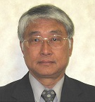
Prof Emiritus Takao Yamashita
Hiroshima University,JAPAN
Keynote: Coastal Processes and Climate Change
Time : 9:30 to 10:00
Biography:
Mr. Takao Yamashita graduated from Kyoto University, Faculty of Engineering in 1975, awarded the Master of Engineer at Kyoto University in 1977, Dr. Eng. from Kyoto University in 1994. After Assistant and Associate Professor of Kyoto University in the field of coastal disaster prevention studies in 1977-2006, he moved to Hiroshima University as a Professor of Graduate School of International Development and Cooperation in 2006. He has conducted research and teaching of global and regional environmental impact assessment and retired Hiroshima University this year to be a Professor Emeritus.
Abstract:
Quantitative understanding of cross-shore and longshore sediment transport system is essential information in carrying out coastal protection. Regular measurements of shoreline and the beach profile changes enable the estimation of nearshore sediment distribution by integrating the sediment budget from the clear lateral boundary conditions (such as the fixed boundary conditions of zero sediment transport) and cross-shore sediment transport rate obtained from the beach profile changes. However this method needs the high accuracy measurement of beach topography. Another way of estimating the nearshore sediment transport distribution is using the breaking wave energy distribution in the surf zone. In this method, it is necessary to determine the coefficients for associating breaking wave energy dissipation and sediment transport rate. Assuming equilibrium beach profile, the coefficients can be determined from sediment transport rate distribution that can explain the measurement results of the shoreline changes. In this wave energy method, incident wave energy flux is commonly computed by the wave height and breaking wave angle at the breaking point estimated from the water depth ratio. However, this method does not take a bore energy dissipation in the surf zone into account.rnIn recent years, a third-generation spectral wave model in shallow waters such as SWAN has been put into practical use, it has become possible to simulate the propagation of shallow waters irregular waves in consideration of the energy dissipation characteristics due to depth-induced wave breaking. It has become possible to reproduce the surf zone energy dissipation of bore by using the output of SWAN’s depth-induced breaking energy dissipation rate to estimate the sediment transport rate in the surf zone. This study proposed the method of sediment transport estimation using and applied it to the annual sediment transport analysis in a pocket beach.rn
- Coastal Structures
Session Introduction
Agnieszka Kubowicz- Grajewska
Institute of Oceanography, University of Gdansk, Poland
Title: The use of submerged breakwaters in Poland

Biography:
Agnieszka Kubowicz-Grajewska has completed her PhD in 2012 at the Institute of Oceanography, University of Gdansk. She is Assistant Professor in Department of Marine Geology. She is an author of 3 papers in reputed journals and 4 book chapters
Abstract:
Submerged breakwaters are one of the coastal structures used to reduce the amount of energy reaching the shore, by forcing waves to break and by extending the residence time of sediments in a sheltered area. Because of the number of aesthetic and environmental advantages the use of submerged breakwaters is gaining popularity in many locations around the world, particulary in Poland where submerged breakwaters have been used in the vicinity of Kołobrzeg and in Gdynia Orłowo. The first location is a popular tourist resort at the Batic Sea coast, where those constructions were erected in the years 2010-2012. The second one is located in the region of cliff coast, part of Nature Reserve where breakwaters were built in 2006. Both of those cases deserve a special attention due to variety of conditions overlapping at one location, making it a most interesting case study. Among the most important, one can point out specific geological conditions, especially in the nearshore zone, along with an intensive abrasion and lack of sediment supply. Those natural phenomena are followed by a series of manmade shore protection systems, composing of breakwaters, groins and beach nourishment. Based on conducted research the influence of structures on the shore zone morphodynamics has been determined and their effectiveness in coastal protection assessed.
Ho-Shong Hou
Professor, Marine Environment & Engineering Department, National Sun Yat Sen University,Taiwan.
Title: Ocean Energy of Taitung Coast in Taiwan

Biography:
Dr. Hou worked for three years as a hydraulic laboratory director and chief research engineer with the Taichung Harbor Project, a man-made deep-water port construction on the West Coast of Taiwan. In 1976, Dr. Hou received his Ph.D. in civil and coastal engineering at the University of Florida. He then worked as the Director of the Graduate Institute of Harbor and Ocean Engineering at the National Taiwan Ocean University, and as an adjunct professor of the Institute of Naval Architecture at National Taiwan University.Dr. Hou subsequently became the Deputy Director of the Harbor Research Institute in Taichung for the following five years, whilst maintaining his two professorships. Soon after he accepted and offer to become the division director (and afterword Deputy Director-General) of the Institute of Transportation of the Ministry of Transportation and Communications (MOTC), positions he held for a total of 12 years. In 1995, he was promoted to Director-General of Department of Railways and Highways within the MOTC.In light of his outstanding engineering and administration background and achievements Dr. Hou was in December 1998 invited by then Mayor of Kaohsiung to serve as Deputy Mayor. In this high responsibility role he was in charge of all municipal infrastructure development projects, and was also subsequently appointed to the position of Chief Commissioner of the Kaohsiung City Election Commission.Dr. Hou is a registered civil and hydraulic engineer, and an active member of American Society of Civil Engineers. Dr. Hou was the President of PACON (2002-2008) International and a Life Member (2006-).
Abstract:
Taiwan east cost are full of ocean energy, especially Ocean Thermal Energy Conversion (OTEC). Offshore 3 km away from Hualien cost or Taitung coast will reach 1,000 M to 1,500 M. Their temperatures are around zero to 4 degrees, while surface temperature around 25 to 28 degrees, temperature difference is more than 20 degrees. If ammonia is used as the catalyst, it is easily to generate electric power. Offshore 33 km from Taitung coast and about 5 km from Green Island, there exists 3~4 knots’ Kiroshio current. MOEA is currently planning to develop 3 giga watts power. For the convenience to develop the Ocean Energy and Ocean Resources, the planning of an airport and seaport is shown in Figure 1 for future transportation of energy and Deep Ocean Water (DOW) products. The SHOTEC power plant is a good solution of OTEC. That scheme not only offers three times thermal efficiency to that of a conventional OTEC plant but also circumvents the difficulties of deployment of deep seawater pipe and evaporator biofouling problem. Therefore, this power plant has advantage of (1) combination of solar and deep seawater energy; (2) without carbon dioxide emissions and waste storage problem; (3) sustainability. This complex ports involve ocean engineering arrangements of ocean engineering installation, DOW intake pipeline, OTEC Fish Coral Reef, etc., and seaport facilities of DOW R&D Center, value added center, logistic center and Tourism Recreation Center. DOW products and mineral DOW water involve cold floral, cold seafood, cold fishery products etc., will be fast transported by this offshore airport to keep their fresh and coldness. These complex ports (seaport and airport) will develop and enhance the eastern Taiwan’s economical development. The ocean energy development of Taitung is welcome an international technical cooperation to participate its ongoing promotion and future developing.
Ajay Shanker
Rinker school of Construction University of Florida, USA
Title: Evaluation of a Longboat Key Resort, the Colony, For Wind-Borne Debris Hazard in Hurricanes

Biography:
Ajay Shanker, obtained his BS and MS degrees in civil engineering in India and then completed his Ph.D in structural engineering from Texas Tech University, Lubbock Texas USA in 1990. For the past twenty-six years he has served as a faculty member at the University of Florida. He has completed twenty-three research grants in he fields of structural engineering and hurricane resistant construction and has advised about seventy students for their theses and dissertations
Abstract:
Longboat Key is a town in Manatee and Sarasota counties along the central west coast of the state of Florida, USA, located on the barrier island of the same name. Longboat Key is south of Anna Maria 611 Island, between Sarasota Bay and the Gulf of Mexico. Town of Longboat Key was incorporated in 1955 and has land area of 11 square kilometers and a population of 7000. The Colony, a beach-front luxury tourist resort, located at 1620, Gulf Coast Drive, Longboat Key, is an 18-acre resort containing 234 condominium units, many tennis courts, restaurant and other amenities. The current land value of resort is estimated at $36 million. This resort was built in 1970s and operated profitably with high tourist occupancy for about fifty years. However, because of poor maintenance and salt laden environment, rotting of wood siding, rusting of structural steel and concrete rebars continued for many years. Eventually all building became structurally deficient and dangerous for occupancy. The town commission then closed down the resort and asked everybody to leave. Between 2010 and 2014 degradation of buildings accelerated and building components e.g., door, windows, balconies, started falling down and the town commission started worrying about the colony becoming a source of wind borne debris in case of a hurricane. The town commission then approached Rinker School of Construction Management to conduct a detailed study for the potential of Wind Borne debris hazard.
Dr Yuan-Ho Lin
Department of Marine Environment and Engineering, National Sun Yat-sen University
Title: THE PLANNING OF OFFSHORE AIRPORT ILLUSTRATING KAOHSIUNG
Biography:
Abstract:
The re-building and redevelopment of major port and harbours in the world have been a great challenge and opportunities to coastal and harbour cities. The old scheme design of harbour port areas are losing its esteem and fading away because of the raising industrialization, changes, production and business structure. These have made many major harbours to adapt a brand new reform on the use of port areas. The unused piers should be re-planned through a good reform on the port space. The development strategy and policy including the decision making and implementation must be undergoing a restrict plan, design and assessment. These consists of the components such as sustainable development, ecological factors, vision of science, product related industries and the competitiveness of port city. These are becoming seriously components to the port city for its success in the reform of harbours re-planning. The present study was initiated to research Kaohsiung Harbour and the aforementioned international port cities. It is intended to accomplish a comprehensive planning, strategy and recommendation for Kaohsiung port city.
Biography:
Abstract:
Taiwan coast is surrounded by the Taiwan Strait and the Pacific Ocean. Sandy coasts are majority and severely scoured by North-Easterly winter monsoon and summer and autumn hurricane (i.e. typhoon). Link block (shore protection concrete block) are largely placed along the beach or vertical to the beach or even arranged offshore parallel to coast (i.e. offshore breakwater) to induce sediment behind the offshore breakwater to reclaimed the lost sand of beach (i.e. beach nourishment). However, such as commercial harbor like Taipei Port, the armour unit of the breakwater are placed by Link Block For East Coast along the Pacific Ocean, the beach slope is very steep, therefore the toe of the coast highway (Highway No.9 & Highway No.11) need to be protected along the highway foundation to protect big waves act on the foundation and erode sand away. Link Block are then occupied largely along the shore to protect highway foundation and keep their stable and sound coast and foundation are not eroded away.
You-Shao Wang
State Key Laboratory of Tropical Oceanography, South China Sea Institute of Oceanology,China
Title: Long-term changes in Daya Bay ecosystems of South China Sea in response to human effects

Biography:
Dr. You-Shao Wang background is primarily on marine environment & ecology and marine biological resources. His PhD research focused on Environmental chemistry from 1997 to 1998 in Shanghai Institute of Nuclear Research, CAS, China. He was also as a postdoctoral fellowship for microbiological research from 1998 to 2000 in China Agricultural University. He has become a younger professor of Qingdao Agricultural University in 1997. He had also worked as a visiting professor from 2006 to 2009 in Scripps Institution of Oceanography, University of California, USA. Since 2000, Dr. You-Shao Wang has been working as a distinguished professor in South China Sea Institute of Oceanology, Chinese Academy of Sciences, China, and also the director of Daya Bay Marine Biology Station (CAS) since 2003 and the deputy director of State Key Laboratory of Tropical Oceanography since 2011. He has published more than 150 papers in the world. Prof. You-Shao Wang has won Chinese Academy of Sciences President Scholarship (1997) and Science and technology progress award (The Second) of the people’s Republic of China (2007).
Abstract:
As a venue of rapid industry, aquaculture development, urban expansion and population growth, Daya Bay is a natural laboratory to study the influences of human activities on coastal ecosystems. Satellite observations suggested that two nuclear power plants operated here have direct impacts on the local environment at the southwest part of Daya Bay, which takes up to ~3% (2002) and ~7% (2003) of the entire bay. Field observations over 1998 to 2007 suggested that human activities here had substantially altered the nutrient balance and driven this bay into a P limiting environment. In the past decade, phytoplankton biodiversity in this bay decreased by ~25% accompanied with significant change in community structure. Ecosystem degrade in Daya Bay was further evidenced by the observed trend of elevating petroleum hydrocarbon level. Principle Component Analysis (PCA) suggested that the long-term variations of water quality and phytoplankton biomass in Daya Bay can be grouped into three distinct clusters: Cluster A (1998 and 2004-2006) characterized by high concentrations of NH4-N and TIN and high TIN/PO4-P ratios, Cluster B (1999, 2002 and 2003) characterized by high concentrations of NO2-N, NO3-N, SiO3-Si, and chlorophyll a and high SiO3-Si/PO4-P ratios, and Cluster C (2000, 2001 and 2007) characterized by high PO4-P and phytoplankton concentrations. Marine reserve within Daya Bay was suggested and discussed based on these findings.
Alexander Grigoriev
Head ,N.N.Zubov’s State Oceanographic Institute, Moscow, Russia
Title: Numerical modeling of water dynamics of Russian zone of the Black Sea within the framework of operational oceanography tasks
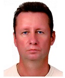
Biography:
Head of laboratory of modeling of currents and sea waters structure. Participation and leadership of academic institutions in more than 30 scientific and applied projects, including national and European Union in oceanography and numerical modeling. Ph.D. since 1992 (more than 30 scientific works, including 2 monographs in collaboration). Since 2012 Assistant Professor in Moscow Physical-Technical Institute.
Abstract:
Modeling of the Black Sea waters dynamics (Russian zone) was conducted within the framework of the European ARENA and ECOOP projects and Russian project JISWO on the basis of Princeton Ocean Model (POM). Nowcasting and three days forecasting of the Black Sea dynamics was carried out in a daily mode with horizontal resolution of ~1 km along the Russian coast of the basin. Examples of calculations are presented and their comparison with space remote sensing and in situ (hydrological measurements) data is fulfilled, results of model validation are discussed. Model data reproduce observed real dynamic structures. Increasing a spatial resolution of processes allows reproduce in calculations the details of hydrological structure, which do not principally find displaying in large-scale models (vortexes with horizontal spatial sizes ~10 km). The conclusion that the proposed modeling technology can adequately monitor the variability of the waters of the region with the spatial and temporal resolution, unattainable using only field data, can prove important for operational oceanography.
Danut DIACONEASA
National Institute of Marine Reasearch and Developmat “Grigore Antipa†(NIMRD),Romania
Title: Current Measures to Protect the Romanian Coastline of the Black Sea
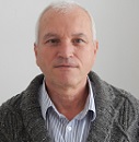
Biography:
Abstract:
In Romania to mitigate coastal erosion in order to increase the value of coastal zone and create new areas of beach tourism in the period 2005 - 2013 were elaborated scientific and technical documentation to development the Master Plan of the Romanian Black Sea coast, through two major projects: - "Study on the Protection and Rehabilitation of the Southern Romanian Black Sea Shore" (2005 - 2007) and - “Technical Assistance for the Preparation of Projects under Priority Axis 5. Implementation of Adequate Infrastructure of Natural Risk Prevention in the Most Vulnerable Areas. Major Intervention Domain 2 - Reduction of Coastal Erosion“ (2010 - 2013). In these projects was drawn up a Strategic Plan for Coastal Protection, which will run for more than 30 years, with coastal protection measures planned in the short, medium and long term. These works include measures to reduce wave energy by building new dams, beach fill (nourishment) with dikes of stability sand (spurs) and measures for retaining the sand on the beach by building new dams, repair the old detached breackwater and 'existing groints. Short-term measures were planned for five priority projects in the southern Romanian coast, in order to reduce the risk of coastal erosion and rehabilitate the area for 7.1 kilometers of shore in places, South Mamaia, Constanta (Tomis Nord Tomis Center, Tomis South) and North Eforie. The beach area was expected to be created about 33.7 ha and which werw put into oparation at the end of 2015 year. NIMRD monitors the Romanian coastline, since 1980 and has designed and realized landmarks for coastal short-term protection measures, in 2014 for the initiation of monitoring of shoreline with coastal protection measures. Based on geomorphological profile of the backshore and swash zone carried out before, during and after realized coastal protections (2014 – 2015) it was done assessment of coastal processes (erosion-accretion).
- Coastal Processes
Session Introduction
Ho-Shong Hou
Professor, Marine Environment & Engineering Department, National Sun Yat Sen University,Taiwan.
Title: Marine Environment Around Taiwan Coast

Biography:
Dr. Hou worked for three years as a hydraulic laboratory director and chief research engineer with the Taichung Harbor Project, a man-made deep-water port construction on the West Coast of Taiwan. In 1976, Dr. Hou received his Ph.D. in civil and coastal engineering at the University of Florida. He then worked as the Director of the Graduate Institute of Harbor and Ocean Engineering at the National Taiwan Ocean University, and as an adjunct professor of the Institute of Naval Architecture at National Taiwan University.Dr. Hou subsequently became the Deputy Director of the Harbor Research Institute in Taichung for the following five years, whilst maintaining his two professorships. Soon after he accepted and offer to become the division director (and afterword Deputy Director-General) of the Institute of Transportation of the Ministry of Transportation and Communications (MOTC), positions he held for a total of 12 years. In 1995, he was promoted to Director-General of Department of Railways and Highways within the MOTC.In light of his outstanding engineering and administration background and achievements Dr. Hou was in December 1998 invited by then Mayor of Kaohsiung to serve as Deputy Mayor. In this high responsibility role he was in charge of all municipal infrastructure development projects, and was also subsequently appointed to the position of Chief Commissioner of the Kaohsiung City Election Commission.Dr. Hou is a registered civil and hydraulic engineer, and an active member of American Society of Civil Engineers. Dr. Hou was the President of PACON (2002-2008) International and a Life Member (2006-).
Abstract:
Coastal morphological change is an island-wide problem in Taiwan. Based on recent research, about 80% of the island’s sandy coastline had suffered from erosion over the past few decades. Historically, with the specific tectonic environment and rapid uplifting rate in Taiwan, lots of sediment had been yielded and transported to the coastal area that resulted in an advancing shoreline. Those phenomena cause marine biology environment changes very much. A lot of long shore morphological features occur such as zeta-shape bay, circular bay, tombolo, river delta, lagoon, salient and barrier islands etc.A buffer zone and wetland have been formed by waves, tides and winds, etc., and then for settling down of wild-birds and fishes and vegetation in the coastal mangrove. Wet-land with vegetation draws a lots of birds living around the area. These near-shore zone involve aquaculture farms, a lot of fish and shrimp are grown up through marine aquaculture. Tidal flat produces a lot of marine biology, especially tidal circulation occurs there. At the South West like Pingdong Dapenwang lagoon a lot of oyster-raising farm and marine fish are cleaned and changed into national park for recreation use and a lot of vegetation greenifying and beautifying along the big-lake.At the east coast, especially Taitung coast full of ocean energy, wave energy, ocean current energy, especially ocean thermal energy conversion (OTEC). Offshore 5 km away from Taitung and Hualien Coast will reach 1000 to 1500 meter deep, deep ocean water (DOW) temperatures are around zero to 4 degrees, while sea surface temperature around 20 to 25 degrees, temperature difference is more or less 20 degrees. If ammonia is used as catalyst, it is easily to generate electric power.Offshore 33 km from Taitung coast and about 5 km from Green Island, there exists 3-4 knots’ Kuroshiocurrent.
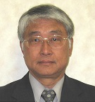
Biography:
Mr. Takao Yamashita graduated from Kyoto University, Faculty of Engineering in 1975, awarded the Master of Engineer at Kyoto University in 1977, Dr. Eng. from Kyoto University in 1994. After Assistant and Associate Professor of Kyoto University in the field of coastal disaster prevention studies in 1977-2006, he moved to Hiroshima University as a Professor of Graduate School of International Development and Cooperation in 2006. He has conducted research and teaching of global and regional environmental impact assessment and retired Hiroshima University this year to be a Professor Emeritus.
Abstract:
Quantitative understanding of cross-shore and longshore sediment transport system is essential information in carrying out coastal protection. Regular measurements of shoreline and the beach profile changes enable the estimation of nearshore sediment distribution by integrating the sediment budget from the clear lateral boundary conditions (such as the fixed boundary conditions of zero sediment transport) and cross-shore sediment transport rate obtained from the beach profile changes. However this method needs the high accuracy measurement of beach topography. Another way of estimating the nearshore sediment transport distribution is using the breaking wave energy distribution in the surf zone. In this method, it is necessary to determine the coefficients for associating breaking wave energy dissipation and sediment transport rate. Assuming equilibrium beach profile, the coefficients can be determined from sediment transport rate distribution that can explain the measurement results of the shoreline changes. In this wave energy method, incident wave energy flux is commonly computed by the wave height and breaking wave angle at the breaking point estimated from the water depth ratio. However, this method does not take a bore energy dissipation in the surf zone into account. In recent years, a third-generation spectral wave model in shallow waters such as SWAN has been put into practical use, it has become possible to simulate the propagation of shallow waters irregular waves in consideration of the energy dissipation characteristics due to depth-induced wave breaking. It has become possible to reproduce the surf zone energy dissipation of bore by using the output of SWAN’s depth-induced breaking energy dissipation rate ( ) to estimate the sediment transport rate in the surf zone. This study proposed the method of sediment transport estimation using and applied it to the annual sediment transport analysis in a pocket beach.
Yosuke Alexandre Yamashiki
Kyoto University, GSAIS, Japan
Title: Continental-oceanic Mutual interaction via Material Transport
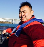
Biography:
Yosuke Alexandre Yamashiki has completed Ph.D. in Kyoto University in 1999, then he worked at UNEP-DTIE-IETC as an Associate Programme Officer from 1999-2001, contributing to the establishment of La Plata River Basin Environmental Management Network (RIGA) and the 3rd La Plata River Basin Workshop. Yosuke joined Kyoto University since 2008, where he received the Best Paper Award in 2014 for his research in monitoring of environmental radioactivity through the Japan Society of Hydrology and Water Resources. In July 2015, he was nominated as Chairperson of the UNESCO-IHP International Initiative of Water Quality (IIWQ) Experts Advisory Group for the next 2 years.
Abstract:
To promote discussion on mutual interaction between Continental and Oceanic zone, we have organized series of scientific session entitled as “Continental-Oceanic Mutual Interaction: Global-scale Material Circulation through River Runoff” since 2009 at Japan Geoscience Union (JpGU) annual meeting. Discharge from Continental-scale river basin is influenced by the fluctuation of SST from surrounding ocean. For river basin in South-American continent, it is well known that there are correlations between Discharge in Amazon River Basin and ENSO, together with Northern/Southern Tropical Atlantic Cold. In this survey we are focusing on relationship with ENSO and IOD based on the hypotheses found in Chan et al. (2008). By analyzing correlation between precipitation data and IOD mode in the region there are some evidences that indicate relationship. Based on that approach we made comparison with long-term observed discharge. It is found that discharge in Amazon basin are widely affected and influenced from those surrounding SST together with IOD in long distance. We also address importance of promoting Continental-Oceanic mutual monitoring focusing exclusively during extreme events. Through the observation by Yamashiki et al. (2014) it was prevailed that most of the contaminated material is discharged into the ocean during extreme weather events. The storm-mobilised radiocesium released into the pacific ocean from Abukuma Basin, the largest river system affected by fallout from the FDNPP, was an estimated 6.18 Terabecquerels corresponding to 61.4% of the total load delivered to the coastal zone during nearly-annual observation period. Future projection has also made by Adhiraga et al. (2015) introducing long-term impact on surrounding ocean.
Gilbert Rowe
Professor University of Texas A&M USA
Title: Causes, Consequences and Mitigation of Hypoxia in Coastal Habitats

Biography:
Gilbert T Rowe has degrees in zoology and oceanography from Texas A&M and Duke (PhD, ’68). He held positions at the Woods Hole Oceanographic Inst. (68-79) and the Brookhaven National Lab (79-87) prior to joining Texas A&M as Head of the Oceanography Dept. (87-93). In '03 he transferred to the branch campus in Galveston (TAMUG) as Head of Marine Biology (03-08). An elected Fellow of the AAAS, he was also a Fulbright Scholar in Chile. His publications (ca. 150) address animal zonation, biomass, sediment community respiration, benthic-pelagic coupling, hypoxia, and carbon cycling, often using numerical simulations.
Abstract:
The generally accepted causes of hypoxia (oxygen concentrations < 2 mg/Liter) in the coastal zone are 1. eutrophication resulting from nutrient loading, 2. Water column stratification created by a freshwater plume and 3. Excess terrestrial organic matter, but the relative importance among these varies between ecosystems and likewise has been the subject of intense debate. The consequences of hypoxia are 1. preservation of organic matter in the sediments, 2. Elimination of both sessile and motile megafauna, and 3. A decrease in mean animal size and diversity among sediment dwelling invertebrates. Enhanced production of trace gases from anaerobic metabolism and diminished fisheries production may also be significant but remain open to question. Blooms of sediment-dwelling sulfide-oxidizing bacteria may prevent toxic sulfide from diffusing into the water column. Mitigation strategies include reducing nutrient loading, reducing freshwater flow and altering freshwater flow into wetlands, but there is wide-spread disagreement on which of these is most effective or even tractable. Climate change and human impacts in the coastal zone may increase the frequency and extent of hypoxia by increasing nutrient loading. Sea level rise may exacerbate loss of wetlands. Diminished supplies of freshwater to estuaries may increase salinities in estuaries and shrink the length of the fresh to salt water gradient in estuaries and near-shore, while flooding and sea level rise may extend the fresh-to-salt zonation pattern and increase stratification, thus enlarging areas of hypoxia. Increases in temperature will enhance vertical stratification and metabolic rates, both of which would add to the geographic areal extent of hypoxia and biological stresses. 'Ecosystem services' must be considered when remedial actions are to be considered, but these will differ depending of the ecosystem in question.
Vijay Prabhu
Post Doctoral Fellow,Hydrogeology Lab, Department of Geology, Periyar University,India
Title: Delineation of Fresh and Seawaters Interface using Geospatial Techniques in the Ramanathapuram Coastal Aquifer System Tamil Nadu South India

Biography:
Dr.M.Vijay Prabhu has completed his Ph.D., at the age of 35 years from Periyar University and continued his research in postdoctorte in the same University funded by University Grants Commission, New Delhi. He is working in the field of Hydrogeology for the last fifteen years. He has published more than 20 papers in reputed journals. He is received University Research Fellowship through Periyar University from December 2009 to August 2011 and working as a Project Fellow in University Grants Commission Major Research Project “WATERGIS” August 2011 to July 2014. He has received UGC Post Doctoral Fellow award Feb-2015 for his PDF research.
Abstract:
Seawater intrusion is a global issue nearly three quarters of the world population live near or on the coast, as found to be true in India also, which has about 7,500 km of coastline with many sprawling and still growing coastal cities. Ramanathapuram coast is one of the important coastal areas for developed biodiversity in Tamil Nadu State,India. In 1986, a group of 21 islands lying off the Tamil Nadu coast between Thoothukudi and Dhanushkodi was declared the Gulf of Mannar Marine National Park its 10 km buffer zone was declared a Biosphere Reserve in 1989 by the govt.of India. The coastal regulation is thus a place of hectic human activity, resulting in human interference because of rapid development, such as rapid urbanization, harboring, fisheries, aquaculture and recreation, etc. The coastal ecosystem and landforms is now highly disturbed and very much threatened, by problems like exploitation of groundwater in coastal aquifer system, salt water intrusion, pollution, siltation, erosion, flooding, storm surges and ever expanding human settlements. In many coastal aquifers, the intrusion of seawater has become one of the major constraints imposed on groundwater utilization for the domestic, agricultural and industrial purposes. Seawater intrusion progresses, existing pumping wells, especially those close to the coast, become saline and have to be increased towards the landward side. Also, the area above the intruding seawater wedge is lost as a source of natural replenishment to the aquifer. The present study is mainly focusing on delineation of fresh and seawaters interfaces in the Ramanathapuram coast and find out remedial measures for sustainable development. The methodology adopted in the present study is Remote sensing, LANDSAT image and GPS data were used as primary data for extracting the shorelines. The base map of the study area has been prepared from Survey of India (SOI) Toposheet maps Nos. 58 N/11 (1971), 13,14 &15 (1970) on 1:50,000 scale. Different image processing techniques have been carried out to enhance the change deduction analysis. The southern coastal area of Tamil Nadu faces severe threat due to rapid changes in geology and geomorphology. This map is being extracted from the Geological Survey of India map and satellite image. Rainfall and water level data were collected from district meteorological stations for the latest years. The geophysical resistivity survey needs have been conducted in the various locations along the coast buffered from the sea shore line up to 1000 meters into the land and interpreted in terms of subsurface lithology / anomaly and seawater intrusion mapping for various depths along the coast. Through this study aquifer unit and their vertical and lateral extend of single and multilayered aquifer system was delineated. Water quality studies were carried out with some major elements and interpreted to assess its suitability for drinking and irrigation purposes. Delineation of fresh and saline water sharp interface is very essential to prevent and protect further degradation of landforms as well as the ecosystem. The aquifer management plan was developed based on the subsurface geological condition. By presenting this fairly comprehensive volume of knowledge and experience on seawater intrusion. The outcome could be more useful for coastal zone planners and policy makers.

Biography:
Å»aneta KÅ‚ostowska graduated MSC degree in 2014, at the Department of Oceanography at the University of Gdansk. She’s master thesis was related to seasonal variation of metal concentrations in the sediments of the GdaÅ„sk Basin area. She is currently a student of the 2nd year of PhD study. Research topic relates to marine sediment - in particular - chemistry, magnetic susceptibility, and the dynamics of change in areas subjected to anthropopression.
Abstract:
Vistula is the biggest, in terms of size, Polish river, annually brings to the Baltic Sea from 0.6 million m3 to 1.5 million m3 of sediment. Anthropogenic pollutions brought together with the waters of the rivers to reservoirs are a significant threat to the ecosystem. In particular, brought loads of pollutants containing heavy metals, petroleum substances, inorganic complexes or biogenic substances. Prevailing hydrodynamic conditions in the area have also a significant influence on the composition of the bottom sediments.Magnetic susceptibility is defined as a geophysical quantity which describes the ability of a substance to change the magnetization under the influence of an external magnetic field.Especially important is the frequency dependence of magnetic susceptibility fd [%], which value indicates the type of pollution, when fd = 0-5% anthropogenic pollution, fd = 5-15% enrichment of natural character.The studies are a pilot for the bottom sediments of the Gulf of Gdansk area. The aim of the study was to determine the relation between the magnetic susceptibility in sediments and the occurrence of particular groups of organisms in the vertical profiles of sediments. Samples were collected at three sites in the Gulf of Gdańsk (southern Baltic Sea, Europe) in July 2014 during BONUS COCOA project cruise. Stations were situated within increasing distance from Vistula River mouth at the depth of 16, 24 and 48 m. At all stations sediments we analyzed bottom water conditions, sediment characteristics (organic matter content, water content, magnetic susceptibility, grains size) and structure and burial depth of benthic macrofauna communities. Measurements of the magnetic susceptibility were performed using magnetic susceptibility meter MS2 and MS2 B Bargtington sensor (magnetic susceptibility was made as part of NCN ( No. DEC-2012/07/B/ ST10/ 04080). At two shallower stations we observed fine sands and at the deepest station sandy muds. Also benthic fauna differ between depth zones. At shallower stations abundance of epifauna was significant in community structure and although organisms were buried into sediment up to 10 cm, most of them were living in top centimeters. At deepest stations the vast majority of organisms belonged to infauna, buried up to 15 cm into sediments. Based on these results it can be concluded that there is a significant correlation between the examined parameters and the value of magnetic susceptibility.The value of the fd [%] in the vertical profiles of sediments testifies to the re-deposition of pollutants from the deeper parts of the surface layer, which may be caused by the activities of individual groups of organisms.
Tomasz Figiel
University of Gdansk, Institute of Oceanography, Poland
Title: Mass magnetic susceptibility contaminated surface layer of sediments in the area of defaulting wrecks as a parameter to assess the state of the marine environment, at the example of ORP Wicher

Biography:
Tomasz Figiel has completed his BSc at the age of 22 years from University of Gdansk and currently he is doing his MSc degree at University of Gdansk. His research areas are oceanography, marine geology, geochemistry, marine pollution and the transformation of the marine environment. He is co-author of several scientific publications, presented at international conferences.
Abstract:
In the last century, in the Baltic Sea region located many wrecks defaulting at the bottom of the basin - remnants of World War II. Sunk with a cargo of both warfare agents, ammunition or fuel, represent a real threat to the marine ecosystem. Systematically releasing substances from defaulting construction, are significant point sources of pollution in the Baltic Sea region. In 2015 and 2016, samples of bottom sediments were taken in the area of the wreck ORP Wicher. They were subjected to grain size analysis , content of organic matter, as well as examined the content of petroleum substances and the massive magnetic susceptibility. The samples were preserved by freezing, until analysis. All tests were performed in accordance with the standards for marine sediments (US EPA), and with at least 3 repetitions. To fluctuations in studied parameters primarily affects the location of the wreck –area of strong currents activity and the depth of 5-17m. The value of measured parameters in the samples primarily depended on the deposits grain sorting. Analysis of magnetic susceptibility showed that higher values were recorded with an increase in the share of the fine fraction <0,063mm [%] and organic matter LOI [%]. In the samples was measured the content of petroleum substances. Based on the results of concentrations of the test substances, the magnetic susceptibility and the coefficient fd [%], it can be estimated that the wreck is a point source of pollution in the Gulf of Puck, which with time can be transported for longer distances.
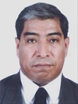
Prof Carlos Melecio Carmona Cedillo
Institute of Marine Sciences and Limnology, UNAM, MEXICO
Title: The Ichthyoplancton adundance distribution asociate to geostrophic currents into Grijalva – Usumacinta River Plume
Biography:
Born in Mexico, and became interested in oceanology (oceanography), after know Ramon Bravo Prieto and Jacques-Yves Cousteau documental work, quickly develop a fascination for ocean and marine life. He studied oceanology at Marine Sciences Faculty, University Autonomous of Baja California. After a stay at Tokyo University of Fisheries, his interest shifted to physical-biological interaction in to the ocean. This was the core of research for earn MSc at Limnology and Marine Sciences Institute, UNAM. Also collaborating into Vaquita-Totoaba Government Program, Colorado River Delta Program, Several Oceanographic Surveys into Gulf of Mexico and Gulf of California, Technical advisor to Shrimp Fishery Cooperatives. And He was a lecturer at University Autonomous of Morelos State and University Autonomous of Hidalgo State.
Abstract:
Analysis of spatial abundance distribution of ichthyoplankton, realted to geostrophic currents into the discharge region of the Gijalva-Usumacinta system rivers. The data was collected at 35 stations infront of Grijalva – Usumacinta rivers discharge area, by the oceanographic survey “PROMEBIO-I”, held from 15 to 18 August 1999. The hydrographic data was obtained by CTD and ichthyoplancton biological data was collected by double oblique tows in three ten meters layers with open-clouse networks of 75 cm diameter in the mouth and 500 ïm of mesh size. The ichthyoplankton was standardized to 100 cubic meters and is reported as number of larvae (no. larvae/100 m3). The geostrophic currents was estimated from temperature and salinity average data in the first 3 layers, using a linear inverse model solved by the finite differences method. From the results it is possible to identify four habitats and two types of fronts: A plume front (permanent), formed by river water discharges, less saline, from the Grijalva-Usumacinta system, and a topographic front (front of shallow seas) associated with the edge of the continental shelf. Maximum number of fish larvae was associated to the front formed by the Grijalva-Usumacinta system and the geostrophic currents are associated with the same pattern.
Balla Maggero
Oceano. & Marine Department, Meteorological Services,KENYA
Title: An efficient and generally applicable coastal ocean prediction system
Biography:
Abstract:
An efficient and generally applicable coastal ocean prediction system must take into account the wide variety of coastal phenomena (currents, waves, tides, etc.) and forcing (buoyancy, wind and external) which occur over the multiplicity of time and space scales. The observational network will generally consist of a mix of platforms and sensors with real time telemetry deployed in nested domains of increasing resolutions. The set of coupled interdisciplinary models for assimilating the data will have compatible two-way nested computational domains. Prediction systems should accelerate scientific research progress in the multi scale intermittent ocean and important practical application areas include management of the multiuse Coastal zone, Naval and Marine operations. Physical and biogeochemical ocean dynamics can be highly intermittent and variable, and involve multiple interactive scales in 2-D feedbacks. In general, the oceanic fields, processes and interactions that matter thus vary in time and space. These processes are importantly dominated by strong sporadic events that are erratic on spatiotemporal scale. Understanding non-linear dynamics specification of actual events and identifying important additional as yet unknowns provides a framework for realistic representation and prediction of the interdisciplinary coastal ocean. For efficient forecasting, the structures and parameters of models must evolve and respond dynamically to new data added into the executing prediction system. The conceptual basis of this adaptive modelling and corresponding computational scheme is the subject of this presentation.
Ayyandurai R
Research Scholar Department of Geology Periyar University,India
Title: GROUNDWATER POTENTIAL AND ARTIFICIAL RECHARGE ZONATION MAPPING USING GEOSPATIAL TECHNIQUE IN THE GADILAM RIVER BASIN IN SOUTH INDIA

Biography:
Mr.R.Ayyandurai has completed his M.Sc., at the Periyar University and continued his research in Ph.D., in the same University. He was worked in the field of Hydrogeology for the past five years. He has published more than 10 papers in reputed journals. He has vast experience in the field of Hydrogeology and Geophysical exploration.
Abstract:
Groundwater potential zones and artificial groundwater recharge zones were delineated using geophysical surveys and geospatial techniques to understand hydrodynamic behaviour in the Gadilam river basin South India. The Gadilam is an ephemeral river originates from Mayanur garudan spring of Garudan rock and traverses via Pasar hill and confluent with Bay of Bengal at Silver beach. The study area falls under semi-arid climatic conditions with numerous surface water tanks and lakes, erratic and almost failure in monsoon. Gadilam river basin lies in between Latitudes 11°40' to 11° 58' N and Longitudes 78° 58' to 79° 26' 35" E covering an areal extent of 1428 Sq.km. The drainage pattern in the area is dendritic to sub dendritic and at tor complex as trellis type. The fast growing population and rapid urbanization, consequently increasing water demand in the study area. The Gadilam river basin is one of the important agricultural production area in south India. There is a growing awareness of the need for adequate water resources to maintain sustainable groundwater development and management. In contrast to land resources, there is a high interdependency among water users due to the movement of water in the hydrological cycle. Geophysical surveys were carried out at representative locales to ascertain the subsurface conditions. Digital Elevation Models (DEM) was obtained with the help of Landsat imageries and IRS P6 LISS IV. These models were used to delineate groundwater potential zones and estimate effective artificial recharge zones. Average rainfall was calculated using isohyetal method and the area of each of the storage lakes was measured using satellite images and it was compared with low potential zones. Fluctuations in groundwater levels, evaporation and infiltration rates were used to determine the water balance for the purpose of estimation of artificial recharge. Artificial recharge rates were found to surpass natural recharge from rainfall. Recharge wells caused a reduction in the effect of evaporation on storage lakes. This study recommends and establishment of sustainable development through suitable artificial recharge methods and are implemented.
Admiral Musa Julius
State College of Meteorology Climatology and Geophysics, Indonesia
Title: Correlation of Fault Size, Moment Magnitude, and Height of Tsunami to Proved Paleo-tsunami Data in Sulawesi Indonesia

Biography:
Admiral Musa Julius is now Bachelor Geophysics student at the age of 22 years from Indonesia State College of Meteorology Climatology and Geophysics. He is member of American Geophysical Union (AGU), European Geoscience Union (EGU), Seismological Society of America (SSA) and Geological Society of America (GSA). He has published more than 5 scientific papers in reputed journals, 27 popular paper and 1 book. He also has invited as a speaker in national or international symposium, such as: 4th and 5th International Symposium of Earthquake and Disaster Mitigation in Indonesia, World Meteorological Day Symposium 2014 in Agency of Meteorology Climatology and Geophysics, and ECGS & ESC/EAEE Joint Workshop: Earthquake and Induced Multi-Risk Early Warning and Rapid Response in Luxembourg.
Abstract:
Sulawesi (Indonesia) island is located in the meeting of three large plates i.e. Indo-Australia, Pacific, and Eurasia. This configuration surely make high risk on tsunami by earthquake and by sea floor landslide. NOAA and Russia Tsunami Laboratory show more than 20 tsunami data recorded in Sulawesi since 1820. Based on this data, determine of correlation between all tsunami parameter need to be done to proved all event in the past. Complete data of magnitudes, fault sizes and tsunami heights in this study sourced from NOAA and Russia Tsunami database and completed with Pacific Tsunami Warning Center (PTWC) catalog. This study aims to find correlation between fault area, moment magnitude, and tsunami height by simple regression in Sulawesi. The step of this research are data collect, processing, and regression analysis. Result shows very good correlation, each moment magnitude, tsunami heights, and fault parameter i.e. long, wide, and slip are correlate linier. In increasing of fault area, the tsunami height and moment magnitude value also increase. In increasing of moment magnitude, tsunami height also increase. This analysis is enough to proved all Sulawesi tsunami parameter catalog in NOAA, Russia Tsunami Laboratory and PTWC are correct.
Moussa Djara BIO
Principal Engineer of Public Works Technical Services,Aménagiste - Environmentalist,Benin
Title: INFLUENCE OF GEOMETRY IN THE SHORE OF SEDIMENTARY Morphodynamics CELL CENTRE IN BENIN
Biography:
Abstract:
This work was conducted as part of a doctoral thesis on the dynamics of the Benin coast and the geometry of the shore monitoring activities in the morphodynamics of a sediment cell initiated by the Geology Laboratory of Environment and Mine University of Abomey in collaboration with the Directorate of Land des Berges Coast and the Ministry in charge of managing and Côtes du Littoral. It aims to control the geometry of the relative sensitivity of the shore-side segment in time. The iconographic material used in this work consists essentially of pictures Landsat satellite, the iconographic material used for the analysis of changes in plaque morphology and those of the shoreline coast segment. They come from stock footage catalogs from instruments of TM (Thematic Mapper), ETM + (Enhanced Thematic Mapper Plus) satellites Landsat 4, 5 and 7 and LC8 (Continued Landsat). They are already orthorectified and projected in UTM / WGS84 projection system and each is accompanied by metadata specifying the acquisition parameters, the type of sensor, the satellite type, date, etc. The results lead us to distinguish that the stretch of coast between Djondji and Djègbadji, belongs to the Central unit. The analysis of the kinetics of the coastline distinguishes two segments: the segment of Djondji-Meko Meko and that of the South-Djègbadji Ouidah. • The coast between Djondji and Meko This segment of coast evolves today in a context of erosion with neighboring -1 m / year speeds (11 meters in 13 years). This evolution is linked to the instability of the mouth of the King since the implementation of the service Nangbéto dam on the Mono river. • The coast of Meko-Djègbadji south of Ouidah This coast is experiencing a segment globally fattening at a neighboring average rate of 1m / year (16 m in 13 years). This development confirms that the sector Meko coast to the East belongs to the transition zone / accretion of the Centre's cell. Climate change is one of the aggravating factors and evolution of the phenomenon of coastal erosion in the coast sector in the past two decades were considered stable coast sector. In the absence of adaptation measures for the next twenty five years, and Djondji Meko coast segment will suffer a decline of about one hundred fifty (25) meters. An estimate of the widths and strips of land surfaces eroded and a financial assessment of soil loss horizons to 25 years were made.
Degbe Lossi Georges Epiphane
Institut de Recherches Halieutiques et Océanologiques du Bénin
Title: Evolution of the coastline of Beninese littoral from 2011 to 2014
Biography:
DEGBE Cossi Georges Epiphane is an orapceanogher, Researcher in the Halieutic and Oceanographic Researches Institute of Benin. He’s working on the Monitoring of the marine and coastal environment: Collect, analysis of the data on the physico-chemical parameters of the coastal and marine waters and hydrodynamic parameters. He has a better knowledge of the hydrodynamic processes (winds, waves, swells, tide and currents) and of the sedimentary transport and morphodynamiques. He is Member of the Advisory Body of Experts on Law of the Sea (IOC/ABE-LOS)/UNESCO and member of the National Committee on the Climatic Changes.
Abstract:
This work aims to study morphology and to follow the evolution of the coastline of the Beninese littoral for better apprehending the phenomenon of coastal erosion. To conduct this study, it was used the direct method based on the mesures of topographical surveys taken of 2011 to 2014 in sensitive areas of the Beninese littoral. The volume of eroded or fattened sediments is obtained from eroded or fattened surfaces calculated by the method of trapezoid. The obtained results bring us to observer vertical and horizontal movements profiles which enable us to distinguish periods of dominant erosion from May to September and from the periods of dominant accumulation from November to April. For the first periods, the profiles tend to pass from the convex form to the concave form, while with the course the second period, they tend to pass from the concave form to the convex form. The coastal sectors most threatened by the retreat of the coastline (erosion) are located East of the split (east of Cotonou) with a mean velocity approximately -9 ± 0.03 m/year at Donatin and approximately -30±0.03 m/year at the East at the level of the bridge toll, the sectors of Djondji with -2±0.03 m/year and the sectors between Hillacondji and Agoué with -5±0.03 m/year. The Sectors of coast which are in dynamic balance or accretion are the sector of coast located at the west of the port of Cotonou with a speed of +4±0.03 m/year and the sector between Ayiguénou and Grand-Popo which is stable. The coastline of the Beninese littoral knows a seasonal evolution.
- Policy and Legislation
Session Introduction
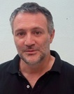
Dr Jose M Bellido
Instituto Español de OceanografÃa. Centro Oceanográfico de Murcia,Spain
Title: The new European Common Fisheries Policy and the Obligation to Land all catches. The port of Santa Pola (Mediterranean Spain) as a study case
Biography:
Jose María Bellido, PhD. He acquired his PhD at the Department of Zoology, University of Aberdeen, Scotland (1997/2002). During the last few years, discards became his main research field. His expertise is also requested in spatial modelling and stock assessment in the Mediterranean as well as in the Atlantic stocks on small pelagic species. He has been the Director (Head of Unit) of the Oceanographic Centre of Murcia (IEO) from 2009 to 2014. Now he is focussing on various research projects at the same IEO Centre and he is teaching at the University of Alicante, mainly to Master students in fisheries and marine sciences and supervises PhD students.
Abstract:
Reduce the discards levels in European Union fisheries is a target of the new Common Fisheries Policy. To achieve it will require to land all regulated species by catch limits and some species regulated by minimum sizes. Due to the characteristics of the Mediterranean Sea are questioned the feasibility, effectiveness and the consequences of applying the measure in this region. This paper aims to answer these questions to improve the management of discards. For this purpose, the discard of an important Spanish Mediterranean port was characterized considering all species caught and, on the other hand, the species proposed by the CFP. The measure also was assessed using a SWOT analysis due to the evaluation of the critical points of regulation by fishermen, managers, NGOs, scientists and entrepreneurs. The daily discard was 11.7 Tm (All Species) and 1.8 Tm (Proposed species), and 2623 Tm were discarded annually (All Species) and 421 Tm (Proposed Species). The regulation showed greater weaknesses and threats (72.6%) than strengths and opportunities (27.4%). The high costs associated with the measure, the necessary logistics, the lack of motivation and adequate control create a negative balance, despite the proposed objective, the willingness of fishermen to reduce discards and the use of the resource by destination proposed. The negative balance shows that the measure does not appear to be feasible in the Mediterranean. Therefore discards will not be reduced in this sea. Perhaps an approach focused on mitigating the causes of discard can be more effective than the proposed of the new CFP.
Seyed Ziaeddin Madani
Iranian National Institute for Oceanography and Atmospheric Science, Tehran, IRAN
Title: Examination of the Necessities, Dimensions and Considerations for Codification of an Iranian National Ocean Policy

Biography:
Dr. Zia E. MADANI is UNESCO-IOC Expert on Marine Scientific Research for Special Arbitration under Annex VIII of UNCLOS. He is also the head of the Department of Law of the Sea and Ocean Policy at the Iranian National Institute for Oceanography and Atmospheric Science, and is an Assistant Professor in International Law of the Sea. Dr. Madani has a particular interest and has published papers on Law of the Sea and Ocean Policy, Antarctic Law and Policy, Legal Aspects on Marine Scientific Research, etc.
Abstract:
Today, majority of States have developed a national ocean policy. This is particularly the case of States with a considerable surrounding marine area and/or sufficient infrastucture to utilise oceans’ benefits. Iran despite the significant benefits attached to it and the possibility of easy access to high seas yet failed to develop a National Ocean Policy. A national ocean policy is initially an instrument that recognises the key role of sea and ocean, coastal zones and their ecosystems in national economy, security, culture, health, welfare as well as wellbeing of each and every persons therein and tends to promote the said role in a national context. Such instrument also functions with the aim to elate public awareness vis-à-vis benefits and advantages oceans may bring along for them in order to be wisely and consciously utilised based on up-to-date science and reseach mechanisms. A national ocean policy instrument also entails contents pertaining to protection and preservation of natural resources and marine habitats of the State’s sorrounding and accessible waters for the sustainable use of current and future generations. Ocean and marine activities in a national ocean policy vary based on the vast and diverse usages of all types of body of water. This paper while intends to examine the necessities, dimensions and considerations to develop and codify an Iranian National Ocean Policy, devises the principles and constituents seem needful to be envisaged therein with a legal and policy perspective.
Dina Sunyowati
Faculty of Law, Airlangga, Departemen Hukum Internasional, University Surabaya Indonesia
Title: The Regulation of Sustainable Mangroves and Coastal Zones Management in Indonesia

Biography:
Dina Sunyowati completed his doctoral studies at the Post Graduate Programme of Airlangga University, Indonesia in the field of Law of the Sea. It is also as a lecturer for the course Law of the Sea, international environmental law and international law. In the last 8 years regularly conduct research in the field of coastal management and small islands in Indonesia. Results from the study are regularly published in national journals and has been active in the seminar / national and international conferences. The Author is also active in Associations of Indonesian Coastal Management Expert.
Abstract:
Mangrove is a part of the forest ecosystem as a whole, and lives between land and sea. Mangroves are very important in the management of coastal resources in Indonesia. In addition to having influence in the coastal ecological system, the mangrove is also potentially economic, which are derived from three main sources, namely : forestry, fisheries estuaries and coastal / internal waters. Mangroves have an important role in protecting coastal and maintaining the habitat for several species with diversity in certain coastal zones. In the past 5 years the condition of mangrove forests has decreased both in number and in their wide functions as a buffer in the coastal zone. This was triggered by loosening licensing by the municipality or province to the entrepreneurs settlement, a location exploitation permit for companies or sites that are not environmentally friendly. It also triggered because they happen to overlapping legislation and mangrove forest management authority as part of the natural resources in coastal zones and illegal logging in mangrove forest. The research method used in this paper is a normative juridical, with the conceptual and statute approach. Based on data from the Ministry of Forestry Republic of Indonesia, there are Indonesia coastal zones that still have good potentials and the biggest areas of mangrove forest such as Papua, Eastern Borneo and Southern Borneo, Riau and South Sumatra. Sustainable and integrated management is necessary to prevent the loss of mangrove areas in Indonesia. The mangrove management should be integrated and sustainable based local community.
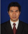
Yulius
Research and Development Center for Marine and Coastal Resources, Ministry of Marine Affairs and Fisheries, Indonesia
Title: Model of The Marine Tourism Development in Wakatobi Regency, Southeast Sulawesi Province, Indonesia
Biography:
Yulius has completed his Master Program of Coastal and Marine Resource Management at the age of 32 years at Faculty of Fisheries and Marine Science, Bogor Agricultural University. Currently, he is a researcher in the field of marine tourism survey. He also has a strong interest in coastal and marine research. He has published more than 25 papers in national journals.
Abstract:
Wakatobi has a huge capacity in natural resources including beautiful and pristine coastal ecosystem with 25 coral reefs species in diverse forms. This regency is a considered as the best biosphere in the world and frequently used as diving and snorkeling sites for national and international divers. Objectives of this study are to determine the role of marine tourism in Wakatobi economic condition, and to formulate the appropriate and strategic policy for marine tourism development plan. Methods used in this research are Location Quotient (LQ) analysis to determine the ability of a sub-region within the sector/specific activity, and prospective participatory analysis for development planning. The results of LQ analysis for marine tourism sector based on GDP data in 2004 to 2007, shows the range of LQ value between 0.808 and 0.881 which indicated the poor potency and low contribution of marine tourism sector in Wakatobi economy. Based on prospective participatory analysis with total of 18 variables for marine tourism development, indicated that Wakatobi regency have four main variables are behavior society of protecting the environment, community character, human resources and motivation. These variables has an important role in the preparation and implementation of development marine tourism in Wakatobi regency.
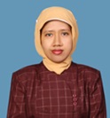
Dini Purbani Sukarman
Research and Development Center for Marine and Coastal Resources, Ministry of Marine Affairs and Fisheries, Indonesia
Title: The Application of Participatory Prospective Analysis System in The Fishing Industry at West Sumatera Padang Waters
Biography:
Dini Purbani has completed her Doctoral Program of Coastal and Marine Resource Management at the age of 42 years at Faculty of Fisheries and Marine Science, Bogor Agricultural University. Currently, she is a researcher in water quality at Bintan Island. She also has a strong interest in coastal and marine research. Se has published more than 25 papers in national journals.
Abstract:
The aim of application of participatory prospective analysis is to determine key variables in the development of sustainable fishing industry according to the blue economy concept. The studies were conducted at TPI Muaro Padang City and PPS Bungus Kabung Bay Padang, West Sumatra Province. Further studies are required in their management policies, as the fisheries management in PPS Bungus and TPI Muaro Padang have not applied the blue economy approach yet, thus their waste utilization. The participatory prospective analyses approach was applied in determining the management policy by organizing consignment by relevant stakeholders such as Department of Marine and Fisheries of West Sumatra Province, Department of Marine and Fisheries of Padang City, Operational Chief of PPS Bungus, BKPM West Sumatra, PT Dempo and fishermen of PPS Bungus and TPI Muaro Padang City. This resulted in four main variables of policy making:1. Environmentally Friendly, 2. Mutual cooperation, 3 . Industrial increase and 4 . Zero Waste.

